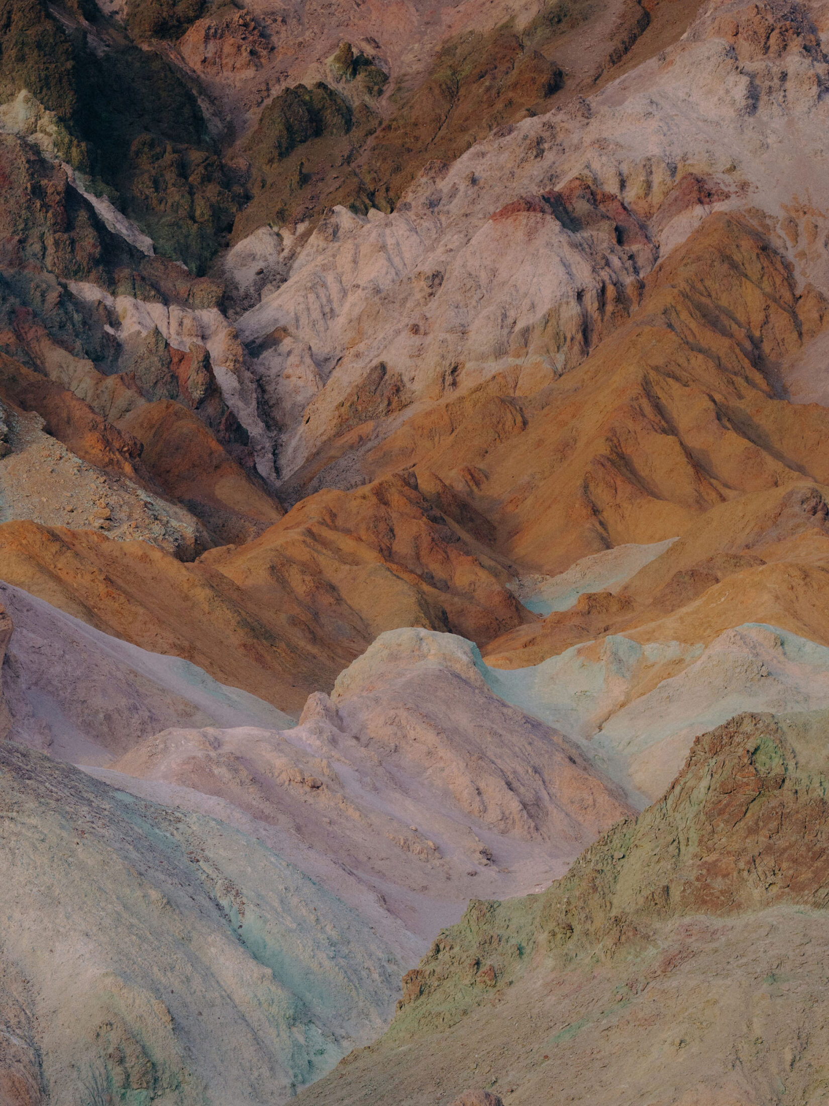
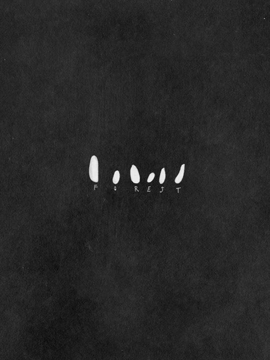
Colusa
And over there, a rough keyhole punched through
the concrete block in an irrigation channel
running through Pleistocene alluvium. The frizz
of small twigs and early grasses—like pencil
scribble. Here at the San Joaquin Fault Zone. The
soft D-flat gurgle of swirling water.
Sutter
Non-marine sedimentary sand. The mottled road
yields to a glorieta of tire tracks shooting off
across the plain. How many months more before
the packed ground loosens and wind begins to lift
away winter’s scars? Sutter Buttes Fault Zone.
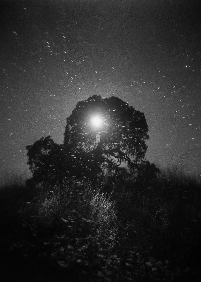
Mendocino
Along the coastal belt, sandstone and Cretaceous
shale. Fallen birch branches sprawl over their
counter-branch reflections on the stream’s
surface. Here near the Mendocino Triple Junction.
Mono
Near the Owens Valley Fault, a frost-crusted slope
of volcanic mudflow. It bottoms out onto
Holocene playa hardly settled enough to underprop
the frequently flooded and patched road. In the
end, the river will have its say.
Del Norte
Smooth contours of white Jurassic limestone
bubble up along a creek bed punctuated by
pyroclastic boulders. Salts, water-stowed into tiny
fissures, crystalize at night, fracturing the rock. A
birch seedling directs its root into the edge of the
fracture. Cascadia Subduction Zone.
Mariposa
Edged against the Melones Fault Zone, fog-
softened yellow poplar trees. The dirt road winds
along Merced River Canyon through Paleozoic
hills. Under the pale-green deergrass, sandstones.
Beneath the blue oaks, schist.
San Francisco
Do we recognize ourselves in what we see? From
beds of infectious marine sand below the
interchange, a few thin, branching shoots go
scrabbling toward an abutment blazed with exotic
graffiti. The San Andreas Fault.
Alameda
Loose lake terrace deposits underlie islands of
sawgrass linked by a zigzag boardwalk. Wild bees
nest in soil along scissures of the Hayward Fault.
Who can say? Are we in or only of this world?
Sacramento
How long will it last, the vestige of the human? A
tranquil shadow-scrim of trees and brush gestures
from the stream’s pearly surface. Loosely
consolidated Pliocene gravel. At high risk for
earthquakes. The San Andreas Fault running the
whole length of the county’s western edge.
Nevada
Adjacent to the Sierra Nevada Fault, a litter of
broken limbs and twigs remain of what had been
forest. As the deep roots die, subterranean water
rises, drawing salt with it. Termites, with fungi in
their guts, are beginning to digest the wood. A soil
expressed from quartzite and sandstone.
Amador
There are tongues of volcanic mudflows to the
north. To the west, the Bear Mountains Fault
Zone. Here, sedimentary beds are run-through
with schist and phyllite. Dead oak leaves catch in
skeins of weeds just starting up through cracks in
the abandoned parking lot.
Solano
In estuarine marsh above Suisun Slough, north of
Grizzly Bay, a torrent furrows its way through
alluvium and Holocene lake deposits close to the
San Andreas Fault Zone. Not tilth, but
waterlogged sod, last year’s grasses. The litter
layer is unhurriedly carried away in runoff. Your
ear catches a musical trickling, percolating.
Santa Clara
East of the serpentine pluton running along Silver
Creek, two massive redwoods grew into each
other and shared a body. Now the afternoon sun
articulates medullary rays between the rings of
that double tree’s amputated base. Along the San
Andreas fault line. Where is there a landscape
without an observer?
Marin
Plugs of volcanic rhyolite jut up from Cretaceous
sandstone north of the visitor center. From the
beach, children drag lengths of bullwhip kelp to a
sandy boardwalk and leave them for the
(imagined) marvel of those to come. The San
Andreas.
Glenn
East of the northwest-trending Coast Range
Thrust Fault, Elk Creek runs wild along striated
bedding planes of shale and sandstone into Stony
Creek. A wide rock beach. Nothing breaks the
water’s surface but an intangible expression of
collateral relations.
Los Angeles
A burnt foundation. Bounding the wet concrete
slab, naked trees push up through syenite and pre-
Cambrian gabbros of the San Gabriel Mountains.
Their root secretions, attracting mites and
springtails, begin to renew the soil. The San
Andreas and a hundred smaller active faults.
Trinity
Near the steeply uplifted and folded southern
Klamath range, metamorphosed sedimentaries are
riven with igneous intrusions. Timber in the
mountains, irrigated crops in the valleys. Two sets
of bike tracks temporarily scar the slope to a
construction site. At the center of each forsaken
footer, a stump of upright rebar. The La Grange
Fault and the North Fork terrane.
Ventura
Broken sea wall, patched road, railroad tracks on a
crushed ballast bed. The sharp-edged stones
interlock under pressure from the ties, stabilizing
the rails. Sand and gravel quarries in Fillmore.
Shales and conglomerates in Ventura. The San
Andreas and over a hundred smaller active faults.
Inyo
An alluvial fan below hillocks of eroding feldspar-
gneiss. Gravel and small rocks cluster in the
interzone between roads streaked with salt and
gypsum. This spot: the lowest point in North
America. What of the world arises from our
minds? Owens Valley Fault Zone.
Merced
Here are interrelations no map can contain.
Beyond a crazed road and oaks swarming the
smectitic riverbank, a sequence of naked hills
extends to the limits of our looking. Ortigalita and
Bear Mountains Fault Zones.
San Benito
Landslides blot away the road. Upper Cretaceous
sandstones, shales, and conglomerates eroding
from the Coast Range. The serpentine-heavy soil
supports Jeffrey pine, incense cedar, and a few
rare species: the San Benito evening primrose
(which will bloom next month) and a millipede
(with more legs than any other). Nearby, the
imperceptibly quivering San Andreas and
Calaveras Faults.
San Luis Obispo
These wave-cut conglomerates, cross-bedded with
shales, embrace granite and quartzite pebbles
beside lenses of erosion-resistant jasper. A stark
littoral zone near the San Andreas, Hosgri, and
Los Osos Fault Zones. The tide going out.
Stanislaus
Susceptible to landslides, the eroding slopes of the
Coast Range expose sedimentary rocks close to the
valley margins. The hills slide slowly down into
faulted crevices where an ephemeral creek runs,
giving rise to quick hallelujahs of grass. Here, near
the Ortigalita Fault, we might ask ourselves: When
did the land stop belonging to the land?
Kern
More than fifty thousand active wells—drilled
four hundred to four thousand feet down through
layers of Pleistocene lignite and sandstones rich
with plant imprints and fossil bird bones—suck up
the oil that migrated from old marine beds into
discrete sand lentils. At the tamped, barren
surface, the dirt fails to hold air or water or
micronutrients. Not even an ant walks over it. The
San Andreas and Garlock Faults.
Yuba
Upwelling magma conveyed gold deposits into
fractures in the folded Sierra Nevada. With
aggressive mining, sedimentation whelmed the
floodplains with gravel, annihilating trees,
altering the river’s course. Now needlegrass, blue
wildrye, and broomsedge undulate in an old
stream bed. Swain Ravine Fault and Big Ben-Wolf
Creek Fault Zone. The road relinquishing itself
one chink at a time.
Placer
Silt plumes into the lake’s shallows where river-
rounded stones of monzonite and Mesozoic
granite hold their breath underwater. Foothills
Fault System. We don’t start a conversation with a
stone. And yet we find ourselves in conversation.
Calaveras
Along strands of the San Andreas Fault Zone,
vortices of dry, minnow-shaped leaves float on
subtle currents in a stream reflecting dark, bare
trees. Paleozoic schist and hornfels mixed with
shale and chert underlie the stream. We say beauty.
We say beauty exists. That beauty exists for us.
Tuolumne
Unsettled earth. Eye to the ground. It’s as though
the rocks self-evacuated from the crumbling wall
and fire pit. Tertiary volcanics east of the
Foothills Fault System. The hill’s grading has
obliterated brush that protected the soil, exposing
weathered, rounded cobbles.
Shasta
Franciscan Complex basalts. Uplifted terraces
punctuated by an incised stream canyon give rise
to this tarn. Which overlooks a secret salmon
spawning ground. Poor soil with low
permeability, clay in the shallow subsurface. Battle
Creek Fault Zone. The grin of a crack in the
megalith.
Lake
The rift starts at Hwy. 29 and runs north across a
plain furry with weeds toward ash-turbid
Thurston Lake. Though within the Konocti Bay
Fault Zone, this fissure, jokingly dubbed “Guy’s
Fault,” follows the trace of a collapsed channel
built to drain Manning Flat. Marine sedimentary
layers of sandstone and limestone wink with local
Lake County “diamonds” that locals call moon
tears.
Fresno
When did concrete enter our lives? Less than
eighty years old, these busted pipelines are being
excavated from a rubbled trench where gray,
alkaline clay overlies lime-silica hardpan. The
Nunez and Ortigalita Faults. In 6,500 BC, traders
in the Levant stored water in buried cisterns.
Cisterns made from concrete.
Monterey
Look closely and you’ll see a measured series of
terrestrial horizons from which the land’s sutures
have been plucked. To till soil is to gut it, to rip
apart its microbial and fungal networks, to lift
away the protective crop residue and lay earth
bare to wind, runoff, and rain damage. Just
adjacent to the San Andreas Fault Zone.
Sierra
How many linked dimensions? Clouds mounding
on the surface of the water merge with pale glacial
detritus at the Foothills Fault System. Why do we
say the landscape is over there if we are always a
part of it?
Napa
There are more than a hundred soil variations in
the alluvial fans emerging from near hillsides onto
the valley floor. Here, a marsh tributary, its dark
surface banded with flotsam and chalky slicks.
The West Napa Fault. Cretaceous and Jurassic
sandstone bedded with limestone.
Alpine
On the creek’s surface, crystals bind to residual ice
that has melted and refrozen. As night
temperatures drop, an expanding glaze begins to
shrink the dark haloes of water. Like skin healing
around a wound. Nearby, on the forest floor, a
black soil of till and colluvium. The Sierra Nevada
Fault Zone.
Plumas
Under any place we stand, the archaic depths of
persistent memory. On this ancient lake bed
strewn with wet dirt, straw and twigs, we come
across the ruined foundation of someone’s house.
An insistence of right angles. Almanor Fault Zone.
El Dorado
Along the western edge of the Bear Mountains
Fault Zone, a snow-packed, glacier-carved lake
with thick trees popping up from lacustrine
sediment around the lake’s apron. But on the
further hill, scraggly pines struggle to thrive on
thin soil beds underlain by rocky granodiorite.
Butte
Strongly metamorphosed white andesite slabs,
pillow lavas, and flow rocks surround the lake’s
houseboats. Cleveland Hill and Sierra Nevada
Faults. A gravelly soil with mixed cobbles.
Contra Costa
It’s gone now, whatever once brought people here
with a need for direction and an exit sign. The
cracked macadam—fenced, blockaded, and
arrowed—erupts with April weeds. As they bury
the fecal pellets of white-tailed deer, dung beetles
scurry across a slope soil derived from exfoliating
shale and sandstone. The Calaveras Fault and the
Mount Diablo Thrust Fault.
San Joaquin
In lowlands north of the Stockton Fault, a wide
valley filled with six-mile sequences of
interbedded clays, silt, sand, and gravel. Little else.
A dissolving rectangular slab of sand, a toss of
pine twigs. Vehicle tracks. Leached sand. But in
the act of looking, your body is there too.
Orange
Poor soil, little ground cover, tufts of sage,
scoured runnels through pebbled Miocene
sandstone. Sediment accumulating in channels. A
lately denuded hillside. The San Andreas and more
than a hundred smaller active faults. Life is
elsewhere.
Santa Barbara
Coastal marine sand and silt drain from the bluffs
of the Santa Ynez. Closer to shore, Miocene shales
are chocked with fossils of mollusks and
clamshells. The ocean here is plagued with fecal
bacteria. With pollutants from runoff and from
underwater oil field seepage fifty meters down.
Santa Maria River and Santa Ynez Faults.
Kings
Desiccated stalks from last year’s sorghum silage
cloak fields of gray-brown alluvium. Bioturbating
worms thread underground channels with acids
that, come June, will stimulate new plant growth.
Four inches below the worms, a layer of chalk
holds moisture for the roots. San Andreas Fault
Zone.
Madera
Tufts of grass knotted in disagreement. And
everything is charged: grass positive and pollen
negative. So while wind whips the grass in circles,
grass sweeps the air for pollen. Undulating hills
overlie basement monzonite. To the southwest,
near the border with Fresno County, the Coalinga
Anticline.
Riverside
Marked by the wide Santa Ana River watershed,
the alluvial soil is coarse-textured and well-
drained, the pH high. Two PVC pipes, glowing
like tusks, curve out from the dull riverbank and
over-cross the mud-colored flailings of exposed
tree roots. San Andreas and San Jacinto Faults.
Tehama
With its linear trajectory, the fence can only
approximate the arroyo’s soft bend. Battle Creek
Fault Zone. Dry-farmed pastureland, a stratified
and acidic silty loam riven with tunnels excavated
by gophers, and with gopher snakes just now
waking and blindly trailing behind them.
Imperial
Gathering its windblown materials from
prehistoric Lake Cahuilla, a little transverse dune
perches at the edge of the largest mass of sand
dunes in California. The Imperial Fault. We comb
the sand with our looking.
Lassen
A snow-brushed, dehydrated lake lined by lava
flow and scant brush adjacent to the Davis Creek
Fault Zone. Local soil, the gravelly residuum of
volcanic rocks. In the near distance, dwarf trees
squiggle up from thin layers of dirt covering a
bone-white strata of insoluble quartzes.
San Bernardino
Like road excrement, upwellings of crumbled tar
and gravel cover the desiccated, skid-marked
blacktop. Overlapping rings of tire rubber,
squiggly fissures. Alluvial deposits and dune
sands. The San Andreas and San Jacinto Faults.
Where I was born.
Siskiyou
The surrounding mountains are rich in pre-
Cenozoic gneisses and hornfels. At a valley stream
confluence, granitic rocks rounded by glaciation
settle themselves into moist, sandy loam. An
orange lichen secretes acids into the grains of its
supporting boulder. Cedar Mountain Fault
System.
Tulare
Splashes of leached salt and alkaline minerals dust
the path of a dry, dendritic creek spooling through
tangles of dead weeds and bracken. The slow-
moving Foothills Fault System. Poorly packed
plutonic granites underlie those hills.
Modoc
At the center of the intermittent flow zone, bunch
grasses lie flat, rinsed with a coffee-brown residue
of nitrogen-rich humus. The Surprise Valley Fault
Zone. A volcanic ash veneer covers lacustrine
deposits of crumbled basalt and andesite. On the
42nd parallel north, this is the northernmost edge
of California where the earth’s rotational speed
roughly equals the speed of sound.
San Diego
Between the Rose Canyon and Elsinore Faults,
directly across from the border wall, bootprints
disturb silty clay interfingered with slope wash
and a radiant spew of coarse granules, the
weathered rind of rocks. Along a north-south axis,
anonymous tracks on the damp ground lead in
both directions.
San Mateo
The inherent overcomes the constructed. Concrete
slabs and galvanized plates yield the rigor of their
authority to tension cracks and sprouting weeds.
An idea of order fractures in slow motion. Flood
plain alluvium from hillside drainage. The San
Andreas and San Gregorio Fault Systems.
Sonoma
On a trace of the San Andreas Fault, who has
assembled these witchy stick teepees? Behind
them, strange, glistering emanations of light play
over the sand. An iconic monolith presides over
two smaller rocks in the inlet—like a black bear
eyeing her cubs. Some of the jasper and blueschist
boulders along the beach have been polished to a
high sheen by the rubbing of Pleistocene
mammoths. Nothing moves but the onshore breeze
crinkling the skin of the water.
Santa Cruz
Marine sands and gravels, twenty to fifty feet
thick. Pretty sea glass on the beach from years of
garbage-dumping at the coastline. A tide pool
draining below cliffs fenestrated with eroded
tunnels. Eerily, the old concrete pier foundation
seems to step away through the fog into
ceaselessly approaching waves. The San Andreas
and Zayante-Vergeles Fault Zones.
Yolo
It’s as though a cloud had transported swarms of
gleaming grunion from California’s southern
beaches onto this swale along Putah Creek. Were
we to pass through that cloud in a plane, we’d look
down and see that the faults and folds across the
valley are aligned northwest in concordance with
the San Andreas. The Putah hauls alluvium to the
Sacramento River. Fallen eucalyptus leaves sprawl
along this narrow path through brushy weeds.
With their hundred thousand teeth, slugs are
chewing down the leaf matter.
Humboldt
Flecked with foam and floating bands of silt, the
tidal sloughs and estuarine channels fill in with
erosional sediment from an upslope degraded by
industrial logging. Once home to the southern
torrent salamander. Mendocino Triple Junction.
Representing nothing, what we’re given to see is
only what presents itself.
Dedicated to Lukas Felzmann.