During monsoon season, Arati Kumar-Rao returns to visit the ancient, deified Ganga—and the communities who live along her shifting banks. Feeling the life that pulses through the delta, Arati bears witness to both the life-giving benevolence and devastating waywardness of the river.
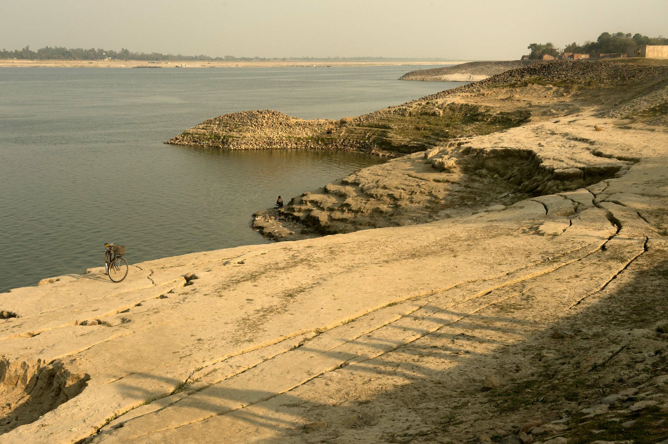
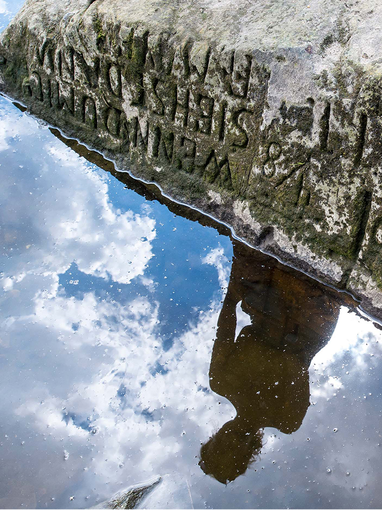
Cracks in the riverbank warn residents of the Ganga’s impending movement.
Writer & Photographer
Arati Kumar-Rao is a National Geographic Explorer and an independent environmental photographer, writer, and artist who documents ecological degradation. She chronicles South Asia’s changing landscapes and climate and their effect on livelihoods and biodiversity. Her work has appeared in National Geographic, The Hindu, #Dysturb, The Guardian, BBC Outside Source, Hindustan Times, and Mint.
During monsoon season, Arati Kumar-Rao returns to visit the ancient, deified Ganga—and the communities who live along her shifting banks. Feeling the life that pulses through the delta, Arati bears witness to both the life-giving benevolence and devastating waywardness of the river.
I AM IN PANCHANANDAPUR, on the banks of the river Ganga in the Indian state of West Bengal. It is the monsoon season, and nothing is as I remember it from my previous trips.
The tea stall that I used to frequent with Tarikul-bhai, my friend and guide for all things related to the Ganga in these parts, is three-quarters submerged. The ferry landings are fully underwater, forcing people to wade waist-deep to reach dry land. The river has risen at least ten feet higher, maybe more, than her level in the dry season.
Ten-wheeler trucks, half sunken in the river, are loading up on raw jute offloaded from large barges that have come from up and down the river. Men, women, and youth, many sporting conical cane hats against the fierce sun, are harvesting and curing jute everywhere. On every water body, from the tiniest pukur, or pond, to the biggest river, cut jute floats on rafts weighed down by dung or mud. After a couple of weeks of soaking, they will strip the fiber from the central stick and dry it for use in fabric, bags, and braided ropes. The sticks will be burned as fuel.
Tarikul-bhai has booked a fishing boat to take us upstream to the head of the delta. The Ganga is no longer the green-blue aquamarine of my summer memories; rather, we seem to be floating in a rimless bowl of tea. The sky—featureless, clad in a thick shawl of white clouds—covers us like a cloche. The sun is nowhere to be seen, but the reflected glare of its light is blinding.
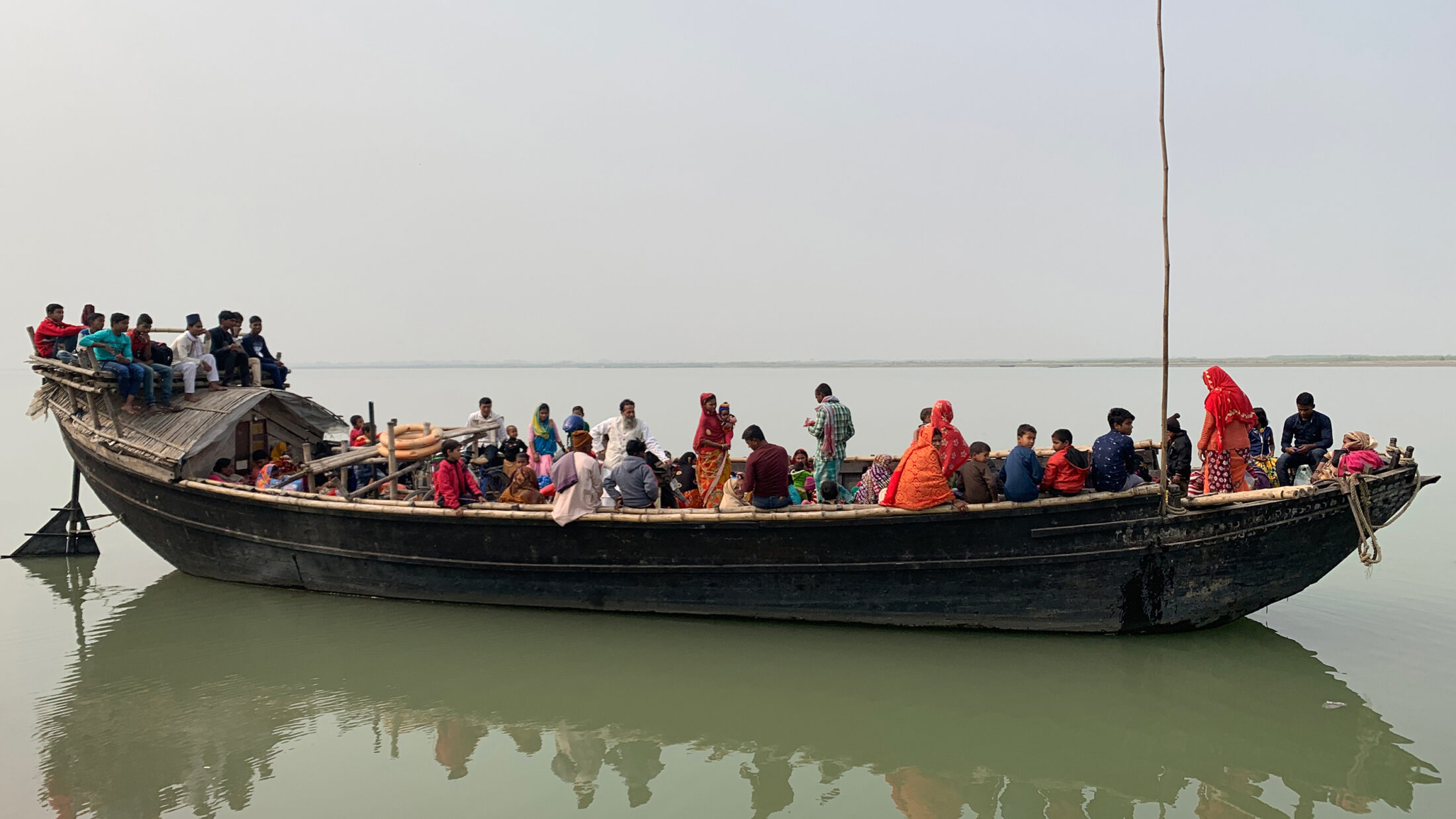
Floating under that cloche in our boat, it is as if we are being slowly steamed. On this windless morning, rivulets of perspiration run down our faces and backs. Clumps of hyacinth, that invasive scourge of all wetlands in India, float by, sometimes wearing pretty purple flowers or bobbing under the weight of gray wagtails or Asian pied starlings. Occasionally a boat, ferrying men, women, children, goats, motorcycles, cars, bicycles, and even a cow, passes by on the horizon, breaking the monotony of the expanse of turgid, tea-brown waters.
To our right, the river eddies viciously with large circular currents called ghurnis. After an animated discussion with the boatman in Bengali, Tarikul-bhai gives me the consensus view: “Bhangan is imminent wherever this current reaches.” He uses the local word bhangan for the breaking of soil. This kind of breakage can destroy and drown acres of land within minutes.
We float past what look like large swathes of marshes but in reality are the tops of vegetation growing on submerged silt islands. Tall Saccharum grasses, cattle fodder, even trees, are more under the water than above it. A grave-faced, massive, endangered greater adjutant stork lifts off from the vegetation and is joined by its mate.
I scan the waters for more signs of life. Somewhere inside this tea soup there is likely to be long-snouted, sharp-toothed, blind, side-swimming Gangetic dolphins—among the oldest cetaceans in the world, which have adapted to the murky, silty rivers of the Ganga-Brahmaputra basin. Somewhere upstream I am likely to see, basking on sandbanks, even longer-snouted, exclusively fish-eating crocodilians called gharials.
Both species are embedded in Indian mythology and in the local consciousness; they are, it is believed, the vehicles of the Ganga in her Goddess form. Every temple along the riverbanks dedicated to the Goddess shows her riding on the “makara”—a composite gharial-dolphin creature. And both species are highly endangered.
As we near a marsh, I ask the boatman to cut the motor. Drifting with the current, with no other boat or settlement in sight, I feel for a brief few moments the raw embrace of this river—the holiest of them all, the spiritually purest, the remover of sins, the redeemer of souls. All across the Indian subcontinent, for thousands of years, every devout Hindu regardless of caste and creed has aspired to touch, sip, bathe in the Ganga at least once in their lifetime.
I trail my hand in her waters to feel, in a visceral way, her unstoppable power, her speed, spontaneity, playfulness, willfulness, her life-giving benevolence and her devastating waywardness. In that moment, I am struck by the immense power that this deified river—not a deity enshrined in cold stone inside a temple, but one that is alive and accessible, mutable and moody, generous and vengeful, welcoming and overwhelming all at once—has over a billion people.
We have drifted downstream; the boatman revs up the engine, jolting me out of my reverie. We continue upstream. The monsoon-swollen river is everywhere, and I remind myself that this flood is not a bad thing in and of itself. The Bengali word for the monsoons is barshakal, implying a regular and welcome inundation, while the word for devastating flooding is bonya.
The river brings fine silt down from the Himalayan mountains and deposits it on these plains, creating some of the most fertile agricultural lands in the world. To walk through such a silt island under cultivation is to breathe in an aroma of paddy (rice), herbs, and vegetables that you never can get in much-tilled, much-fertilized industrial farmland. This cycle of flood and ebb is what sustains—has sustained for centuries—hundreds of millions of people, for this is the most populated river delta in the world.
The delta was originally thickly forested, but the lure of silt-covered fertile land and the navigability and access that Bengal provided to the hinterland transformed it into a center for trade. In consequence, the forests were replaced by agricultural fields and the delta became increasingly populated as the people adapted themselves to the cycles of beneficial floods and ebbs.
Abu’l Fazl, the grand vizier of Emperor Akbar, wrote in the sixteenth century about this region of Bengal: “The principal cultivation is rice, of which there are numerous kinds. If a single grain of each kind were collected, they would fill a large vase…. As fast as the water rises, the stalks grow, so that the ear is never immersed.”
A long-stemmed variety of rice (Oryza sativa) is grown in the swamplands, where it can withstand water eighteen to twenty feet deep. When the waters recede, the seeds are broadcast, and when the rains set in, the grass shoots up with the swell. Local varieties such as this one, long eschewed in favor of short-stemmed, high-yielding commercial paddy, are known to grow a foot in twenty-four hours. They reach heights of over twelve feet to keep pace with the swelling rivers and are harvested from boats.
We chug upstream against the monsoon freshet, which is strong and fast. It takes us a couple of hours and then some to cover the fifteen miles to the head of the delta. This is where the Ganga leaves the state of Bihar and bends southward into West Bengal. On her right bank are the rocky hills of Rajmahal, a historically prominent city favored by both Mughal emperors and the British for its unique geography. The bedrock is so strong that Rajmahal is immune to the vagaries of the meandering river.
Manikchak, on the opposite bank, has soft, pliable agricultural land, rich and giving, home to a robust population of farmers making the most of its fertility. Here the river, pregnant with silt, comes around a bend and, finding no purchase against the hard stone of the right bank, ricochets, ramming into the soft clay on the left bank.
All rivers, in their deltaic reaches, play ping-pong between banks, creating meanders. The Ganga has been eroding her banks for centuries. Writing in the late eighteenth century, Major Robert Hyde Colebrooke, who went on to become the Surveyor General of Bengal, describes how the meandering Ganga swells “more than twenty-five feet” during seasonal floods and how the strength of the receding waters triggers erosion:
It is not unusual to find, when the rainy season is over, large portions of the bank sunk into the channel; nay, even whole fields and plantations have been sometimes destroyed; and trees, which, with the growth of a century, had acquired strength to resist the most violent storms, have been suddenly undermined, and hurled into the stream.
As a surveyor, he would go out on the river in a boat and sometimes find himself in the vicinity of a crashing bank. He compares the noise to “the distant rumbling of artillery, or thunder.” But he describes this phenomenon as gradual, giving the locals enough time to remove their effects should they be too close to the crumbling bank.
This is a natural phenomenon. The river constantly migrates, and this migration triggers human migration in response. Professor Kalyan Rudra, chairman of the West Bengal Pollution Control Board, says, “Himalayan rivers in their deltaic parts often move over great distances. The swatch of meander sweep is proportional to the discharge flowing through the river.”
Except, the Ganga has been flagrantly flouting these limits over the last fifty years.
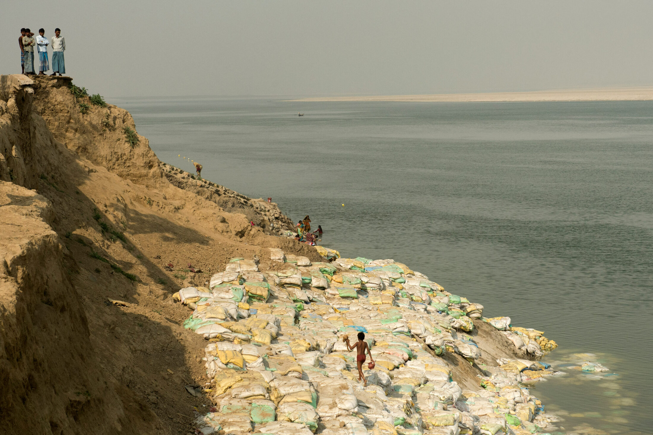
Local authorities sandbag crumbling cliffs on the river’s banks in a futile attempt to stem the erosion.
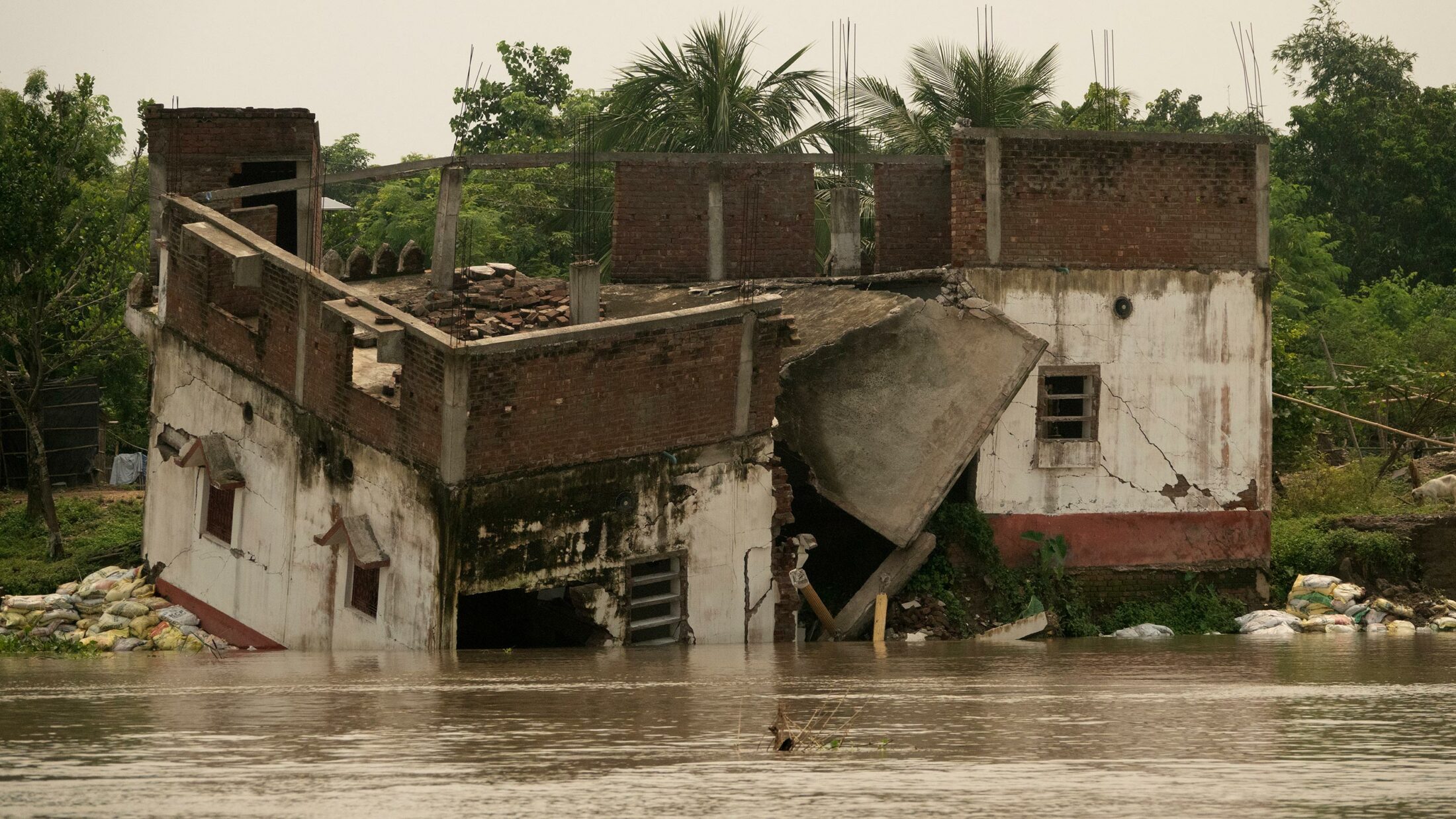
The monsoon of 2022 devastated the village of Birnagar.
ANITA DAS, her husband, his aged mother, and the couple’s ten-year-old son were at dinner that rainy night in July 2020 when it began: a thunderous rumble that seemed to emerge from deep within the bowels of the earth enveloped them, like the surround sound of doom.
Das and her family scrambled to gather whatever possessions they could lay their hands on and ran out of their little brick house in Birnagar into a scene of total chaos. Their neighbors, similarly burdened with whatever they could carry, were racing for higher ground, their screams of fear a counterpoint to the growling of the earth.
In the dark of that night, Das, her family, and their neighbors dashed towards the primary school that had been designated as the temporary shelter in times of trouble. Having delivered her mother-in-law to the safety of the school premises, Das and her young son dashed back into their home to rescue whatever else they could.
Slipping and sliding in the falling rain, the people of the region gathered their goats, calves and cows, mattresses, cots, vessels, bundles of clothes, TVs, documents, pictures of their gods and goddesses … What they could lay their hands on they deposited at the school, then they ran back for more through the ghostly gloom of the monsoon night.
They had seen signs of the impending disaster earlier that evening when the Ganga, swollen by the monsoons, began to eddy around their little village. These eddies, thick and brown with silt, are the harbingers of impending erosion—similar to the circular currents we saw from the boat.
The river in spate gradually undercut the ground beneath their homes. A big crack split the earth and a number of homes were trapped in the space between the crack and the river. The destruction was inevitable, and swift. By 3 a.m. the river had cut away the ground, and Das and her hapless neighbors watched as everything they had built and lived for vanished into the depths of the turbulent river.
“We are landlords to bed and beggars to rise,” says Tarikul-bhai, with a wry smile.
Tarikul-bhai is a resident of Panchanandapur, which is slightly to the north of Das’s Birnagar, and he has witnessed such devastation multiple times over the past four decades.
This cycle of flood and ebb is what sustains—has sustained for centuries—hundreds of millions of people, for this is the most populated river delta in the world.
Destructive erosion is a biannual event. The first iteration happens during the monsoon season, when the riverbed fills with the heavy sand brought down the course by the freshet, causing the waters to rise and swallow homes, trees and fields, schools, mosques, and all else in its path. The second iteration occurs when the rains ebb and the waters recede, by which time the monsoon floods will have softened the earth, and in such deltas, the groundwater feeds the receding river. The softened banks are undercut by the flow and the land subsides, tumbling homesteads and paddy farms and cattle and sheep and the occasional unwary human being into the waters.
Manikchak, Panchanadapur, and several other places on the left bank of the Ganga lose land to erosion twice every year. “Some people here have moved homes seventeen times in the last twenty years,” says Tarikul-bhai.
It is not as if only those in close proximity to the river are affected. About four decades ago, Panchanandapur used to be a bustling town in the district of Malda in northern West Bengal, with a thriving trading port and bustling sugar mills and textile, grain, and mango markets. Tarikul’s friend Mohammed Inamul Haque, a sixty-seven-year-old teacher in Panchanandapur, recalls the town as it was even thirty years ago, when he was secretary of the market. “There were 628 shops in the market,” he says. “A lot of trade would go through Panchanandapur. I have seen the river swallow it all in front of my eyes.”
Haque owned thirty-three acres of land, which he lost to the river in eight bouts of erosion. After his eighth displacement, he sank all his remaining savings into a sturdy two-storied brick home that he built five kilometers away from the river.
That five-kilometer buffer between river and home gave him an initial sense of security—but over the years that security eroded along with the land itself as the river gulped its way closer and closer, and by the time I visited in 2022, the Ganga was flowing less than five hundred meters away from his front door.
Roughly seven hundred thousand people live alongside this stretch of the Ganga. “This is not just my story,” Haque says as he sits on the verandah of his home and looks into the distance, where the glint of the river shines through the trees. “Everyone here has stories like this. Some people had two hundred bighas, others had four hundred.”
All deltaic rivers meander in their lower course, and a certain amount of erosion is inevitable. But something happened in northern West Bengal in the 1970s that triggered an abnormally deviant behavior in the massive river—behavior that has wreaked havoc in the lives of those hundreds of thousands who live along its banks. To understand what happened, it is necessary to first understand the course of the river.
People cross the river daily to farm on the fertile islands formed by the fine silt that washes down from the Himalayan mountains.
THE GANGA IS BORN some twelve hundred kilometers away from where Tarikul-bhai and I stand looking down into its turgid waters. Two energetic streams, the Bhagirathi and the Alakananda, emerge from the glaciers of the lofty Himalayan range and tumble down through the state of Uttarakhand, in India. They meet at Devprayag, and the Ganga is born of their union.
The river roars south through steep gorges, swinging west to Rishikesh, where the land begins to flatten out and the river’s headlong rush slows down. The gorges open out into the plains at Haridwar, where she flows placid and slow. Hanging a left turn, she makes her way east, swelling in size as she folds into herself large Himalayan tributaries from the north—the Yamuna, the Ghagra, the Gandak, and the Kosi—and the Sone from the south.
Flowing flat through the fertile Indo-Gangetic plains that form the Hindi heartland, the Ganga emerges from Bihar to bend south again into West Bengal. This bend is the head of her massive fan-shaped delta, before she joins the Bay of Bengal in a spectacular, million-tongued mouth clothed in dense mangrove forests—the Sundarban, “beautiful forest.”
The mouth of the delta, which straddles India and Bangladesh, is the largest unbroken stand of mangrove forests in the world, home to the charismatic Royal Bengal tiger, the Gangetic and Irrawaddy dolphins, saltwater crocodiles, river sharks, and the endangered masked finfoot, among others.
The river carries so much sediment that her fan can be seen as a turgid plume of water almost sixty miles beyond the coast. The resulting thickness of the sediment bed at the mouth of the river is a whopping ten miles.
Some thirty thousand feet above, from the window seat of a commercial plane flying over the delta, I spotted that plume beyond Sagar Island, the last piece of land before the mighty river pours herself into the Bay of Bengal.
As legend has it, this island is where it all began. The island was the home of King Sagara, a popular and benevolent ruler, and his 60,001 sons. Once, while they were performing the Ashwamedha Yagna—the horse sacrifice that when successfully completed elevates a mere king to the rank of monarch—the sacred horse went missing.
Sagara sent his sons to find the horse and they, in their arrogance, laid waste to all the lands they passed through. Eventually they reached the netherworld, where they saw the sage Kapila meditating and the sacrificial horse tied to a nearby tree.
Assuming that the sage had stolen the horse, they interrupted his meditation and smugly accused him. With one look and one word, the enraged sage reduced sixty thousand of Sagara’s sons to ashes. Only one remained, and he returned to his father to tell him what had transpired.
Years later, the king’s grandson traveled to the netherworld to plead with Kapila to bring his ancestors back to life or, at a minimum, restore their souls. “Only Ganga can wash away their sins and make them immortal,” the sage replied.
Two generations of Sagara’s descendants tried to appease the gods, beseeching them to send Ganga—who resides in heaven in the ablution pot of Lord Brahma—to earth. Finally, Bhagiratha, the great-great-grandson of Sagara, succeeded in persuading her to come to earth.
But there was a problem. The force of her descent from the heavens would likely be more than the earth could take. Bhagiratha did penance once again, pleading with the gods to help. Brahma, the Creator, and Vishnu, the Protector, insisted that they were helpless. Finally, Shiva, the Destroyer, agreed. He would, he said, allow the Ganga to fall from the heavens onto his head, thus reducing the force of her descent.
The Ganga, prideful of her place in Heaven and always willful in her ways, thought to sweep Shiva away with the sheer force of her descent. The god, sensing her intent, imprisoned her in his matted hair and held her captive until, moved by Bhagiratha’s desperate pleas, he allowed her waters to trickle through his hair and flow down to earth.
Mythology thus neatly explains topography, weaving a story around the Ganga’s origins in the Himalaya. To this day, it is believed, Shiva continues to hold the Ganga in his dreadlocks, controlling her force and allowing only a trickle to escape at a time. And thus, because of her contact with the Lord, she is ever pure, ever flowing, always divine.
The story goes that Bhagiratha rode ahead in a chariot pulled by the divine white elephant Airavata, hacking a way through the Himalayan ranges for Ganga, who joyfully danced along in his wake. And thus they came, down the mountains and through the plains, bending south into the forests of Bengal, the river purifying everything in her path, until man and river reached Sagar Island and from there flowed into the netherworld, where her purifying touch restored the souls of the sixty thousand sons of Sagara.
The day the Goddess descended to earth was Makar Sankranti, the day the sun passed from one constellation into another. And so, ever since then, on every Makar Sankranti—which falls in the middle of January—millions of devotees of all castes and creeds have gathered on that final teardrop-shaped island, Sagar, at a place called Gangasagar, to bathe in the holy waters.
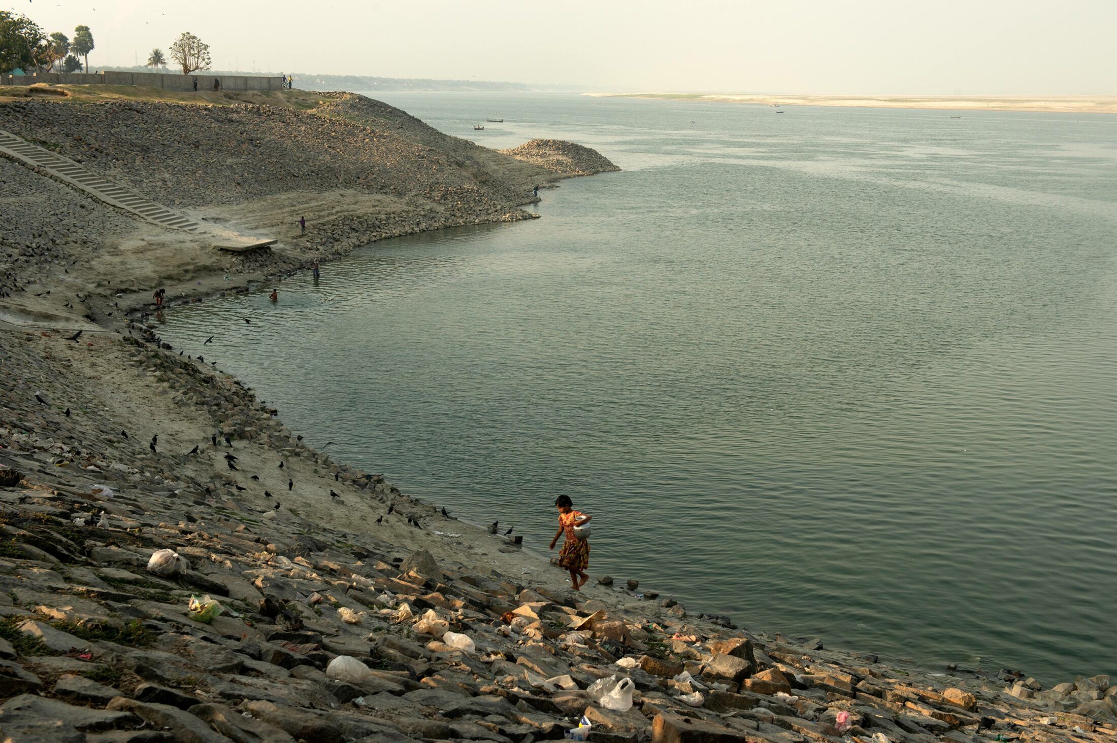
A girl in the erosion-plagued district of Murshidabad in West Bengal, India, fetches water from the Ganga.
MYTHOLOGY OFTEN RUNS parallel to, and intertwines with, history. Thus, the spiritual importance of Bengal as the scene of Ganga’s merger with the sea runs alongside the historical and commercial importance Bengal has always had for those who rule Delhi.
The Ganga, careening through twenty-five hundred kilometers of India’s soil and draining a quarter of her landmass, reaches the Bay of Bengal in several braided distributaries. These navigable distributaries allow the hinterlands to access the Bay and thus facilitate trade. Delhi was always invested in riches from lands near and far, and a good, deep port was therefore vital.
The small coastal town of Satgaon emerged as the trading linchpin of the thirteenth century. Strategically perched on the banks of the navigable Saraswati, at the cusp of the Bay of Bengal, it had access both inland and to the sea. Chinese dhows and junks anchored offshore, transferring their wares to smaller country boats that could ply deep into the interior, towards Sonargaon (near modern-day Narayanganj in Bangladesh), the then capital of southern Bengal.
Satgaon, the Moroccan traveler Ibn Battuta wrote, became “a large town on the coast of the Great Sea,” a medieval-era marketplace for perfumes, for gold, for slaves of “exquisite beauty.” Traders flocked to Satgaon, lured by the handsome profits to be had.
The Saraswati river ruled the waterways for a few glorious centuries before it came to grief on account of an overlooked facet of Himalayan rivers and their capacity to carry vast quantities of silt down from the mountains. The Ganga carts more sediment than most rivers in the world—almost four times as much as the Amazon. This sediment fertilizes the delta and the plains, facilitating the growing of rice, millet, mustard, greens, and fish—sustenance for the teeming millions of Bengal. But over time, the river chokes itself on its own silt—which is what happened to the Saraswati. Oceangoing vessels could no longer drop anchor at the port. Satgaon lost favor as the mouth to prosperity, while elsewhere a settlement along the Hooghly began to draw weavers and artisans and gained prominence.
In the seventeenth century, the British were steadily wresting control of Bengal from the Mughals. For them this new settlement—which they called Calcutta—became the port of choice. Job Charnock, an administrator with the East India Company, is credited with founding a trading port here in 1690. For the emerging British Empire, the Hooghly was a gateway to Assam and a navigable waterway into the northern Gangetic plains.
Trade reoriented itself away from Asia and in the direction of Europe, supplying everything from gold and other precious metals to human currency in the form of indentured Indian laborers, who were shipped off to the far-flung reaches of the British Empire. Calcutta on the east coast and Bombay on the west became the Empire’s two most important Indian ports.
But the strong-willed Ganga had her own plans. Through the nineteenth century, the Hooghly was gradually silting up; by the early twentieth century, ships, wary of the massive underwater shoals that had formed, could barely reach the port of Calcutta. The importance of the port began to erode and with it the prosperity of the people of northern Bengal.
Under pressure from local merchants, the British passed the Calcutta Port Act of 1870, creating the Calcutta Port Commission, which attempted to dredge the river and clear it of obstacles. Defying these efforts, the Ganga continued to lay it on thick.
Arthur Thomas Cotton was a military engineer initially attached to the Madras administration. He was an outspoken proponent of engineering hydrology, of building dams and canals for irrigation, of using waterways rather than railways. In southern India, he led teams that constructed dams across the Kaveri river in what are now the districts of Thanjavur and Tiruchirapalli in modern-day Tamil Nadu; he then led similar projects on the Godavari and Krishna rivers.
In 1853 he turned his attention to Calcutta’s growing woes. He suggested the construction of a dam across the Ganga at Farakka, in what is now the Murshidabad district of West Bengal. This, he theorized, would flush the Hooghly with the waters of the main channel of the Ganga and make it navigable again, thus reviving the dying port of Calcutta.
The British engineers, however, could not come to a consensus about a suitable site for the dam. The Cotton plan lay dormant for over a hundred years until 1957, when the government of newly independent India revived the idea as part of Prime Minister Jawaharlal Nehru’s quest to build “temples to a new India.” They consulted British expert Dr. W. Hensen, who ratified Cotton’s choice of Farakka as a suitable site:
The best and only technical solution of the problem is the construction of a barrage across Ganga at Farakka with which the upland discharge into the Bhagirathi-Hooghly can be regulated as planned, and with which the long-term deterioration in the Bhagirathi-Hooghly can be stopped and possibly converted into a gradual improvement. With a controlled upland discharge a prolongation of freshet period will be obtained, and the sudden freshet peaks which will cause heavy sand movement and bank erosion will be flattened.
The project was now ratified by “expert” imprimatur. Between 1963 and 1971, a 2.62-kilometer-long barrage was built at Farakka, with a feeder channel that pushed water into the Hooghly.
It did not work.
Hensen had not considered a key element—that the Hooghly was a tidal estuary. The river sees saline water inflows from the Bay of Bengal twice daily. The north-flowing tidal bore could be as much as 160 times that of a south-flowing monsoon freshet. Given that, the amount of water washing upriver, carrying with it suspended sediment, was too much for the water from the Hooghly to push back out. The Farakka Barrage, thus, not only failed to accomplish its stated mission, but succeeded in creating a far more sinister problem.
Back in 2015, with Tarikul-bhai as my guide, I had made my first visit to the head of the Ganga delta, upstream of the Farakka Barrage. I made that visit and subsequent ones during the dry season, when the floodwaters had receded and the river flowed aquamarine and low.
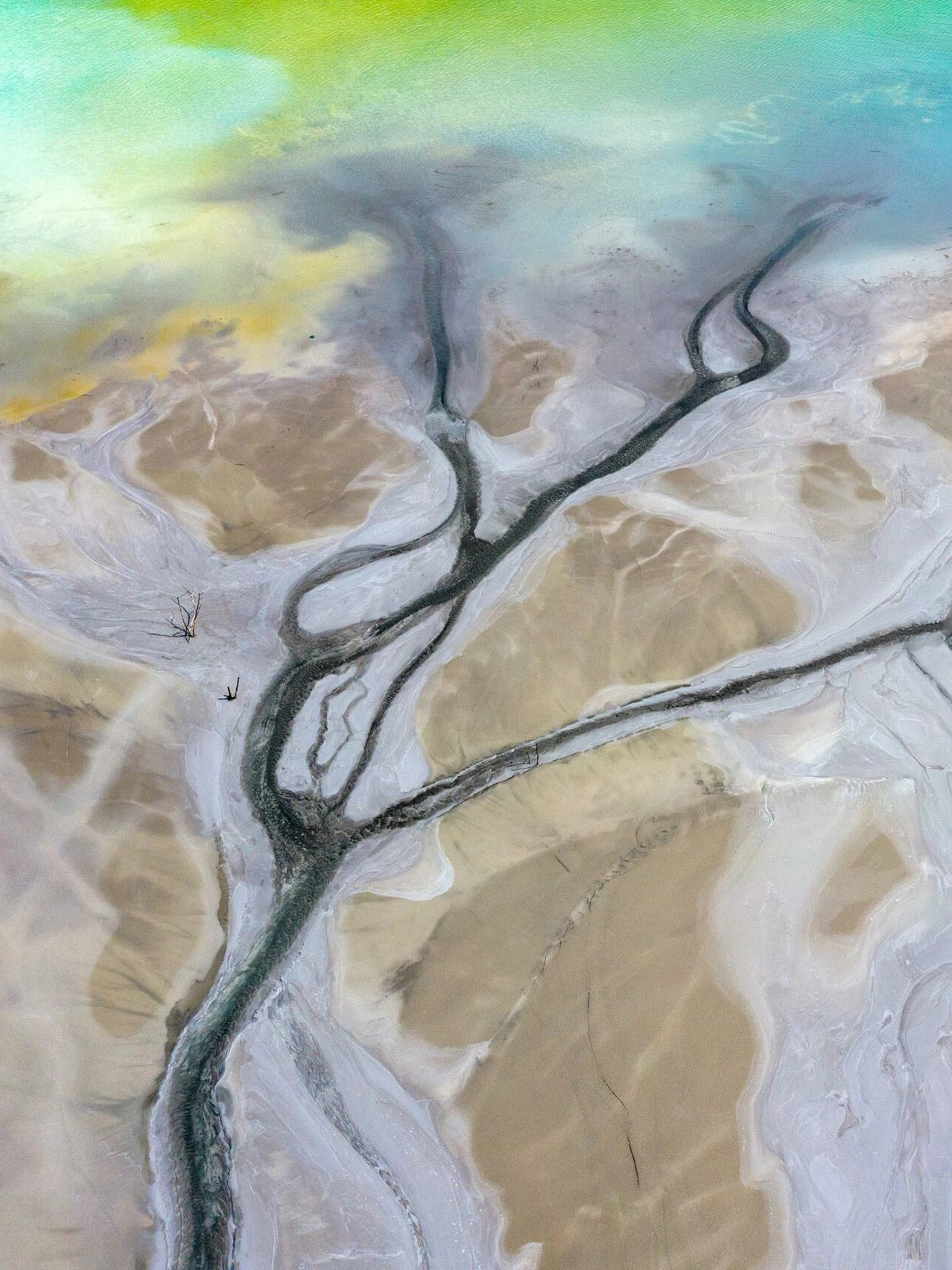
Once the monsoon retreats, silt islands—called chars in West Bengal and diaras farther upstream in Bihar—rise out of the ebbing waters. These seasonal islands, formed by large deposits of silt during the dry months when the river’s flow is lowest, defy the standard land/water binary. They are suspended particles, carted from elsewhere, carried in the womb of the river, and birthed midstream, only to be claimed right back in subsequent seasons. These shifting sands are migrants in their own right and officially belong only to the river.
The silt islands are fertile, they yield bountiful crops; but they’re too ephemeral for anyone to build long-term lives and livelihoods on. People who lose their land to the river “recognize” it when the river births an island on the other side of the channel. Driven to desperation, these internally displaced people, these environmental migrants, take refuge on the chars. They mark out portions of the chars for themselves, give their portions names, till the land and plant their crops and reap their rewards until the onset of the next monsoon, when the surging river might take it all back, leaving them homeless, and displaced, yet again.
And this is where the ill effects of the Farakka Barrage come into play. A river—especially a Himalayan river like the Ganga—is not simply a conduit for water. She carries with her much more by way of suspended particles and biota. She is a multitude unto herself.
By obstructing the natural course of the Ganga, the Barrage not only diverts water away but also blocks the transport of all that sediment. With nowhere to take the silt, the river dumps it at the dam. Over time these deposits accrete, raising the riverbed ever higher. This further checks the progress of the river. She then veers further left (since the right bank is rocky), carving new channels to get out of the trap. The veer is so severe now that she no longer flows coaxially to the barrage, but at an angle.
Her riverbed is so clogged now that, especially during the monsoon swells, she wanders all over the district of Malda. She is so off course that “the river may outflank the barrage in the course of time, opening a new course through the Kalindri-Mahananda route,” says Rudra.
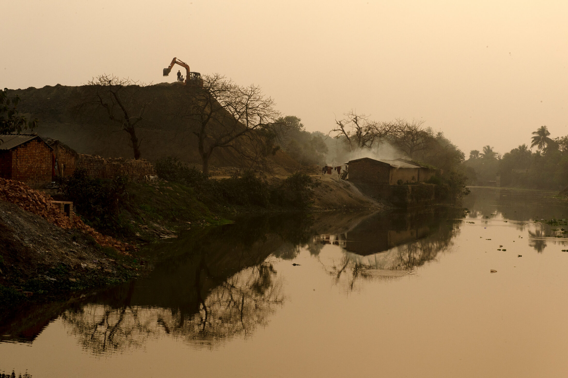
Locals, robbed of their livelihood, are forced to subsist in devastated landscapes.
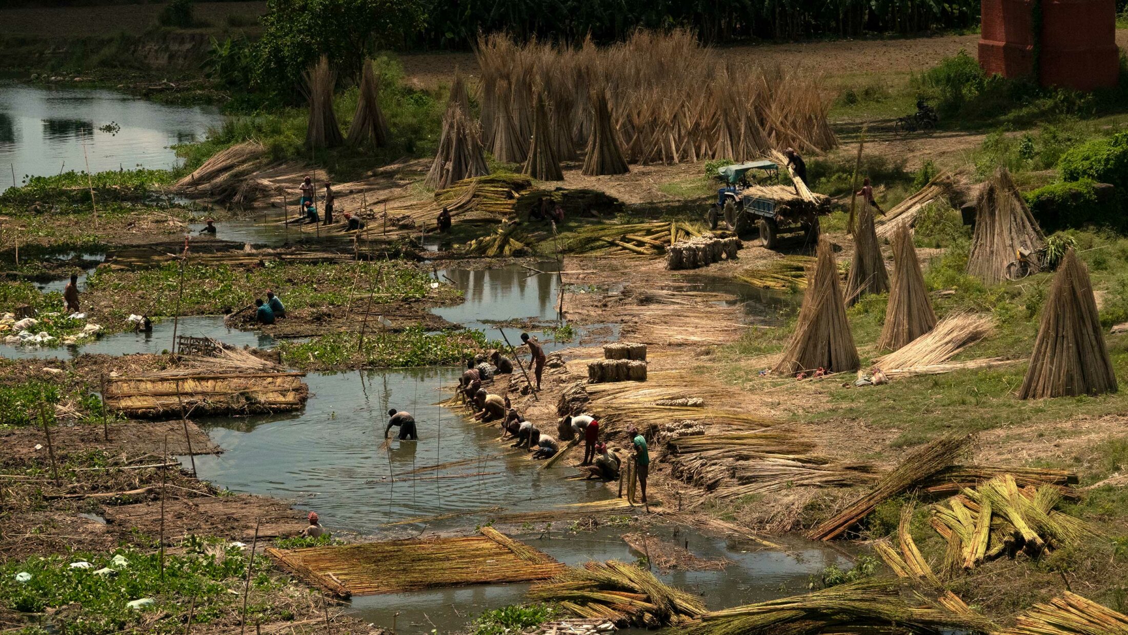
During the monsoon season, raw jute is soaked in the Ganga before being prepared for use in fabric and rope by jute cutters.
THAT MALDA is in the eye of this man-made catastrophe is significant. For over four centuries, from the thirteenth century to the seventeenth century, the capital of Bengal was in the district now known as Malda. The cities known as Gaur, Pandua, Tanda, and Rajmahal are all within a few kilometers of each other, at the head of the Ganga delta. Of these, Gaur was the city most favored; it was the capital for all that time, with the exception of three decades or so.
In the early days Gaur was known as Lakhnawti, a Persian corruption of Lakshmanavati, the name given to the city during the reign of Lakshmanasena, the last ruler of the Sena dynasty. It was a thriving port on the Ganga, who flowed to the east, and the city was known for its fine muslin cloths and silks, prized the world over.
Gaur/Lakhnawti was a populous city, with over 1.2 million families and an influx during festivals, as noted by the Portuguese traveler Manuel de Faria e Sousa in the mid-seventeenth century. “Along the streets, which are wide and straight,” he writes, “are rows of trees to shade the people, who are so very numerous that sometimes many are trod to death.” According to Sousa, in the “principal city in Bengal” the boundaries were marked by high mud walls.
All that now remains of this fabled city, favored by rulers such as the Mughal emperor Akbar, are the ruins of mosques and minarets, of high arching gateways and bridges. The monuments are all made of stone and brick, heavily inlayed and painted; many of the ruins still retain the original pigments, giving us an idea of how visually arresting the city might have been.
By the time the British surveyors came by in the eighteenth century, the city of Gaur had long fallen. The fact that the river appears on the eastern side of the city in early documentation but now flows quite a few miles to the west of it is proof enough that the migration of the river, sometime in the sixteenth century, likely played a major role in the city’s decline.
Writing in 1915, Major F. C. Hirst, who was tasked with studying the problem of siltation along the Ganga, attributed the changes in the river’s course to an earthquake in 1505. Probably measuring around 8.0 on the Richter scale, this was a major seismic event in the area. In the second half of the sixteenth century, the Ganga began to shift southward. Other rivers in the region also seem to have shifted course around this time.
As the Ganga migrated, the city of Gaur was likely left without a clean water supply, and the river’s procession from east to southwest may have turned the region into a festering swamp. There was also a disastrous flood that engulfed the city, which may have contributed to its abandonment. In 1575, a plague reportedly created havoc throughout the city, which had been restored, but documentation from that era refers to Gaur as having “inhospitable” and “unhealthy” living conditions.
By the time Major James Rennell—who built a detailed atlas of Bengal and its various rivers—visited Gaur in 1760, it seemed to have been reclaimed by wilderness and was inhabited by deer, wild boar, and even tigers that stalked the high grasses. A quarter of a century later, Henry Creighton surveyed the ruins of Gaur and in 1786 produced the only detailed work on the ancient city.
The main stem of the Ganga has held to its new course ever since. But the pileup of silt against the walls of the Farakka Barrage and the resulting rise in the riverbed is forcing the river into an oblique course, and it now threatens to return to the course it followed in the sixteenth century, farther east from where it flows today.
Along the Ganga’s ancient path, east of the massive new channel, only a small arm of the river now flows.
WHEN THE GANGA, foiled in its original course by the Farakka Barrage, swung wildly eastward into the channel she occupies today, she threw up a large sandbar, a char, just off the right bank. Over 300,000 homeless people from the lost villages on the left bank of West Bengal made a new home there, gave it a name, and began to farm.
Palash Gachhi is like most chars: fertile, rich, unowned, and open to anyone who wants to live on it. But it has a disconcerting subtext: When it first appeared, it was on the wrong side of the Jharkhand–West Bengal border, which unlike other state borders is not fixed. For some inexplicable reason, the Survey of India demarcated a part of the border between the two states as “the path the Ganga takes.” The problem is that the Ganga adheres to no permanent path. She moves, she veers around obstacles—and the border moves with her.
Neither state likes the idea; both dispute the border. Jharkhand claims this char (which has over time added more sediment and joined the mainland) as its own, but it disowns the people who live on it. As far as officialdom is concerned, the people of Palash Gachhi are Bengalis living in Jharkhand. They fall between bureaucratic cracks: they can avail of no services from Jharkhand since the state does not recognize them as its people, nor can they avail themselves of services from West Bengal since they are technically living in Jharkhand. They are the nowhere people—nowhere on any government’s radar, living in the here and now, unsure of what tomorrow holds.
Over a dozen of these disenfranchised people walk with us as we transect the char, discussing the issues they battle with. A transformer has been stolen, plunging one half of the meagerly electrified island into inky blackness. There is no sanitation; there is no light. There is a hospital building but there are no doctors; there are school buildings but no teachers. One school is exceptional in that it boasts a teacher—who shows up once every two days, teaches for a couple of hours, and leaves.
The problem is that the Ganga adheres to no permanent path. She moves, she veers around obstacles—and the border moves with her.
Given the lack of adequate health care, childbirth is a hazardous process, but there are an astounding number of little children on the char. It is a source of local pride. “Have you seen so many kids anywhere else?” they ask.
The kids flock around us in dozens, bright-faced and eager-eyed. Reena, twelve, says she wants to become a teacher. Gehul, fourteen, wants to be a moulvi, a Muslim cleric. But they are the exceptions—children who have some notional idea of a “future.” Most others just return blank stares when I ask what they want to do when they grow up.
A flock of women, their faces half-covered with their saris, accompany us, shepherding the children along. Rabha Bibi speaks up from among the throng. She lost her daughter at birth, she says ruefully, because she couldn’t reach the hospital in time. When she went into labor, four men carried her on a khatiya (a woven cot), some three kilometers to the ghat. There they transferred to a country boat, which chugged along for almost an hour to reach the village of Panchanandapur. Then the men carried her another four kilometers to the only hospital the people of Palash Gachhi have access to. The journey took five hours—and in the end, it was all too late.
Rabha’s story plays out in a generational loop. Her daughter has lost a child. Her neighbor has lost a friend, a woman who died in childbirth.
Since these nowhere people don’t exist on paper, no statistical surveys have been done, no data mapped. But anecdotal evidence supports the belief that infant mortality and maternal mortality on these chars are inordinately high, as most births occur at home with no proper medical assistance. “We need a functioning hospital here, to save the lives of children and mothers,” Rabha says to a crowd agreeing emphatically.
They hope, they dream, that life will change—but there is no indication that it ever will. And while the women continue to dream, their men take destiny into their own hands and go looking for jobs elsewhere. Some of these migrants are as young as twelve. The young girls, meanwhile, are enrolled in schools that aren’t open, or that they’re unable to attend because they have to earn money for their families.
“Erosion doesn’t stop at our doorstep,” says Tarikul-bhai. “It gnaws its way in, eating through every family.”
The able-bodied men leave; the women and children are left behind in desperately degraded landscapes. There is no livelihood here, what with the fields, orchards, homesteads, schools, hospitals all taken by the impeded river.
On each visit over the years, I have seen groups of women and young girls hunched over baskets, rolling beedis. These are mini-cigars: tobacco rolled in the leaves of the tendu tree (Diospyros melanoxylon) and tied with a thread at one end.
I met a woman downstream of the barrage where the river, deprived of silt, tries to regain sediment load by gulping land. “I know beedis are unhealthy,” she told me, her hands joined together in a plea. “I know the UN is trying to get them banned. But if anything like that happens, what measly income we make will also stop.” Rolling a thousand beedis takes two days and fetches one hundred rupees—less than a dollar a day. If the beedis the women make are surplus to demand, they are not paid.
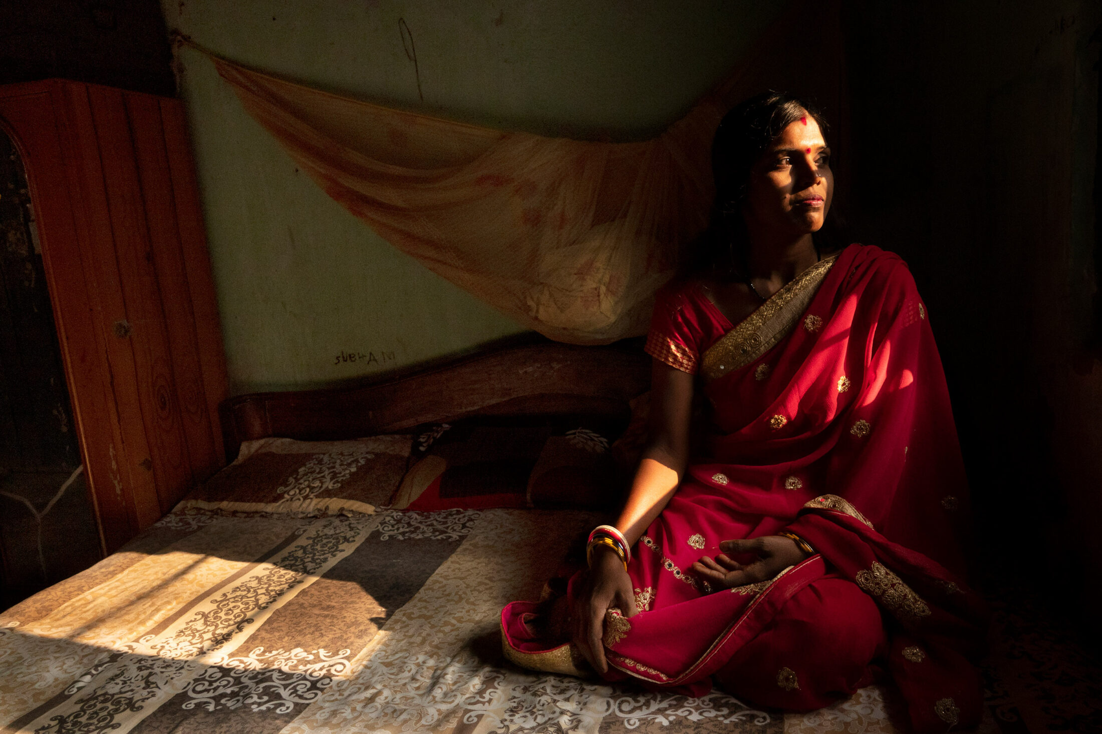
Anita Das, who lives upstream of the barrage and lost everything for the first time, says beedi-rolling is the only option; there are no other jobs available. She has a high school certificate and is sharp as a tack, with a personality and aptitude that would likely fit on a corporate ladder—but such an option is not open to her ilk.
Anita Das is among those who lost almost everything in last season’s erosion.
Following the loss of their home, Anita and her family of four live under a blue tarpaulin sheet, just like a hundred thousand others. “You have no idea how hot it gets under there,” she says. “Children have gotten sunburnt. Women have no privacy to change clothes. There are no bathrooms for us—we slink out at nights or in the early morning and walk long distances just to find an area private enough that we can use it for our ablutions.” She drops her eyes as she realizes that she is saying all this in front of the many men who have gathered around us.
We get up and head towards the edge of the chewed-up bank. She pushes the bicycle she rode on to meet us, talking continuously as we walk. She tells of desperate families marrying off their underage children—especially girls—since they are unable to support them; and how young boys are pressed into child labor—every paisa is invaluable when you have nothing, and no prospects. These children usually end up working in brick kilns, which not only employ underage children but also gouge the riverbank for clay, further weakening its structure.
On each visit, I meet more displaced people living in abject misery. On this latest trip, I talk with folks who have been “rehabilitated” by the government and given patta (sanctioned land) for a four-hundred-square-foot bamboo hut. Even as we’re chatting, a man approaches me with a xeroxed sheet of faint lettering, clearly an official document attested by the District Commissioner’s office.
He claims that the land these internally displaced people were given was his. He has the papers to prove it, he says. The government designated the riverine tract as a “wasteland,” which means that it can be allotted for “better use.”
“My family has been farming on these lands, and these mango orchards have been in our family, for centuries,” he says, eyes flashing anger. “How can the government just [designate] it as a wasteland and give it to them?”
Such disputes, I learned, were just one more consequence of a disrupted river, of an unclear border between states, of government departments at loggerheads, of sandbars that appeared and disappeared at the whim of the Ganga, and of a people constantly uprooted through no fault of their own.
Inamul Haque and Tarikul-bhai, along with a few others, formed a committee back in 1995 to serve as a fulcrum for erosion-affected people. Their demands were simple then and are the same today: they ask that the government release information on vulnerable areas, acquire that land, pay the villagers at market rates, and rehabilitate them in a fair and equitable manner.
They don’t want the government to “sanction relief,” as they know from experience that it will be siphoned off by middlemen and functionaries who grow fat on the misfortune of their fellows. They would rather the government acquire the land at risk and in return give them new land, electricity, schools, hospitals, and a livelihood away from the erosion.
The government has, instead, pumped tens of millions of rupees into fortifying the banks with boulders in a bid to stem erosion. It costs over 100,000 rupees to protect one meter of riverbank—and it doesn’t guarantee against erosion, say experts, who point out that the river in spate washes the boulders away along with the land and everything on it. Yet the effort continues; overall, the government has spent upwards of 130 million rupees (about $1.6 million) on futile fortifications, as of 2015. That number is likely much higher now.
“It is a collusion between the government, which allocates the funds, and the contractors,” says Tarikul-bhai with the fatalistic smile of one who has seen it all before and is not fooled by promises anymore but has not lost hope. “Often, they do 10 percent of the work and claim [compensation] for 100 percent. Also, they start work in the monsoons, which is stupid. How can you work on fortifying the bank when the soil is already wet and soft with rain?”
I look around me, at the gaunt, haunted faces of people who have lost everything; at the simmering anger of the man who claims the land the displaced people have been given is rightfully his; at Tarikul-bhai, who has been fighting for over three decades now for fair rehabilitation and who knows the fight has just begun.
We stand, all of us, just a hundred meters from the edge of an impeded river that has already gulped down nearly five hundred meters of land this season alone.
Before we get on the boat to return to Panchanandapur, Tarikul-bhai steps into a mosque to offer midday prayers.
The mosque hangs precariously over the bank. Its foundation has been sandbagged, and the swollen river laps persistently at it. Three children race each other up and down the cliffside, unmindful of a Gangetic river dolphin that arcs in and out of the river, soundlessly. Suddenly it hunts, and fish dart out of the water in desperation. A few seconds later, all is calm again—the fish relax until the next chase.
I climb down the gouged-out cliff and sit in the boat. As the boat bobs on a deceptively calm Ganga, my mind floats up several images: the Anthropocene interventions in the delta, including canals diverting waters from the main stems of rivers; extensive embankments that impede the transfer of silt carried by the river, thus suffocating the river and denying the delta of the valuable material; dams—from the high Tehri on the Alakananda in Uttarakhand to the Farakka here in Bengal—which have so altered the flows of the Ganga; and the consequences of this willful mismanagement, borne by some of the most marginalized sections of society.
And yet, all along the Ganga in Bengal and along the Hooghly (which is also called the Bhagirathi here) are massive temples and holy places, some among the holiest in India—like the Kalighat just south of Kolkata.
Perhaps nowhere is this dichotomy more apparent than in the 2017 High Court decision in the state of Uttarakhand that declared the Ganga and her major tributary Yamuna to be rights-bearing “living entities,” and that defiling the rivers would be against the law.
The Supreme Court, however, overturned the High Court’s ruling. The apex court said, in effect, that if the Ganga and the Yamuna were people with rights, then pumping waste and sewage into them would amount to violating their right to life as outlined in Article 21 of the Constitution. This would make millions of households, industries, and even pilgrims bathing in the rivers culpable. How would one adjudicate such potential prosecutions?
Explicit in the apex court’s judgment is the fact that while on one hand we revere the Ganga as a Goddess, as a person, on the other, we continue to defile, impede, divert, and suffocate her—and there is no redress.
Tarikul-bhai emerges from the mosque, his head still covered. We push off just as the sky begins to darken. All along the riverbank, life plugs on. A mother sits at the river’s edge combing her daughter’s long black hair, holding a pink hair-tie in her teeth. Four youth idle with fishing poles on the half-submerged roof that once belonged to a school. Further on, the jute cutters are still at it, thrashing and stripping the fiber and hanging it out to dry.
I am silent for the hour-long boat ride back. How can it be that a river is both sacred and profane at once? What will it take for us to make this right? I shake my head involuntarily. As if reading my mind, Tarikul-bhai says in Bengali, “You cannot wake someone who only pretends to be asleep.”
Read More Stories from Volume 4: Shifting Landscapes
Our fourth volume, Shifting Landscapes, is woven from this liminal space. Within you’ll find stories of changing rivers and migrating forests, blurred boundaries between human and animal, geological landscapes that reveal human histories, and prophecies that weave themselves into the land.
Sign up to receive our newsletter each Sunday morning! We are an ad and subscription-free magazine committed to sharing stories crafted with care. Join us as we explore the threads connecting ecology, culture, and spirituality.