Adam Loften is an Emmy- and Peabody Award–nominated filmmaker and producer of virtual reality experiences and podcasts. His films include: Sanctuaries of Silence, The Atomic Tree, Counter Mapping, and Welcome to Canada. His work has been featured on PBS, National Geographic, The Atlantic, and The New York Times.
Chelsea Steinauer-Scudder is a writer based in northern New England whose work explores the human relationship to place. Her essays have been featured in Crannóg Magazine, Inhabiting the Anthropocene, and EcoTheo Review. Her forthcoming book is Rebirth: Mothering Through Ecological Collapse.
Emmanuel Vaughan-Lee is an author, Emmy- and Peabody Award–nominated filmmaker, and a Sufi teacher. He has directed more than twenty documentary films, including Taste of the Land, The Last Ice Age, Aloha Āina, The Nightingale’s Song, Earthrise, Sanctuaries of Silence, and Elemental, among others. His films have been screened at New York Film Festival, Tribeca Film Festival, SXSW, and Hot Docs, exhibited at the Smithsonian Museum and London’s Barbican, and featured on PBS POV, National Geographic, The New Yorker, and The New York Times Op-Docs. His new book, Remembering Earth: A Spiritual Ecology, is forthcoming from Shambhala in summer 2026. He is the founder, podcast host, and executive editor of Emergence Magazine.
Jim Enote, a traditional Zuni farmer and director of the A:shiwi A:wan Museum and Heritage Center, is working with Zuni artists to create maps that bring an indigenous voice and perspective back to the land, countering Western notions of place and geography and challenging the arbitrary borders imposed on the Zuni world.
“Modern maps don’t have a memory.”
—Jim Enote
Long, long ago, the A:shiwi lived deep within the earth, in darkness. Prompted by a message from the Sun Father, they began to climb the branches of four great trees, passing through the four levels of the underworld, at last emerging into daylight and greeting the sun for the first time at Chimik’yana’kya dey’a, or Ribbon Falls, in the Grand Canyon. After their arrival to the surface of the earth, they began to acquire knowledge needed for their survival in this new environment. They planted seeds and flourished. Later, the people emerged from the canyon and began exploring the wider world around them. They split into three groups and embarked on separate migrations. The medicine societies went north to the place of ice. Another group journeyed south to the land of everlasting sunshine. Yet another, joined by the medicine societies, eventually arrived at the Middle Place, known today as Halona:wa, where present-day Zuni,1 New Mexico, is located.
The A:shiwi have been in present-day North America for thousands of years. Twelve thousand members of the tribe live on the Zuni Reservation today. Their sacred lands reach far beyond the reservation boundaries—trails of prayer snake and meander through the history of Emergence from the Grand Canyon and the story of Salt Mother’s migration, paths of song ascend the high buttes and tumble with the rain through the arroyo.
Watch the companion film, Counter Mapping, by Adam Loften and Emmanuel Vaughan-Lee
In March of 1877, less than two weeks after his inauguration as the nineteenth president of the United States, an executive order was issued from the office of Rutherford B. Hayes:
It is hereby ordered that the following-described tract of country in the Territory of New Mexico, beginning at the one hundred and thirty-sixth milestone on the western boundary line of the Territory of New Mexico, and running thence north 61°45′ east, 31 miles and eight-tenths of a mile to the crest of the mountain a short distance above Nutria Springs . . . hereby is, withdrawn from sale and set apart as a reservation for the use and occupancy of the Zuni Pueblo Indians.2
The Zuni were not alone in having their ancestral lands bounded and constricted in this way. Over a billion and a half acres of indigenous lands were seized by the United States government between 1776 and 1887.3 By the mid-1800s, executive orders had replaced treaties as the tool at hand for claiming territory. Native lands disappeared swiftly with a few strokes of a faraway pen. Once an order had been issued, government surveyors were dispatched to carve out the territory.
The maps that resulted from such orders—atlases, political maps, topographical maps—became unquestioned and lasting truths of ownership and identity. Modern maps show the decisive outline of the A:shiwi (Zuni) reservation in New Mexico, that of the Diné (Navajo) in Arizona, the Lakota (Sioux) in South Dakota, the Niitsitapi (Blackfoot) tribe in Montana, and many more.
Such maps are widely assumed to convey objective and universal knowledge of place. They are intended to orient us, to tell us how to get from here to there, to show us precisely where we are. But modern maps hold no memory of what the land was before. Few of us have thought to ask what truths a map may be concealing, or have paused to consider that maps do not tell us where we are from or who we are. Many of us do not know the stories of the land in the places where we live; we have not thought to look for the topography of a myth in the surrounding rivers and hills. Perhaps this is because we have forgotten how to listen to the land around us.
A growing community of Zuni elders, religious leaders, and tribal members have set out to remember.
“You just have to know how to listen.”
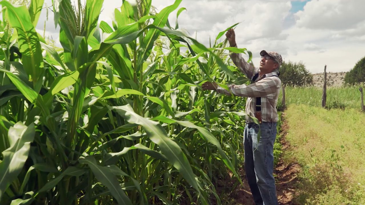
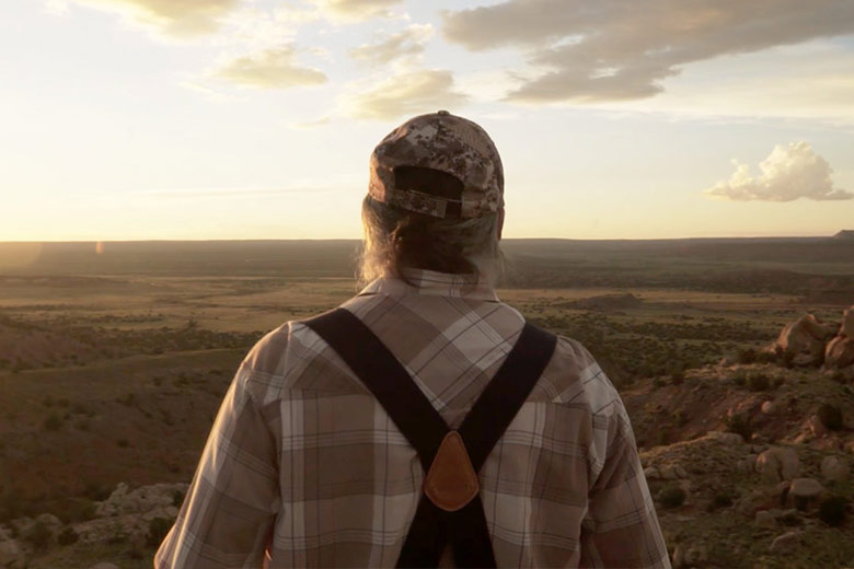
Jim Enote, a traditional Zuni farmer and director of the A:shiwi A:wan Museum and Heritage Center, is in his field checking his crops. If you were to find Jim’s farm on Google Maps, you’d see that his land is bordered by Indian Service Route 2, on the far western edge of the state of New Mexico. But this is not how Jim understands the location of his farm. He knows it in relation to the meandering path of the Zuni River, to its distance from the Grand Canyon, its proximity to the spring that provides essential water to his crops, to Salt Lake, to the Zuni Pueblo, to the memory of his grandfather.
Jim carefully examines the stalks and the leaves of the corn. “They’re telling me things. You just have to know how to listen.” As he pulls weeds, picks hot peppers, and occasionally tilts the bill of his hat to squint at billowing clouds filling the sky, he speaks to his plants, asks how they’re doing and what they need. When he leaves his field in the late afternoon, he turns to this plot of land, which he has been tending for decades—which his family has been tending for generations: “I’ll be back soon,” he says.
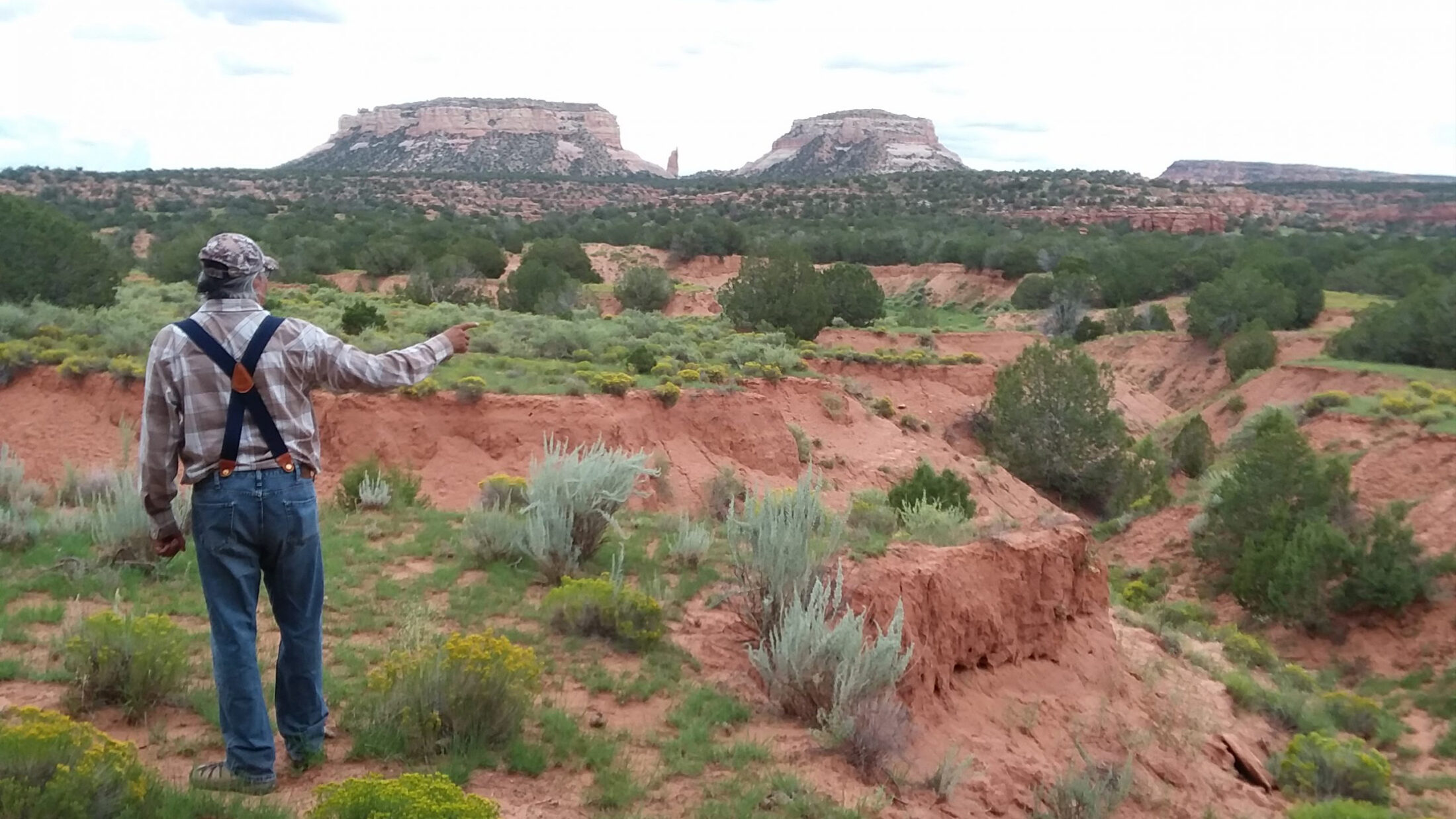
Listening to the land is part of Jim’s vision in collaborating with Zuni artists to create maps that challenge conventional ideas of mapping. In 2006, Jim brought together a group of Zuni elders, council members, and religious leaders to serve on a cultural advisory committee. Together, they began to imagine what it would mean to create “counter maps”—maps that reclaim the names of Zuni places and depict the land of the A:shiwi as they know and see it, immersing the viewer in a landscape interwoven with culture, story, and prayer. The committee decided that the first three maps would be of the Zuni Village, the reservation lands, and the surrounding region. They put out a call for submissions.
Ronnie Cachini first got word about the mapping project from a family member who’d heard an announcement on the local radio station. After submitting a pencil sketch to the committee, he received the news that he’d been selected to create the map of the Zuni Reservation.
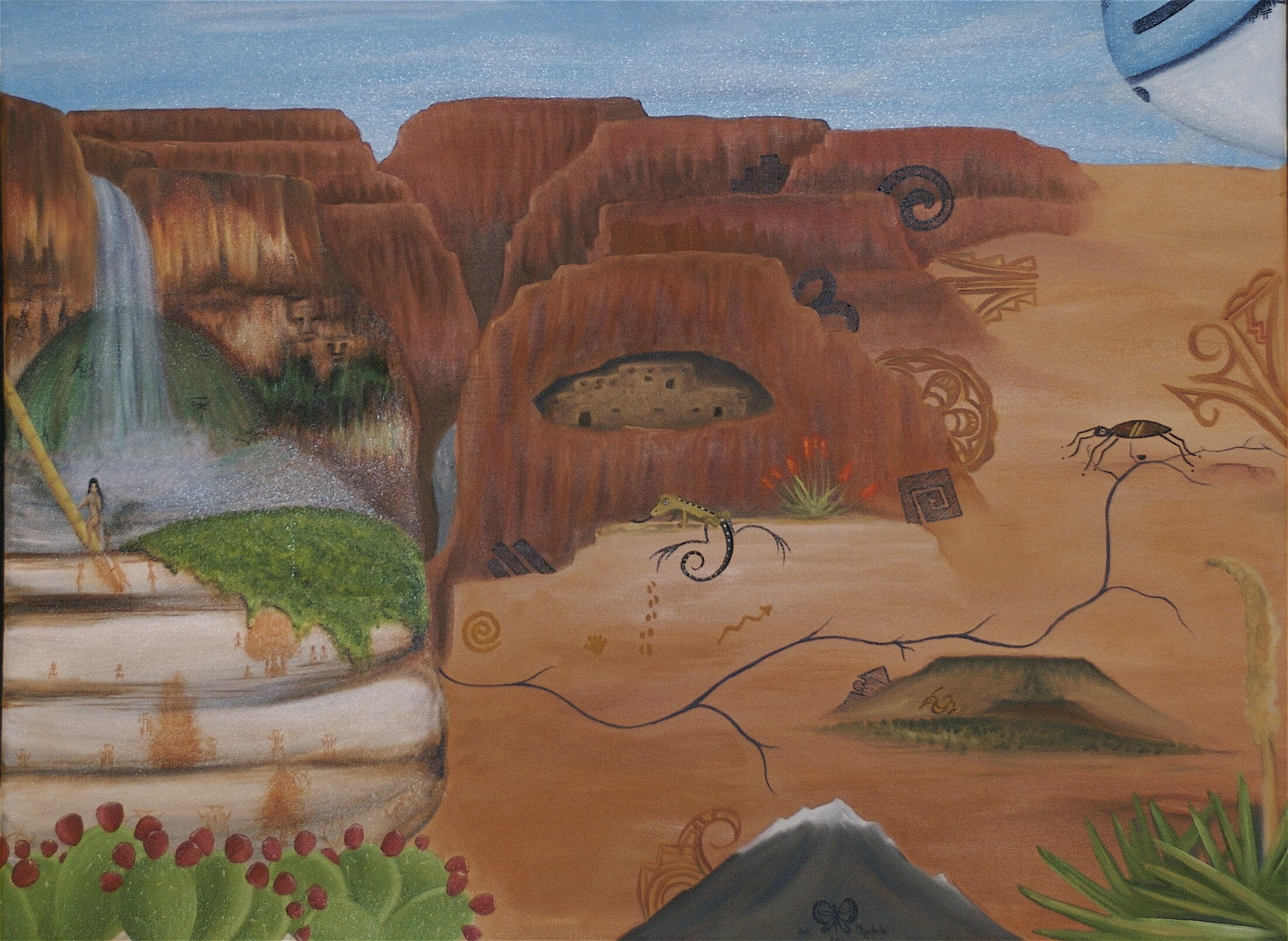
Mallery Quetawki, Grand Canyon, 2008

Ronnie Cachini, Ho’n A:wan Dehwa:we (Our Land), 2006
Ronnie is fifty-four years old, born and raised in Zuni. A:shiwi was his first language, taught to him by his grandparents. He is a medicine man for the Eagle Plume Down Medicine Society and a head rain priest, along with his grandfather, Smith Cachini Senior. Together, they select the dates for fasting during the summer and winter solstices and participate in ceremonies and prayers to renew the earth. “We offer the prayer sticks in asking our ancestors to protect the land and to nourish Mother Earth with an abundance of moisture. . . . If we’re still fasting when it snows or rains, it’s a great feeling, because they have accepted our prayers and our prayer sticks. . . . Whatever moisture we get, we count it as a blessing.”
In his map of the reservation lands, Ho’n A:wan Dehwa:we (Our Land), Ronnie painted places and waterways of cultural significance tied to the A:shiwi migration history. His painting features snow-capped plateaus, ancient farming villages, buttes, and lakes, all of which rise as soft islands of color from a green and yellow background. Modern roads intersect the canvas as thin black lines. Deep blue, angled feathers hang from the rim of a golden basket.
Ho’n A:wan Dehwa:we looks nothing like a typical road atlas. It in no way resembles the Google Earth view pulled up on your phone with the swipe of a screen. It is full of color and texture and story, painted onto wide canvas.
“A conventional map takes you to places—it will tell you how many miles and the fastest route. But the Zuni maps show these significant places that only a Zuni would know,” says Ronnie, “especially if you’re in a religious leadership position: you see the prayers that we say, the prayers that we hold. . . . I incorporated a basket and prayer sticks to signify that. The prayer sticks that we make and that we offer to our ancestors are what holds this village together, which holds the people together. That’s what my painting means.”
During the winter solstice, the prayer that relates the Zuni creation and migration history is told in its entirety. Mallery Quetawki grew up on the Zuni Reservation, hearing the prayer every year in the short days of winter. She did not, for a long time, think of this prayer as much more than a beautiful poem. Of a younger generation, Mallery did not grow up speaking Zuni fluently as Ronnie and Jim did and could not always glean the full meaning of the words being chanted and sung. The places sung about often remained abstract in her mind.
“We misconstrue some of the meanings because we don’t know what some of these words mean. We don’t speak complete Zuni anymore. We’ve mixed with English, we’ve mixed with Spanish, and other languages that have come along.” When the prayers were incorporated into the Zuni maps, however, Mallery was able to relate to them in a way she never had before. “It’s a really great learning experience to actually visualize these prayers, to put prayer into art and into a literal map. Culturally, it allows us to reconnect to our past.”
Mallery was in her second year of a dual degree in biology and art at the University of New Mexico in Albuquerque when she heard about the Zuni mapping project through her father, who was serving on the cultural advisory committee and encouraged her to submit a sketch.
“I was selected to paint our connection between our village and the Grand Canyon area.”
“It’s a really great learning experience to actually visualize these prayers, to put prayer into art and into a literal map. Culturally, it allows us to reconnect to our past.”
Mallery’s painting was to include Ribbon Falls, the place where the A:shiwi emerged into the sunlight and a site she was deeply familiar with in traditional prayers. Zuni men journey to the falls to leave offerings and to collect pigments and medicinal plants. As a Zuni woman, Mallery is not permitted to visit Ribbon Falls. “It’s a cultural reason, being that women did not take part in the kiva festivities. It is a male-only portion of society. That is a religious part of our culture,” says Mallery. In the matriarchal society of the Zuni, women own land, property, and livestock and traditionally have stayed behind from journeys that are potentially dangerous. “[My father] said, ‘You play the most important role in the village, so we don’t want you to go through those dangers. It is grueling and we do it as a protection to you.’ . . . I felt really good about hearing that version, because I was kind of left out. I grew up very traditionally, so I understood it.” Mallery created her painting of Ribbon Falls and the Grand Canyon based on photographs and stories that she sought out from her family, elders, and community.
Each clan and society in the Zuni community holds different details of the creation and migration stories. As Mallery heard these ancient stories recounted again and again, she began to feel a deeper relationship to the places that ultimately appeared on her map. “All these prayers we thought were just chants and poetry were actually recollections of history, retelling of history.”
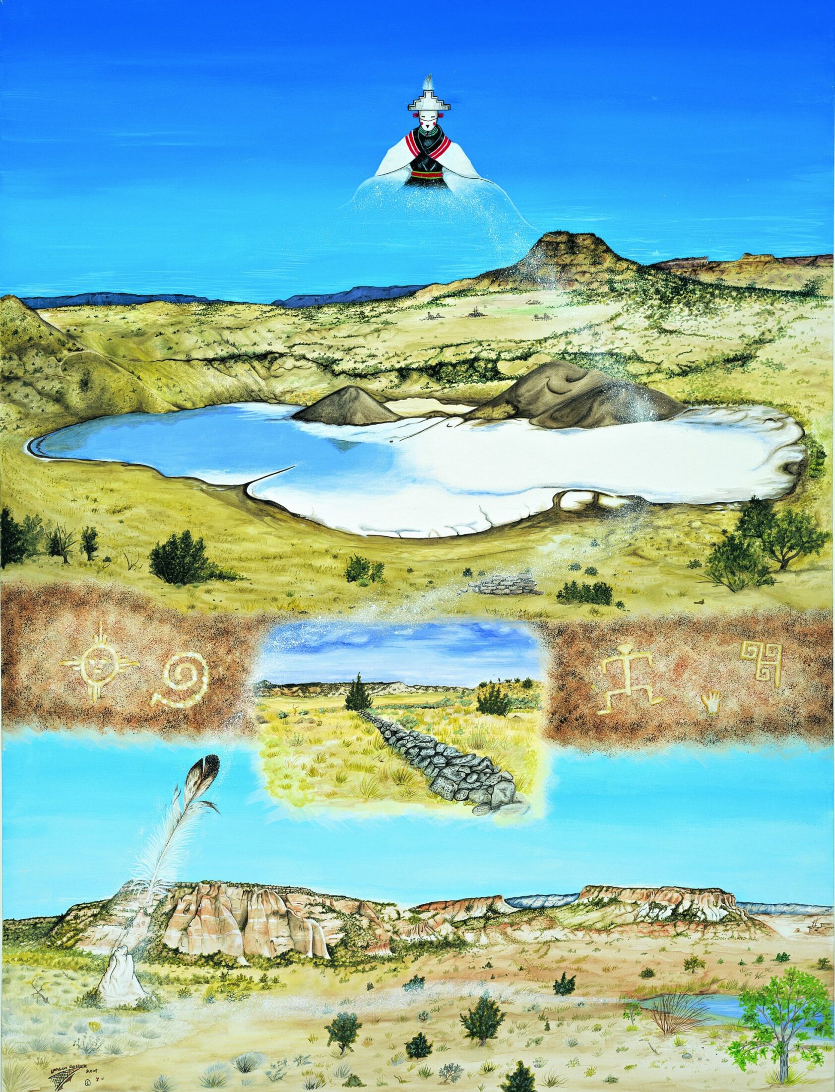
Mallery completed her map, entitled Grand Canyon, in 2008. “I put a lot of myself in it. I think a little more so because I didn’t get to physically experience Ribbon Falls, so it’s like I had to actually dig a little deeper to try to paint it in a way that I can bring awe to other people, even though I didn’t get to have that experience.” In her painting, a figure, framed by Ribbon Falls, reaches a hand down to a creature who is climbing into the world of light. Below, other beings make their way through the four levels of the underworld. The Colorado River flows from the Grand Canyon. The Little Colorado River twists to the right, setting off on its own, marking the migration path of the A:shiwi to the Middle Village, meandering past San Francisco Peaks and Woodruff Butte, to the place where the Water Strider stands.
“During our migration, our people were still looking for the center of the world, the Middle Place,” says Mallery. “They came on hardship, and so they were assisted by the Water Strider. It’s said that the Water Strider will extend its arms and legs out, and wherever its heart touches, that is the center of the universe, the center of the world, and that is where we will settle.”
Grand Canyon is a map of a traveled landscape, the journey from creation to home.
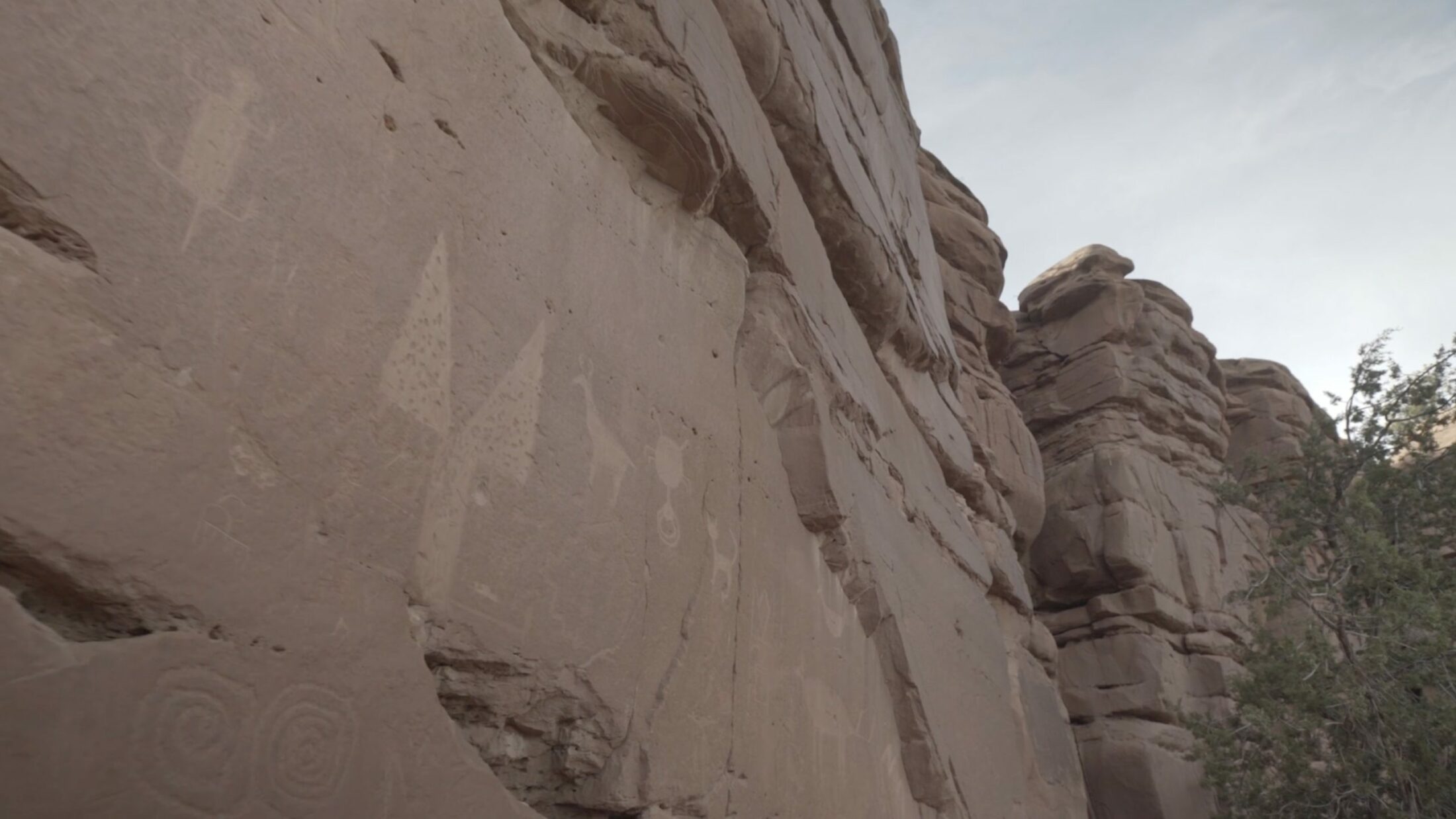
Jim runs his hand over a fish carved into a red sandstone wall that towers over the dusty, cracked ground dotted with cacti, yucca, and pine. Several hundred yards away, the land drops abruptly into an arroyo. For thousands of years, the A:shiwi etched animals, events, and stories into rock, painted rainfall and gardens onto pottery, and composed songs that told the way to springs and rivers. This, too, is mapping, says Jim. The names and images connected with places conveyed a symbiotic relationship between the people and the land.
After their lands were colonized by the Spanish in the sixteenth century and later claimed by the United States, indigenous peoples of the Colorado Plateau were left in a deeply familiar territory of unfamiliar names. “The names are in English or Spanish, and so they completely leave off the meaning of the place, and its essence, too,” says Jim. In the 1862 publication of the Johnson Family Atlas, the aboriginal lands of the A:shiwi and the Diné are stamped as the “Military Department of New Mexico.”4 Even “Zuni” is a foreign word. “Zuni is a name that was given to us by the federal government,” says Ronnie. “That’s how the federal government recognizes us. But we call ourselves A:shiwi. The name means ‘human being.’ It doesn’t mean anything else but human. Shiwi is a human. A:shiwi are human beings.”
On the War Department’s 1877 map of the United States, a red flag marks the location of Fort Wingate in northwestern New Mexico, a few miles north of the Zuni Pueblo—a site established by the United States government in 1860, in part as an effort to displace the Diné people.5 “‘Fort Wingate’ just tells us that there used to be a fort there that was built in the 1800s,” says Jim. The Zuni name for the site, however, is Bear Spring. “That says something about the environment and the resources, especially the life-sustaining resources, that are there.”
Non-Zuni names became canon. Today, the roads in and around Zuni are called Indian Service Route 2 or State Highway 53. Once, they were Zuni foot trails, ways to get to important sites for prayer, water, and needed resources. “Some of the trails are mentioned in songs, and those songs really say something about a destination: that trail goes to a place and the name of it is described as a destination, and how to get to that destination,” says Jim. “State Highway 53 doesn’t tell you where you’re going.”
For thousands of years, the names of places were interwoven with experiences and stories of the landscape. Increasingly, younger generations do not know the original names of—nor the original connection to—culturally significant places. Instead, they see maps that assert reservation borders, intersected by Indian Service roads and military outposts.
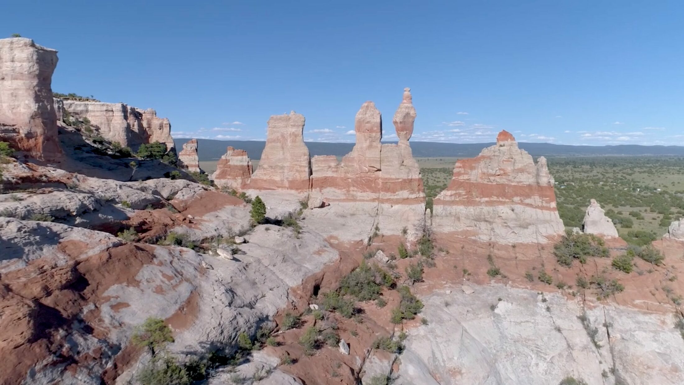
The Zuni maps, says Jim, contain something very important: a different way of looking and knowing. “To assume that people would look at the earth only from a vantage point that is above and looking straight down doesn’t consider the humanity of living on the landscape. Saying that there’s a pond, there are cattails, there are turtles in that water—that is a different view that expands the human experience of a place.”
This different view is what Jim, the committee, and the artists hope the Zuni people will recognize when they encounter these maps and consider their place in the cosmos—not a world that is constructed from GPS waypoints or one that was decreed in an executive order—but a particularly Zuni world, infused with the prayers and histories that created it. The Zuni maps have a memory, a particular truth. They convey a relationship to place grounded in ancestral knowledge and sustained presence on the land.
That such a relationship consistently fails to appear on modern maps has been the impetus for creating and sharing the Zuni maps—both with the A:shiwi people and with a wider audience. They remind all of us of the ancient names, voices, and stories that reside within the landscape, inviting us to examine our assumptions about what it is that makes up a place and the role that we play in that long and layered story.
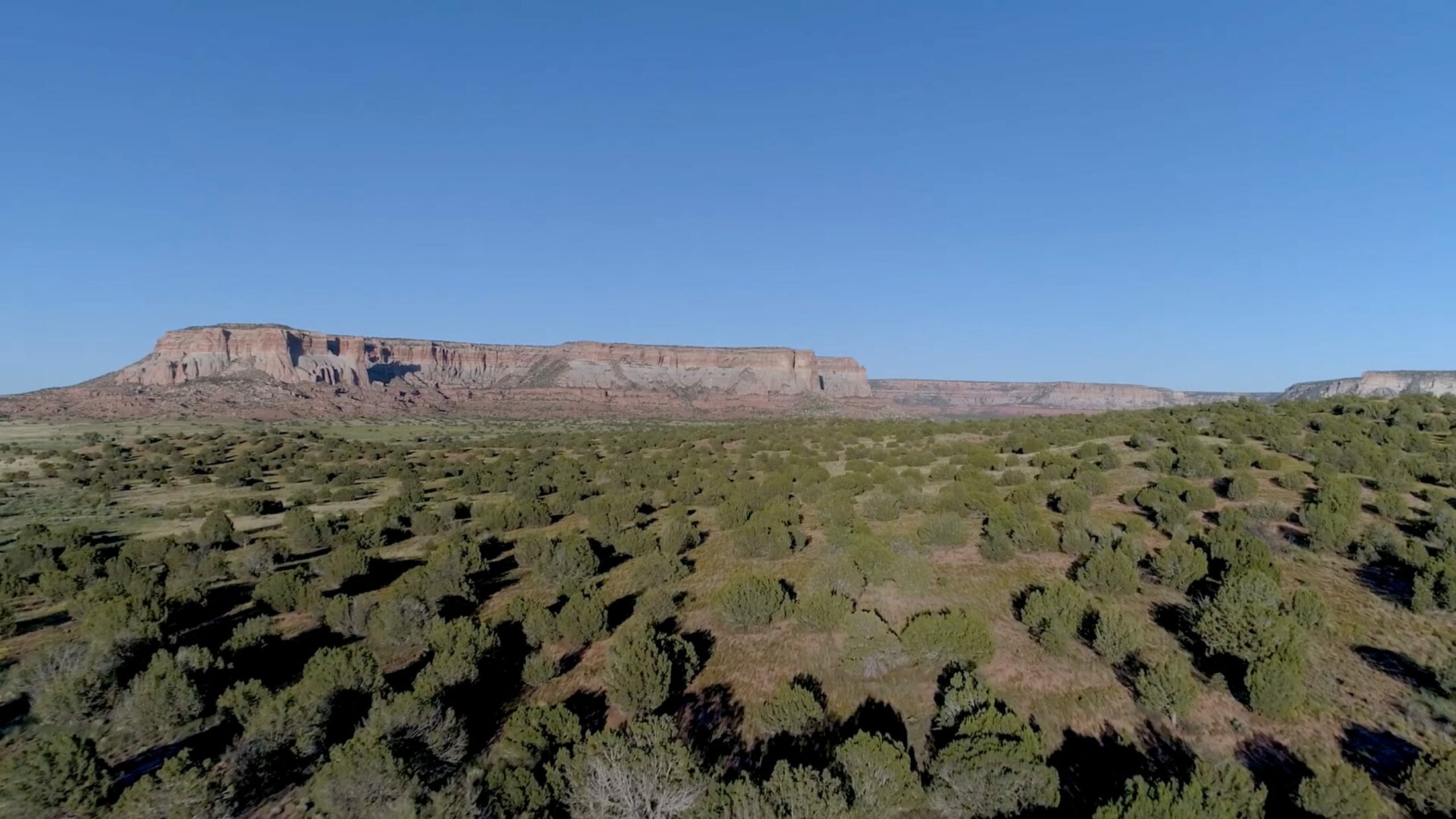
Every morning, Jim’s great-grandparents awoke before dawn and said a prayer to assist the sun in rising. There are times, Jim says, when he longs to see the world as they did. He wishes he could forget, if only temporarily, that the earth revolves around the sun, that our lives are grounded in the laws of physics. “My great-grandparents were living a life that was about maintaining a cosmological process. They were part of helping winter become spring and summer. They were part of helping the sun come up and giving thanks for that.”
But Jim cannot shake free of modern ways of thinking. He faces the challenge of reconciling traditional ways with a modern worldview that, by and large, originated from the same culture that marginalized indigenous people and then inhabited or destroyed their sacred lands. While Jim values many of the advantages and breakthroughs of science and technology, he also recognizes a loss of connection, and a gap in collective memory about being part of a greater and more ancient process, particularly among younger generations.
“We live in two worlds,” says Ronnie. “We have our traditional world and then we have the modern world. We don’t mix them. . . . Our traditional way is still strongly intact, and the modern way of life is what sustains us . . . that’s what we live on. We all have jobs, we all have bills to pay.”
Many children no longer grow up with multiple generations in the same household, learning the stories and language from their grandparents, visiting the places that exist in the ancient prayers. Many leave the reservation to seek better employment and educational opportunities. In an effort to sustain traditional knowledge, every family in Zuni Village was given a poster-sized copy of each of the first three maps that were created; these now hang on the walls of Zuni homes. Ronnie’s map is among them. “We’re teaching these young families our migration history,” he says. “It is basically the creation of our people, creation of the world, our prayer. And so what we hope is that the map art would help the young people get back to where they came from.”
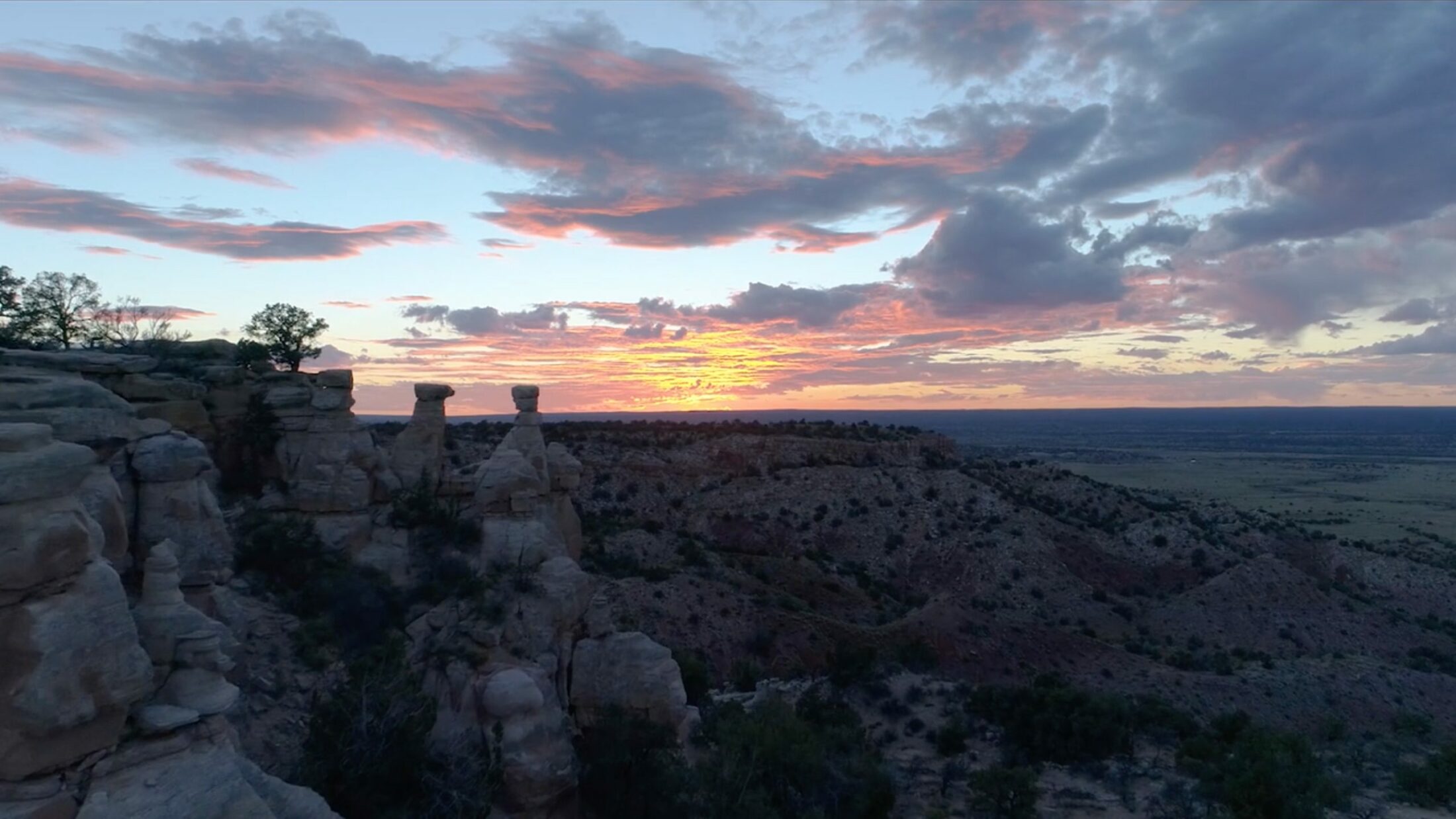
Mallery, now thirty-two, left the reservation after high school and has lived in Albuquerque for fourteen years. “For the modern society who doesn’t speak Zuni day in, day out like it was in the old days, we have jobs in the city. We have school. We’ve had to learn English. We’ve gone out and gotten education, and we were out of the reservation. We’re not so connected as we were in the past, so a lot of these stories and prayers get—I don’t want to say misrepresented—but we forget that it’s not just a beautiful poem, it’s not just an epic or a story.”
The Zuni maps are an effort to orient the Zuni people, not just to their place within the landscape, but to their identity, history, and culture. The maps contain a powerful message: you have a place here, we have long traveled here, here is why this place is important. Through color, relationship, and story, the maps provide directions on how to return home.
“It’s place-making power, said by prayer, now that we’ve made it visual,” says Mallery. “It’s an actual map. It made me appreciate where I come from even more. . . . It’s definitely given me that extra need to pass it down. To make sure my kids know the story. To make sure their kids will continue to see these stories, as well as hear them. . . . It’s unforeseen how long our future children will be able to hold fluent conversation in Zuni. Now that we have an actual way to map out how we are today, I feel that it’s giving the future more time to hold on to what we have. We’re adding time to our cultural clock.”
The Zuni maps draw deeply on shared experiences of place. They depict petroglyph carvings, images from prayers and songs, colorful stacks of pottery, arroyos and mesas. They are an opportunity for the Zuni to reclaim a deep understanding of a shared cultural tradition, rooted in ancestral lands, told again in a familiar language. The maps are a critical part of constructing a bridge between the worlds of tradition and modernity, connecting the old ways with the new.
“We can do both,” says Jim.
Through color, relationship, and story, the maps provide directions on how to return home.
The Zuni maps remind us that modern, conventional maps convey only one very particular way of being in place, one which often, counterintuitively, leaves us disoriented and disconnected. Conventional maps do not tell us what it means to be somewhere—the details of the landscapes we live in, the sounds of the trees and the birds, the long histories of the arroyos and the mountains, the names of the people who built our homes.
“Modern maps don’t have a memory,” says Jim. “For me, the whole landscape around here is home. I have patterned languages that help me to remember how I get from one place to another. I go to my field in the summer. I collect wood in the fall and winter. I may be pinion picking or going to collect tea. . . . This whole constellation of what makes up a map to me has always been far beyond a piece of paper.”
To outside eyes, what is perhaps most haunting about the Zuni maps is that they confront us with not-knowing. They present us not only with the stories and myths that we are not privy to in the Zuni worldview but also with the disorienting realization that many of us have forgotten the earth-based stories and myths of the places of our own, or that we never had those stories to begin with.
It is story that weaves our experiences into the landscape and ties us to place. The Zuni maps, to this point, hold a question: To what extent do such stories and myths of place have to be deeply specific to place? There is a tendency in a globalized society to assume that knowledge is open and accessible, able to be reached across the world with the click of a button. In many ways, of course, this is greatly valuable. But the Zuni maps suggest that stories of place—the ones that really and truly connect us to the lands outside our own front doors—cannot be downloaded from the internet or read in a book. They suggest that the stories that are particularly rooted in the land can only be discovered by taking the dedicated time and attention to encounter the land itself—over long periods of time, through many seasons. Perhaps stories and myths of place need to have been spun from the threads of this landscape. While it seems easy to believe that what is at the core of any relationship to place is and must be universal, perhaps the language and the telling cannot be universal at all. We are far less likely to care for places if we have not bothered to know or understand them.
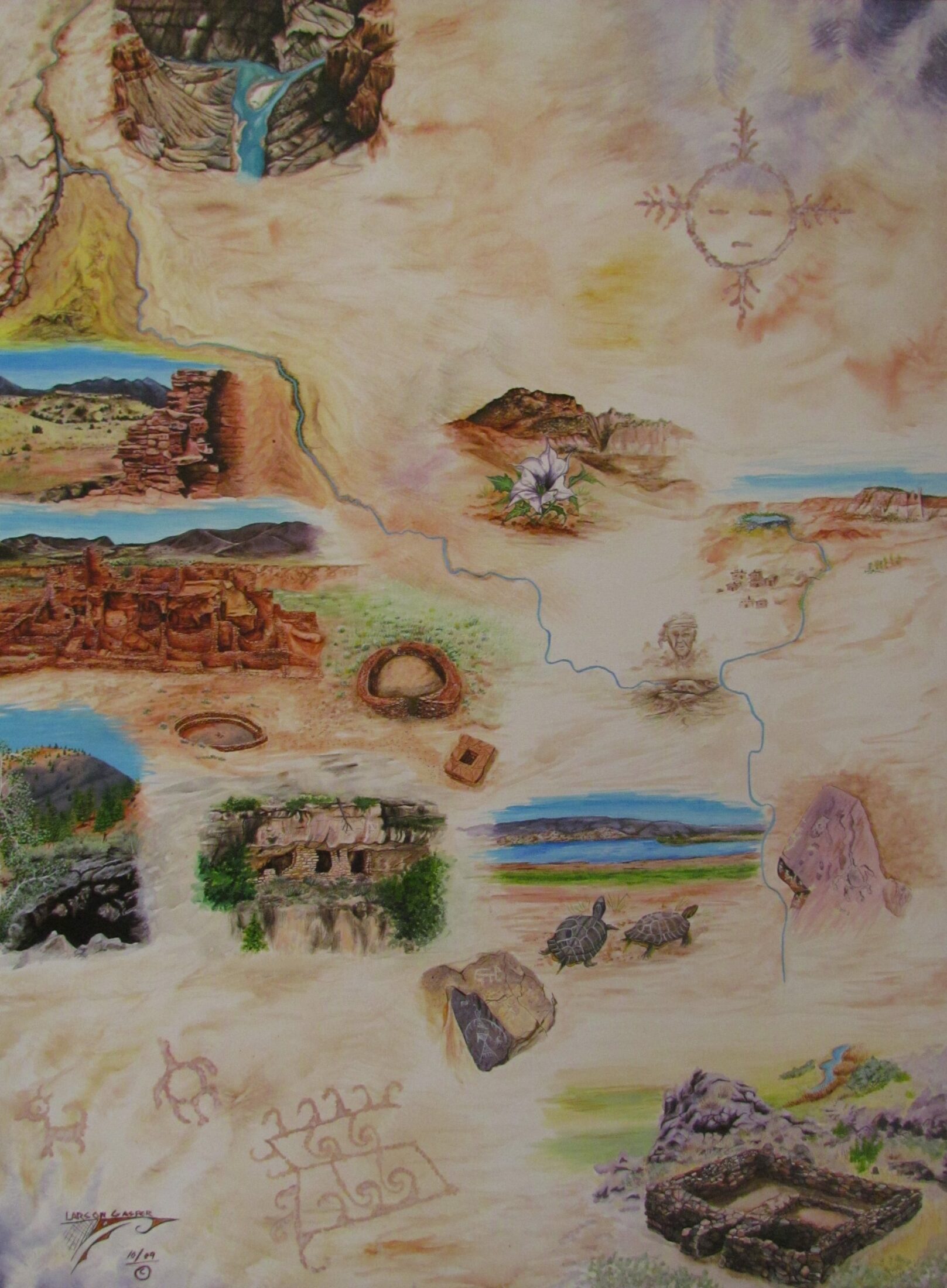
Larson Gasper, Little Colorado River, 2009
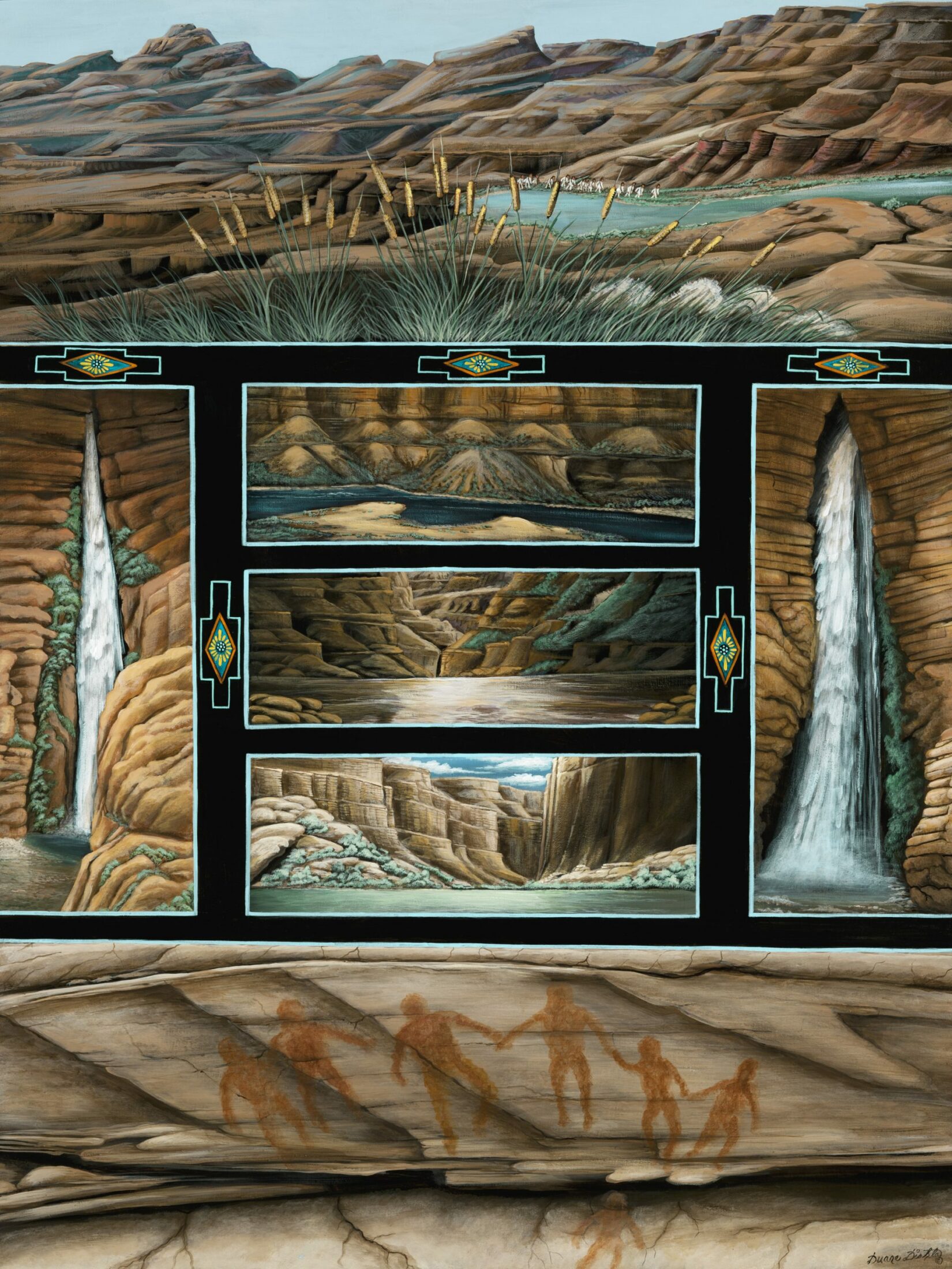
Duane Dishta, Grand Canyon, 2009
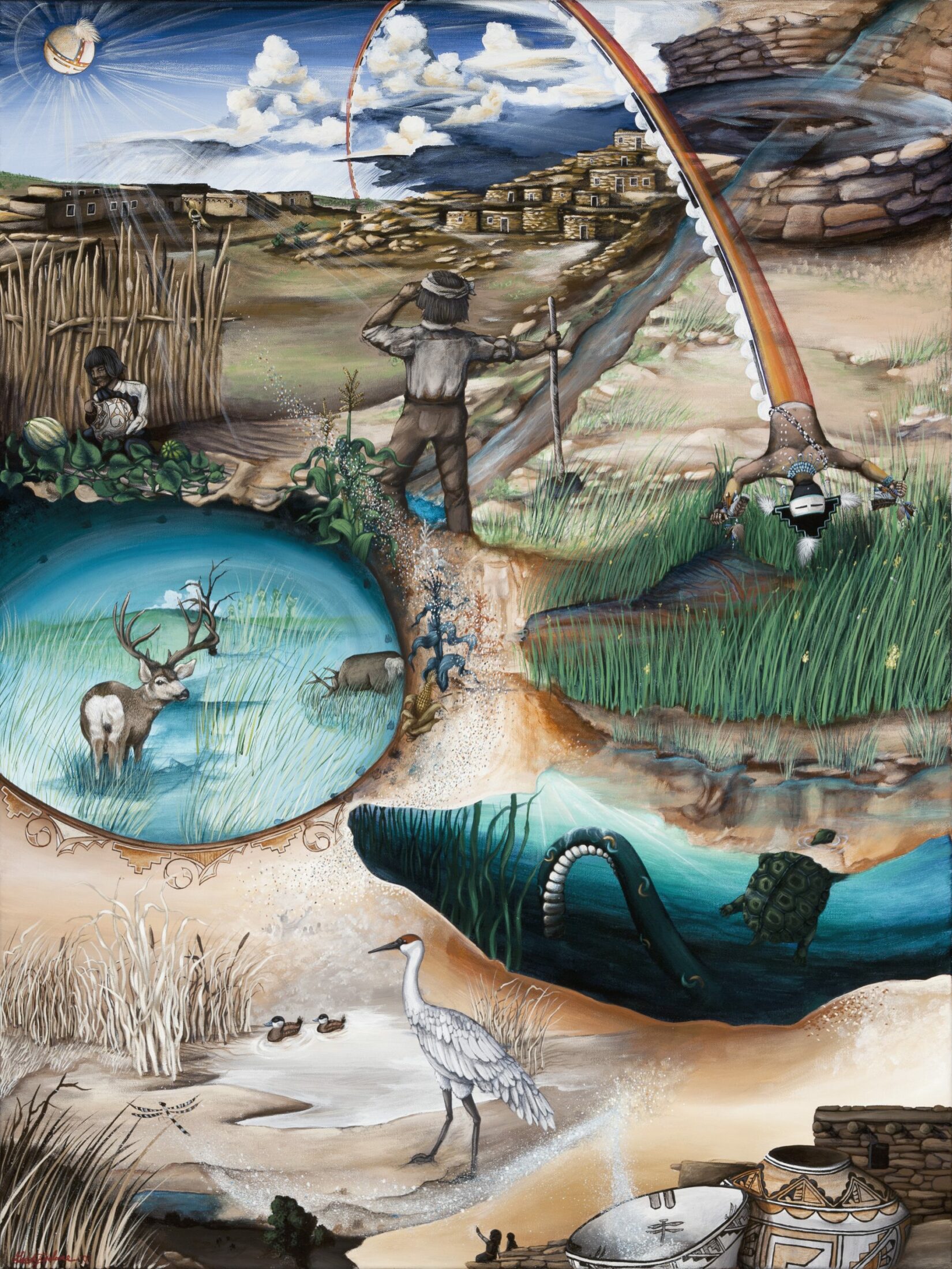
Geddy Epaloose, K’ya’na: K’yawakwayina A:dehya (Ojo Caliente), 2009
Woodruff Butte in Arizona rises from the landscape of Mallery’s painting. A thin arm of the Little Colorado extends toward it on its way to the Middle Village. The butte is a sacred site of pilgrimage and prayer for both the Zuni and the Hopi. Its name in Zuni, Dematsali Im’a, refers to a medicinal plant harvested there since time immemorial, used by shamans for its healing properties. Dematsali Im’a sits on private land. In the 1990s, the landowner allowed it to be mined for gravel; it has since been reduced to a pile of rubble. Ancient Hopi shrines, eagle nests, and the medicinal plant have all disappeared from the site. Mallery chose to memorialize Dematsali Im’a, as it once stood, in her painting.
That plant, she says, was the story of that place. “And now it’s gone. And we don’t know what else to tell.”
The Zuni maps are, first and foremost, for the Zuni people. But they hold a powerful message for a non-Zuni audience as well: we are all part of a greater process. We would not be here if the sun did not rise every morning, if the rivers stopped flowing. The maps are in many ways an invitation: How would you map the places that live in your memory? What are the voices of the land that are forgotten, unheard? To ensure the resilience and well-being of the places where we live, we cannot assume that land is simply ours for the taking, a means to our own ends. The Zuni maps remind all of us that we, too, must take the time to deeply listen, to hear and share stories in which we and the land have equal voice.
The Zuni maps remind all of us that we, too, must take the time to deeply listen, to hear and share stories in which we and the land have equal voice.
To date, thirty-two Zuni maps have been made, including two more painted by Ronnie: The Colorado River and Sites of the Grand Canyon. “All the maps have something to do with our prayer,” he says. “That’s our history. Our history just doesn’t start in the Grand Canyon and come straight to Zuni. No, it’s vast.”
Sites of the Grand Canyon is inspired by a boulder that Ronnie and the cultural advisory committee came across on one of their journeys up the Grand Canyon. The boulder is covered in ancient petroglyphs. After looking at it for a long while, Ronnie realized that the boulder itself was a map of the Colorado River, each petroglyph representing a place, a story, or a prayer.
“That’s the map of the river. There’s little side canyons, and then there’s a little circle or a square, and some even had little dots. And I believe those were highly significant places, or a place name. Those places had names. And then there’s other little petroglyphs, like the images that had the two tails hooked together. They’re jointed like that. At the very end in all the prayers that we have, we have a verse that says ‘Hold on to each other tight. Hold on, never letting go.’ That little petroglyph says to us: never let each other go. It has the tails hooked to each other, signifying that we’re never going to be apart and we’re never going to let go of our traditions. Never letting go of who you are is what it means. That’s the closest way I could say it in English. Never letting each other go. Never letting yourself go, meaning never forgetting who you are, where you came from, here in your heart.”
- The first person to record the name Zuni was a Spanish explorer in the sixteenth century. The indigenous people who are federally recognized and widely known as the “Zuni” people call themselves A:shiwi, a word meaning “human being.” In our experience writing this essay, the names “Zuni” and “A:shiwi” were often used interchangeably by the A:shiwi people we spoke to. We have used both here.
- “Invasion of America: How the United States Took Over an Eighth of the World,” eHistory (website), University of Georgia, accessed January 5, 2018.
- Ibid.
- “Johnson’s new illustrated (steel plate) family atlas, with descriptions, geographical, statistical, and historical,” Library of Congress (website), accessed January 5th, 2018.
- “Map of the United States,” Library of Congress (website), accessed January 5th, 2018.
Counter Mapping
Jim Enote, a traditional Zuni farmer and director of the A:shiwi A:wan Museum and Heritage Center, is working with Zuni artists to create maps that bring an indigenous voice and perspective back to the land, countering Western notions of place and geography and challenging the arbitrary borders imposed on the Zuni world.
