
Writer
Boyce Upholt is a freelance writer. He is the recipient of the 2019 Award for Investigative Journalism from the James Beard Foundation and was named a 2016 “Writer of the Year” by the International Regional Magazine Association. His work has appeared in Mother Jones, The New Republic, The Atlantic, TIME, The Oxford American, and The Believer, and has been included as a “notable” selection in the Best American Science & Nature Writing series. He is currently working on a book about the Mississippi River.
Photographer
Jenny Ellerbe is a photographer and writer whose work focuses on the largely overlooked region surrounding her hometown of Monroe, Louisiana. Her book Poverty Point: Revealing the Forgotten City, co-written with archaeologist Diana Greenlee, received a 2016 Louisiana Endowment for the Humanities Book of the Year award. In 2023, she was named Documentary Photographer of the Year by the Louisiana Endowment for the Humanities.
For thousands of years, Indigenous societies were building hundred-foot pyramids, fifty-acre plazas, and intricate clusters of hillocks along the wild waterway of the Mississippi River. Beholding the 2,200-mile levee system that now curbs the river’s torrent, Boyce Upholt wonders: what do our monuments say about who we are—and the crises we face?
My weight remains
heavy upon this land.
—Allison Hedge Coke, “Snake Mound”1
The Mississippi River appears on most maps as a line of blue that cuts the continent in half—a convenient borderline between the hidebound east and the wilder west.
A river, though, and especially a river so big, is never orderly, at least not when left to its own devices. The Mississippi’s unruliness grows as each new tributary joins the flow. Many are big enough to lend their names to whole states: the Minnesota and then the Wisconsin, the Iowa and the Illinois. By the time the Missouri arrives, halfway down the continent, the nation’s big river has grown to the extent that—again, speaking here of natural conditions—it can writhe across a floodplain six miles wide. When the Ohio joins at the bottom tip of Illinois, this river becomes a monstrosity. A continental torrent. I’ve heard stories of through-paddlers who, after traveling more than a thousand miles from the headwaters, give up when they reach this confluence, overwhelmed by the size of the water.
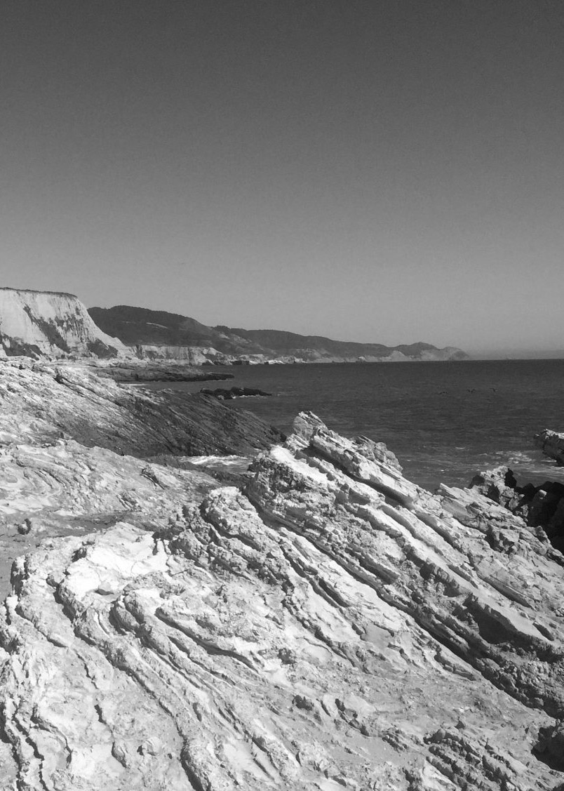
To understand the southern river, you have to know that as recently as twelve thousand years ago, there was no river here. There was not even land. Instead, an arm of water reached up from the Gulf of Mexico, the result of much higher oceans. The terrain that now lies along the southern Mississippi was laid down over the subsequent millennia as water poured off the continent, carrying bits of mud that filled this long and narrow bay. Eventually, the mud sprouted into a vast forest of cypress swamps threaded with bayous and streams—one of the most productive ecosystems in North America. After six thousand years, the mud had reached the edge of the continent—roughly the site of Baton Rouge today—and began to grow outward into its delta, a forking network of ridges that give way to the salty gulf. Even after this land was laid down, the river’s floods would reseize the old territory every few years, creating a pool of water that stood in places ninety miles across. The river’s path was always changing, its banks crumpling inward. Early settlers compared the sounds of the trees ripped free by erosion to canon fire.
European settlers had a distinct response to this chaos: Less than a year after he established the tiny encampment that would become known as New Orleans, the commandante-general of France’s local colony set a crew, including enslaved Africans, to work. They piled up soil along the riverbank to form a protective wall. The resulting embankment—the “levee,” it’s called, from the French word for lift—grew through the centuries and now stands thirty feet tall in places.
The ethnomusicologist Alan Lomax visited the riverside landscape in the early twentieth century, amid the last great burst of levee construction, to record the local blues musicians. “Over the years this great wall of earth has loomed ever larger in my imagination,” he later wrote. Eventually he came to see the levee as “the most distinctive spiritual and cultural feature of the Delta landscape. It was the principal human response to the titanic power of the great river.”
The levee is a monument, in other words.
There were other monuments, built by other people, that the first white settlers could not help but note.
In 1804, a group of men departed Natchez, Mississippi, intent on scouting the Ouachita River. They made it a few dozen miles west before they stumbled upon a remarkable construction: an earthen pyramid, covering an acre of ground, that rose in three tiers until it stood, according to their estimates, eighty feet tall.
One of the explorers guessed that the Troyville site, as archaeologists know it today, might have been a “temple for the adoration of the Supreme being,” or perhaps a tribute to some great chief. Clearly the result of some great civilization that, just as clearly, was long gone. The river cane around this pyramid grew so thick that it was nearly impenetrable. The surrounding region was occupied by a few pioneer cattle drivers, living lives that the explorers considered barely civilized.
Over the years to come, the mounds were neglected—soldiers dug rifle pits into their slopes during the Civil War; as a modern town began to grow at their feet, settlers chipped apart the soils. Finally, in the 1930s, the state of Louisiana finished the job. Engineers wanted to bridge a nearby river and decided the mounds were a convenient source of fill. Over a full month of round-the-clock shifts, crews wielded picks and steam-powered shovelers and horses outfitted with scrapers, slowly bashing through clay that had laid intact for thirteen hundred years.
An archaeologist arrived soon after the destruction, hoping to salvage what information he could. His search stalled when the locals grew suspicious, convinced the visitor was seeking an ancient treasure. Their demands for payment “finally became so unreasonable and so impossible to grant that the excavation of the great mound site had to be summarily stopped,” the archaeologist wrote in his report. It feels fitting, somehow. What is our modern economy but one big treasure hunt?
This kind of destruction is typical, sadly. There were thousands, perhaps hundreds of thousands, of sites in North America where Indigenous people carefully arranged soils into monumental constructions: pyramids and cones and hillocks, embankments and enclosures, silhouetted effigies of animals and humans and spiritual beings. Perhaps the best word to describe these constructions is earthworks: a juxtaposition of “grounded earth [and] dynamic works” that, as Indigenous scholar Chadwick Allen writes in his recent book Earthworks Rising, emphasizes the labor and thought embodied in their bulk. “Mounds,” though, is the more familiar word, used widely for centuries by writers both Native and non-. These earthworks were built for many different reasons, by people who spoke different languages and held different worldviews, who lived in various regions, across eras that span millennia. Nowhere, though, do they stand in greater concentration than along the Mississippi River and its tributaries. Their presence is all but unknown to modern Americans, or at least they were unknown to me when I moved to the land along the river—the walled-off floodplain—and decided, eventually, to write a book about the place.
The mounds I saw, the survivors, were worn down by years of neglect, abused by plows, diminished in size and grown over in trees. They signaled little to me. As I’ve grown to know this river, though, I’ve come to believe that these mounds hold lessons that anyone who hopes to live here ought to heed.
The river’s path was always changing, its banks crumpling inward.
The modern ignorance of earthworks is ironic, given the obsessions of the nation’s founders. Thomas Jefferson dug the bones out of a burial mound near his Virginia property. Early settlers along the Ohio River built their towns at the foot of ancient earthworks, as if to signal that the new villages, too, were destined to be so grand.
But since their claims to this land depended on the idea that the local people were wasting its potential, these early settlers had to concoct wild theories to explain the presence of such monuments. Perhaps Vikings were the architects, or wandering Israelites, or Welshmen or Egyptians. What was clear to the settlers, at least, is that whatever advanced thinkers built these structures were gone, wiped out by the barbarous peoples that now occupied the continent.
It was not until the end of the nineteenth century that Western scholars put the “moundbuilder myth” to rest, acknowledging that the ancestors of Native Americans had indeed built the earthworks—though even today you can watch YouTube videos attributing their presence to extraterrestrial intelligence. But somehow as their history became clearer, the mounds themselves seemed to fade from attention. If my required high school course on “civilizations” ever mentioned their existence, I must have skipped that lesson. Perhaps now that it’s undeniable that this continent has been a carefully tended place for thousands and thousands of years, it’s easier for the people who write the textbooks to not discuss that past at all.
When the story of the mounds is told, it often centers on a site called Cahokia. A thousand years ago, along a creek in the low floodplain of the Mississippi River, just downstream of the mouth of the Missouri, an unprecedented project commenced: an old village was burned; thousands of new homes were built in quick succession—dozens of neighborhoods in total, each centered around one or several earthen mounds. Eventually, more than 120 pyramids rose atop the floodplain. The greatest pyramid lay at the city’s center and eventually stood a hundred feet above its fourteen-acre base. The top was level, wide enough to contain storage huts and sleeping houses, council chambers and temples. According to archaeologists’ calculations, a speaker standing at the top could project his voice across the fifty-acre plaza below. Four smaller mound-and-plaza sites surrounded this central pyramid, one in each of the cardinal directions, creating what archaeologists call a “cosmogram.” The entire city was carefully laid five degrees off the meridian—aligned with the site where, once every nineteen years, the moon rises at its southernmost point on the horizon. This was, in other words, a feat of engineering and astronomy both.
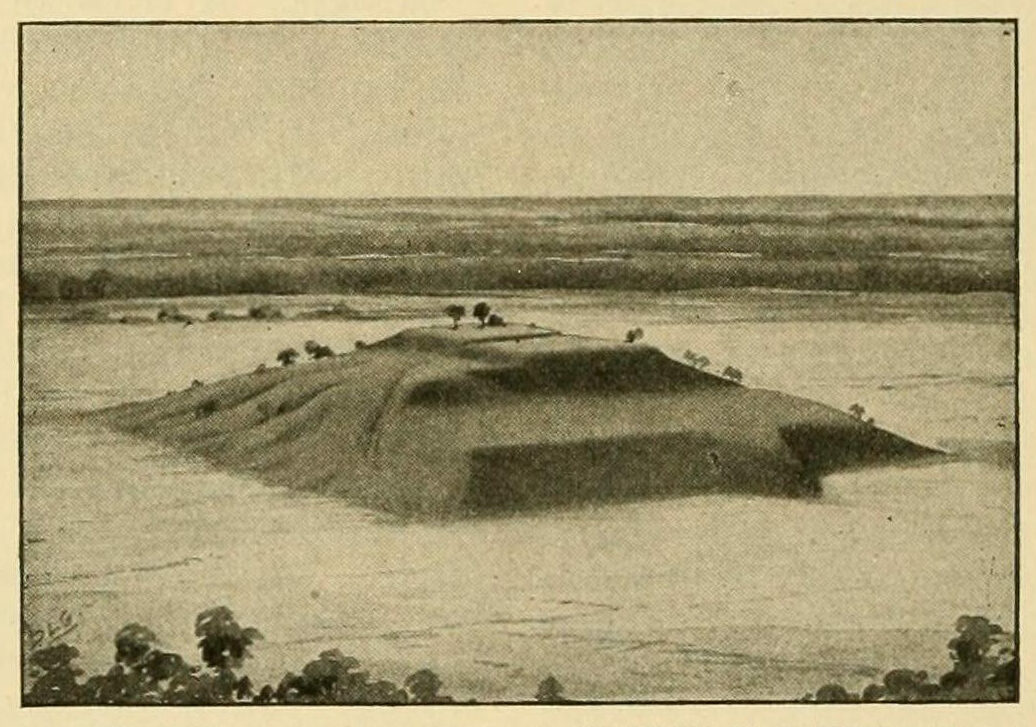
Cahokia Mound, St. Clair County, Illinois, ca. 1050 CE.
Cahokia was a massive city, home to at least ten thousand people, many of them immigrants newly arrived from distant regions. Another twenty thousand people, perhaps more, lived in the surrounding farming hinterlands. This would have made the city one of the largest in the United States at the dawn of the nineteenth century.
Cahokia, despite its grandeur—and in some ways because of it—is often depicted as a dark place. This is thanks to the revelations of the archaeologists who, in the 1960s, uncovered a series of mass graves hidden beneath a low mound just south of the great plaza. Dozens of bodies had been cast into pits, many decapitated. Nearby, other bodies were carefully honored, wrapped in beaded capes, laid atop animal pelts.
Archaeologists had recently developed a taxonomy of societal evolution. Cultures, they supposed, matured over time, growing from small “bands” to “tribes” to “chiefdoms” to top-down “states.” The kingly bodies at Cahokia lent credence to a corollary theory: that simple bands of hunters and gatherers were too disorganized to build anything as impressive as these riverside complexes, that mounds required a central authority. Cahokia was seen as the moment when Native America climbed the final rung on the ladder of social evolution. And the brutalized bodies suggested how the climb happened. Archaeologists figured the city’s elite must have amassed influence by invoking ancient stories, portraying themselves as associated with the forces of life and death. I can’t help but notice that the discoveries at Cahokia affirm our own broken politics: they seem to suggest that a capacity for avarice, a desire for control, is simply what it takes for a society to reach its peak.
Avarice and control certainly shaped the history of the levees. The colonial governments expected landowners to bear the cost of building these walls, which meant in practice that only the wealthy could settle along the soggy riverside lands. Not that they labored themselves: levee-building was work for the slaves.
Even so, the work progressed slowly, leaving many unprotected gaps. Later, when the river came under US control, landowners began to band together into “levee districts” in the hope that coordination might help. The engineers were not always the best and the brightest; they built levees too narrow, too close to the river. The floods came too quickly, and too little could be accomplished, especially with malaria sweeping through the riverlands. Still, the landowners found ways to profit. After slavery ended, they exploited poorly paid “sharecroppers” to labor in their fields. Eager to protect this setup, the planters convinced the federal government to take over the cost of constructing a single, continuous wall along the river.
Half a century later, in 1926, federal engineers declared the levee system was all but complete. Then in 1927 a massive tide of water bashed downstream, ripping a hundred holes in the great wall. That spring and summer hundreds of thousands of people slept in wet and muddy flood camps. The government tried a new approach after that disaster, building “floodways”—corridors designated to receive the river’s excess waters. This approach reflected some bit of ecological wisdom, a recognition that rivers need room. But that was the extent of the humility. As the spillways were built, the government engineers began to straighten the river’s looping bends, an effort to send the floodwaters downstream more quickly, thereby lessening flooding. The levees, meanwhile, doubled in bulk in some places.
I’ve read accounts that cast the levee as a monument to cooperation, given that it was built by people banding together in ever-larger groups. There’s another way to read this history, though: here, powerful people managed to convince the government to spend other people’s money to protect their land. The construction of this wall helped ensure that the cypress forests that once lined the river were sliced down, that the largest wetland on the continent would be drained. That an exploitative economy would take hold, wherein a few wealthy families who owned the land would profit while others did the work.
By the twentieth century, the work building levees was mostly supplied by free Black men, though some investigators compared the conditions to slavery. The workers lived in camps where there were no toilets; the waste was simply dumped into the surrounding swamps. Alan Lomax said these sites could be smelled from a mile away. To help corral labor, contractors delayed payday, sometimes by months, forcing workers to shop at the commissary—where prices were two to three times higher than in town. “I can get all the labor I want for whatever I care to pay,” one contractor told an investigator.
An engineer in one camp noted in a letter to his family that it was common to see a foreman shoot and kill a worker. But that wouldn’t stop the job; the corpse would be buried in the night, “and that’s all there is to it,” the engineer declared. The Black men in these camps were seen as disposable, tools to be used in the fight against nature. The metaphor became literal during a flood in 1912, when an engineer in Greenville, Mississippi, ordered Black prisoners to lie down atop the levee, holding back the rising water with their bodies until sandbags could arrive.
Lomax talked to the white men who ran the camps. They looked back with pride. “We levee contractors created a billion dollars’ worth of land and property,” one told him. “That’s what we did down here in the state of Mississippi.” The river had been tamed, its floodplain turned into money, “and that big green wall protects that wealth.”
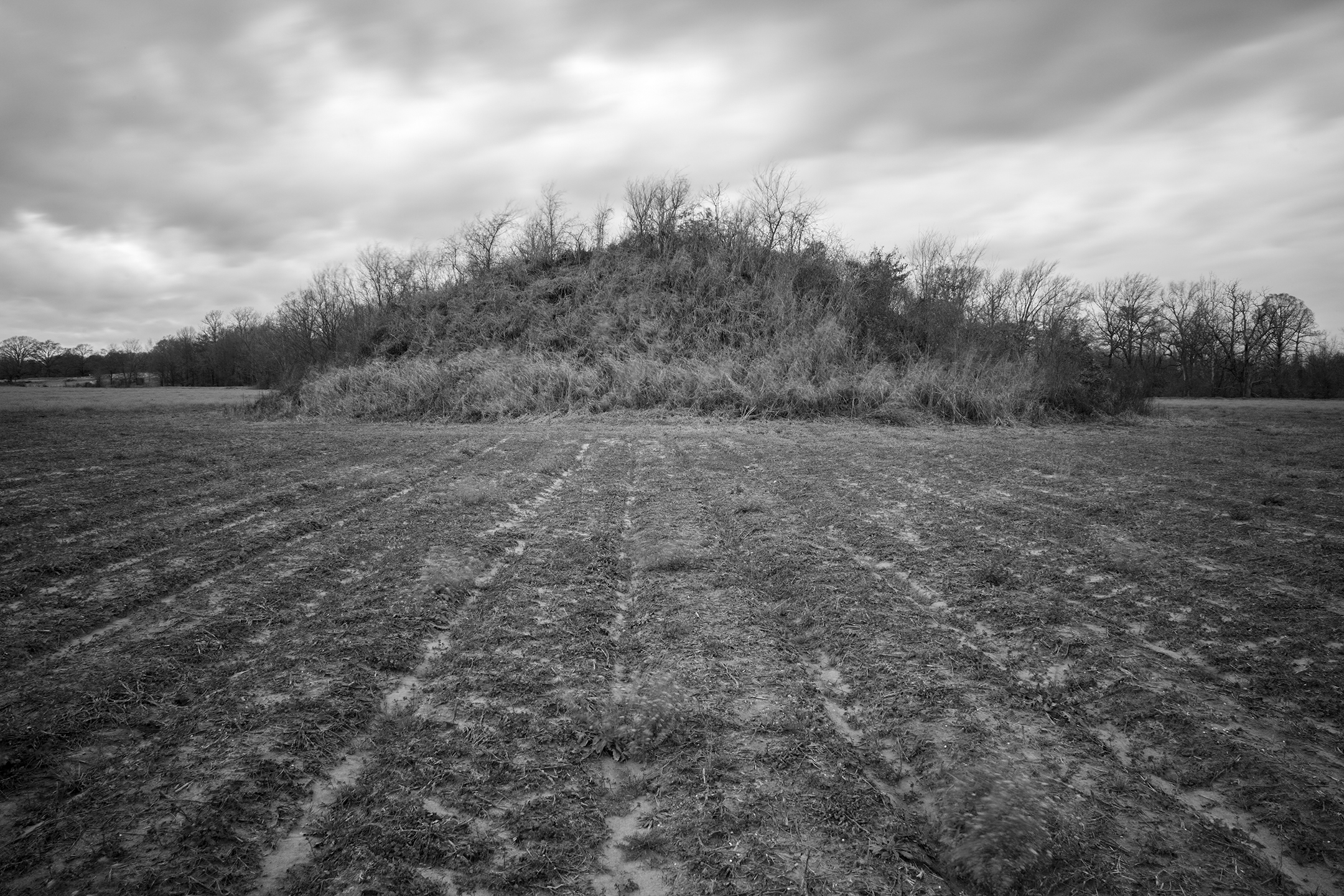
Lower Jackson Mound, West Carroll Parish, Louisiana, ca. 3950–3650 BCE.
While Lomax could collect such oral histories, there is no way to speak with the people who oversaw the construction of the river’s ancient earthworks. Our understanding of these monuments often depends on archaeology.
As a layman, I find the field’s insights at once enticing and frustrating. We can know the material facts of the continent’s ancient history with startling clarity: the teeth of long-dead Cahokians reveal a regional shift in diet—the precise generation when people began eating larger quantities of corn. Wooden residue, preserved in the soil, shows us the shape of the city’s long-lost neighborhoods. Fossilized pollen tells us when the surrounding forests were chopped down. We can get a sketch of this place, and yet the picture remains so empty. The questions I most want answered cannot be easily calculated from material remains. What did these people call themselves? What stories did they tell as they poured out their basketloads of soil?
There is another way to study the mounds, as Chadwick Allen points out in Earthworks Rising: as a form of writing—as “Indigenous knowledge encoded in the land.” Allen’s book is a cultural and literary study, less concerned with who built what mounds when, and more with how earthworks are, as he puts it, “recorded and documented through living Indigenous bodies in order to be reactivated in Indigenous presents for Indigenous futures.”
Here, too, I am a layman—and, more than that, an outsider. I’ve spoken with Indigenous people about earthworks, sometimes on the record, mostly off; I’ve visited mounds in their company, mostly here in Louisiana, where I live. But for every request that has been answered, several more have been met by silence—an understandable reaction after so many years of misinterpretation and hostility and abuse. What I can offer here are just the reflections of a student of the Mississippi River, someone trying to find the full story of my home. I’ve read too many travelogs and histories of this river where the earthworks go unmentioned or, at best, are presented as a reminder of all that was lost as this river was tamed.
Indigenous stories of earthworks often emphasize what Allen calls the “three-worlds theory.” There is the Upper World, above us, which features order, or at least a cyclical permanence: the sun and moon rise and set, an endless dance precisely repeated; the stars, too, for all their seeming boundlessness, rotate in a complex but predictable swirl. Below us is the Lower World—a chaotic domain of water, ever-changing, but also abundant and fertile. We live in the third part of this cosmos, the Middle World, an island in between. The Choctaw novelist LeAnne Howe has noted that these realms can overlap, forming spiritual ecotones. The sites where mounds appeared were often ecotones, too: they sat upon the edge of wetlands, as if perched alongside the lower world; they rose towards the sky, aligned precisely to match the turns of the upper world.
There are Southeastern stories that appear to embody the construction of these earthworks, earth-diver stories, which describe the emergence of the Middle World: some kind creature—a muskrat in some stories, a crawfish in others—swims down into the endless waters to bring up a handful of mud. Howe describes how moundbuilding might have been “a kind of theatrical performance, one in which the performers tell the story by collectively sculpting the earth.” The mounds, then, can be seen as a renewal, a reenactment of the world’s beginning.
As for Cahokia, there are also stories that seem to reflect its trouble. The Osage, for example, speak of forebears who, as they wandered the Middle World, happened upon a village surrounded by bleached-dry bones. The people who lived in this village—the Isolated Earth clan—destroyed whatever life they encountered. By joining the Osage on their westward migration, the Isolated Earth clan was able to find a new home that was free of so much death. There are Cherokee stories, too, of an ancient caste of priests who grew so powerful that even the Earth rejected them, spitting out their bodies. Mounds, then, offered a solution, a place to contain their remains. (As in the Osage stories, these people were not seen as rejected enemies: they intermarried with the Cherokee, and so their blood lives on.) These stories, to me, offer a reminder: if the archaeologists are right, if Cahokia was a violent place, people can still decide to steer a society in the other direction, too.
And the archaeologists may not be right, anyway. By the time I first learned the story of Cahokia—the honored bodies, the murderous priests—many of the oft-repeated interpretations were out of date. Though how could I have known? A state park surrounds the mounds now, but the introductory video at its visitor center had not been updated in thirty years.
The old assumption was that whoever ruled Cahokia sustained their power by doling out surplus crops—but no one has found anywhere that such supplies could have been stored. Based on figurines found at the site, and on contemporary Indigenous practices, there’s reason to believe agricultural decisions were made not by some single overseer, but by groups of women. Sure, there were elites and commoners in this city, but there’s no way to know whether or not this meant a dictatorship.
One thing is clear: a dictatorship is not a prerequisite for building a mound. Even a state-like government is not required. By the time archaeologists found the cache of bodies at Cahokia, radiocarbon evidence had already suggested that other mound sites were far more ancient. Many archaeologists dismissed such data as erroneous at first, but, finally, in the 1990s, the field widely accepted the truth: the simplest predecessors to Cahokia, piles of shells and soils formed into rings and flat-topped platforms, were built far earlier—at least 7,500 years ago. After two thousand years, the practice had morphed into something more ambitious and elaborate—something undeniably monumental. This was millennia before anything like government—or anything very close to modern agriculture—appeared along the Mississippi River.
One thing the mounds signal is how this river has never been alone, never been a wilderness.
The largest site from this era, Watson Brake, includes eleven mounds, some more than twenty-four feet tall, connected by a lower wall of earth. These sit atop a terrace that at the time of construction probably overlooked a clear-running side channel of the Ouachita River, near the edge of the Mississippi’s vast floodplain. The mounds were perched, then, between dry forests and watery swamps, upon the rich blur of an ecotone. Archaeologists suggest that these mounds served as base camps for villagers who went hunting and fishing in the surrounding landscape—people who, so far as the evidence shows, were egalitarian. We can’t be sure why the mounds were built, though clearly they weren’t necessary for survival: other nearby villages never bothered to build. The first mounds, then, weren’t built to aggrandize some leader. Instead, they seemed to bring people together as a community.
Watson Brake grew in occasional bursts of construction over at least six hundred years. Centuries sometimes passed with no progress. To put that to scale: six hundred years ago, Christopher Columbus was not yet born. Whatever culture produced Watson Brake, it lasted for longer than the settler experiment so far.
Around 2800 BC, Watson Brake and several other similar sites were abandoned. One potential culprit is the river itself. Due to long-term fluctuations in the climate, its rate of flooding sometimes jumps upward. For two centuries, or five, or more, floods will shudder through the river valley; then for equally long periods the river will droop into quietude. Watson Brake and its peers were built during one of these calmer periods. When the mound sites were emptied, floods were beginning to crash through the local bayous with renewed vigor.
For centuries, it appears that no one built another mound. Some archaeologists believe no one lived along the southern Mississippi at all, so chaotic was the river. Then, after fifty generations—a thousand years!—the practice resumed, scattered at a half dozen sites in Mississippi and Louisiana. This time there was a difference: this new world of mounds had a clear central node.
Poverty Point, as the place is known, sat fifty miles from Watson Brake, and, like its predecessor, was set at the edge of the Mississippi’s swamps. Travelers delivered goods to this place from up and down the big river: Galena rock from Iowa and Missouri, Pickwick chert from Tennessee, flint from Indiana. Red jasper pendants carved in the shape of pot-bellied owls were carried away from Poverty Point, to sites as far afield as Florida. Someone buried more than 250 shattered bowls and vessels here; the heavy soapstone was almost certainly carried by water, which would have required a voyage of more than eight hundred miles, including a long passage along the edge of the Gulf of Mexico.
As at Watson Brake, this monument grew through the centuries. The final mound stood seventy-two feet tall—the largest earthwork yet built on the continent. The soils appear to have been laid down quickly, without even a pause for heavy rainfall. In recent times, this region has never gone longer than a month without a storm; archaeologists, multiplying by three to be safe, figure the structure was built in ninety days or less. Such a project would have required thousands of laborers, hauling basket after basket of carefully selected soils.
Many archaeologists believe that Poverty Point was not a village but a seasonal gathering place where people came to make art and tools and to trade; nothing has been found that suggests there were permanent home sites. Here, then, fishers and hunters and gatherers from nearly half a continent found a way to work together, to build something utterly grand and completely new. That’s not to say they ignored the past: the site’s largest mounds were built along a perfect meridian, which, if extended south, intersects with a smaller mound built in an earlier era. The shape of the site seems arranged to match the solstices; the place is centered around a plaza that faces the wetlands to the east. This site, then, can be read as a map of many dimensions, an atlas not just of space but of time, referencing the people and places and forces that led to its construction.
Within a century of the completion of the last mound, activity seemed to cease at Poverty Point. If anyone still arrived on pilgrimage, they left behind nothing. Once more, life seemed to change everywhere along the southern river: traders abandoned their long-distance routes, and after centuries of gathering, people settled into quieter, local lives. Moundbuilding continued, though on a far more modest scale—mounds became the focal point of a village rather than a continent. It would take several more centuries before anyone was quite so ambitious again. Why? We cannot know, but this was an era, too, when the river was shuddering through its changes. The Gulf of Mexico had been rising for centuries; now it began to fall. The order of the cosmos was beginning to change.
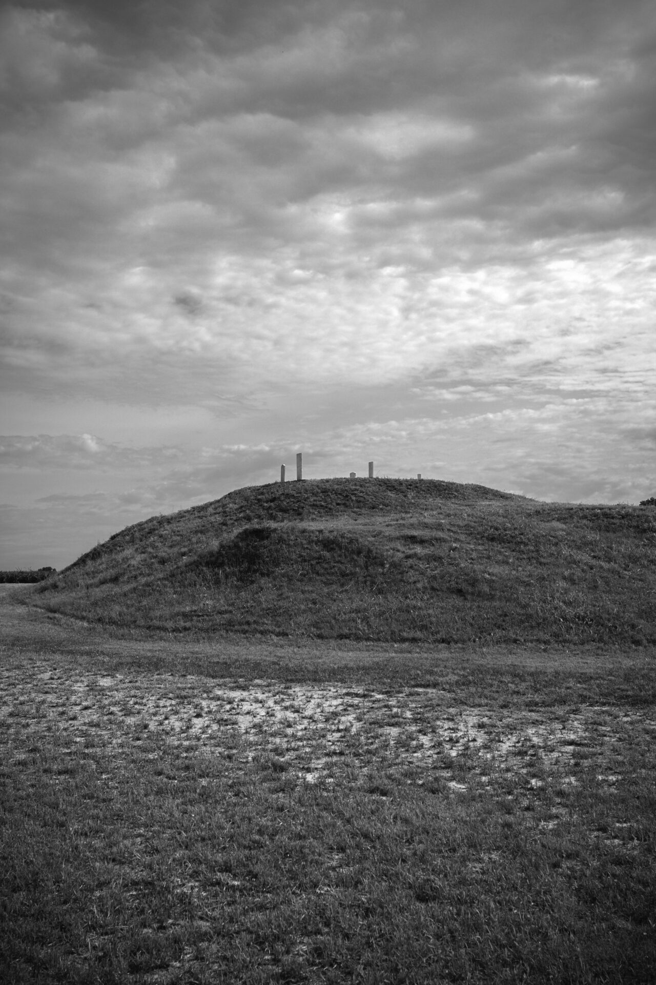
Mound A at Poverty Point, West Carroll Parish, Louisiana, ca. 1300 BCE.
In her book-length sequence of poems, Blood Run, Indigenous writer Allison Hedge Coke gives voice to a set of mounds along the Big Sioux River, a tributary on the border of Iowa and South Dakota that eventually sends its water through the Mississippi, into the Gulf. The final poem in the sequence offers prophecy, words that are attributed to “the old ones”:
When the animals leave this place
the waters will come again.
This power is beyond the strength of man.
The river will return with its greatest force.2
Indeed, in 2019, a year of big floods across the Mississippi watershed, the Big Sioux River twice broke stage records. The mounds at Blood Run were spared, but levees burst downstream, on the Missouri River, where the flooding delivered billions of dollars in damage, mostly to the region’s sprawling farms.
Along the southernmost Mississippi, where the levee stands tallest, the wall held firm. It has for decades: according to the US Army Corps of Engineers, no finished levee here has failed or overtopped since the 1927 flood. Still, there is an old adage, familiar to any river engineer, about the two kinds of levees: there are those that have failed and those that will fail.
Many hydrologists now believe that levees make floods worse, pressing the water tighter, like plaque lining an artery. The effort to straighten the river’s bends has caused mud to accumulate in certain stretches, lifting river stages. Add in the fact that farms and parking lots cover much of the Mississippi’s watershed, reducing its ability to hold and store water. Add in the fact that a warmer climate holds more water, which can lead to bigger blasts of rain and more frequent flooding. It’s no surprise that Mississippi River floods are getting bigger. Under worst-case scenarios, the river’s discharge may increase 60 percent by the end of the century. One recent study, conducted by a private consulting group, suggested that in less than ten years some levees along the southern river are all but guaranteed to fail in a hundred-year flood.
Poverty Point is an atlas, pointing to its past. The levee mostly obscures. Its bulk is so large that these days you can walk a stone’s throw from the nation’s largest river and have no idea you’re near water. Its placid green slope of grass hides the brutal facts of its construction, too. As I came to learn this hidden history, I could not see the levee as a monument to anything but control—control of the river, control of the landscape; control of fellow humans.
When I envision the future of the Mississippi River, I’m sometimes tempted to suggest that we tear down our modern earthworks: let the water return to its former land. We could make the entire valley a national park, perhaps—a monument to itself, to the beauty of the world when it’s left alone. But this is an absurd thought. Not just an impossibility, but a wantonly destructive proposal. Millions of people are protected by this wall, including some of the nation’s poorest communities.
Perhaps the three-worlds theory provides a better approach. To some modern minds, these layered worlds may sound mythical, but are they any more mythical than the Western idea that humans and nature are separate—that some parts of nature are so separate that they can be considered “wild”? One thing the mounds signal is how this river has never been alone, never been a wilderness: this is, after all, one of the youngest landscapes on the continent; twelve thousand years ago, as the mud began to fill the watery basin, people were here already, fishing in the fresh swamps. The mounds, then, can offer a different kind of monument, not to the beauty of empty land, but to the possibility of human connections within a more-than-human world.
I don’t mean to conjure a snuggly “Mother Nature” who wraps the people in her warm embrace. This river is not Eden. It never was. The river’s valley was a place of life and chaos both. The anthropologist Jay Miller spent years studying moundbuilding traditions, including modern busk ceremonies, in which congregants stomp and sing as they renew their world by building small mounds. The book that resulted from these studies, Ancestral Mounds, describes the Middle World as “a vengeful living being, with thin skin and hollow heart, floating on a vast sea.” The earthworks provide ballast, a kind of insurance—an attempt not to control the world, but just to set an anchor amid its chaos. The mounds, Miller notes, are intended as security for every human and every more-than-human being. Perhaps this is what people learn after thousands of years of living along one of the world’s great rivers: that change is inevitable, that chaos will come, that the only way to survive is to take care—of yourself and of everyone else, too.
The earthworks provide ballast, a kind of insurance—an attempt not to control the world, but just to set an anchor amid its chaos.
In Western culture, we sometimes think of time as a one-way line. Societies climb up a ladder: we settle into some chosen homeland, then learn to garden and eventually farm. We build villages and then towns and then cities—always stepping forward, progressing from bands to tribes to states. We arrive along an unruly river and tame it, building an endless landscape of farms.
This telling only works if you scratch out the past few hundred years and ignore the rest of the river’s past. The last few centuries of levee-building, though, have to be considered within the longer timeline the earthworks represent. On the Mississippi, this longer story follows a more looping path. Hunter-gatherers accomplished incredible feats of engineering here. They hosted great gatherings. Then, in times of crisis, they turned inward, taking care of their communities, their local patch of earth. It’s tempting to regard the largest constructions—like Poverty Point and Troyville and Cahokia—as signs of triumph, moments when people became worldly and grand. The moments when people built small and local mounds, then, must become the dark ages by comparison. But perhaps this is backwards. If mounds provide ballast, perhaps Cahokia was not a sign of great ascendency, but rather of crisis, the moment of greatest need. Besides, the story of earthworks is long and patient. Thousands of years passed sometimes between the largest constructions. Cahokia, then, may not be the last and greatest of the continent’s mounds, but just the largest built so far.
On my first visit to Cahokia, I decided to watch the sunrise from atop the central mound. The surrounding region offers a compendium of sad Americana: warehouses and trucking depots, steel refineries and coal-loading terminals. The check-in kiosk at the “Indian Mound Motel” is protected in glass; before it went out of business, the Mounds Drive-In pivoted to X-rated films.
As I waited for the first rays of light, a trio of locals appeared atop the mound and told me they had just wrapped up a long night wandering from bar to bar. Looking back to the west, I could see another mound—a landfill. It first opened in the 1950s, and five decades later, it was already taller than any of Cahokia’s mounds. Before I came, friends had told me that to watch the sunrise here was a deeply spiritual moment, but in this setting, with this company, I did not feel much at all. Only later did it occur to me that the point of this monument may not have been to serve as a place where one could stand, alone on its precipice. The point was its presence, a steadying weight upon an unsteady world. The point was its building, the collaborative work of renewal.
By now it should be difficult for anyone to deny that the Earth is precarious. Beautiful, yes, but full of danger. When we burn its buried fossils, we set loose great tempests and rising oceans and raging wildfires. When we try to pin down rivers, they wriggle free again. Now that we see what happens when we fight against the landscapes, perhaps we can see a better approach: heed the wisdom of the peoples who built these mounds, who endured here for millennia. Follow the wisdom of the earth divers—reach down to create again, together, ballast against the floods.
- From “Snake Mound” in Blood Run, by Allison Adelle Hedge Coke. Copyright © 2006 by Allison Adelle Hedge Coke. Reproduced with permission of Salt Publishing through PLSclear.
- From “When the Animals Leave This Place” in Blood Run, by Allison Adelle Hedge Coke. Copyright © 2006 by Allison Adelle Hedge Coke. Reproduced with permission of Salt Publishing through PLSclear.
Read More Essays