Navigating a Shifting World
Open storyAsk yourself where you are, what’s around you, and what the history is beneath your feet.
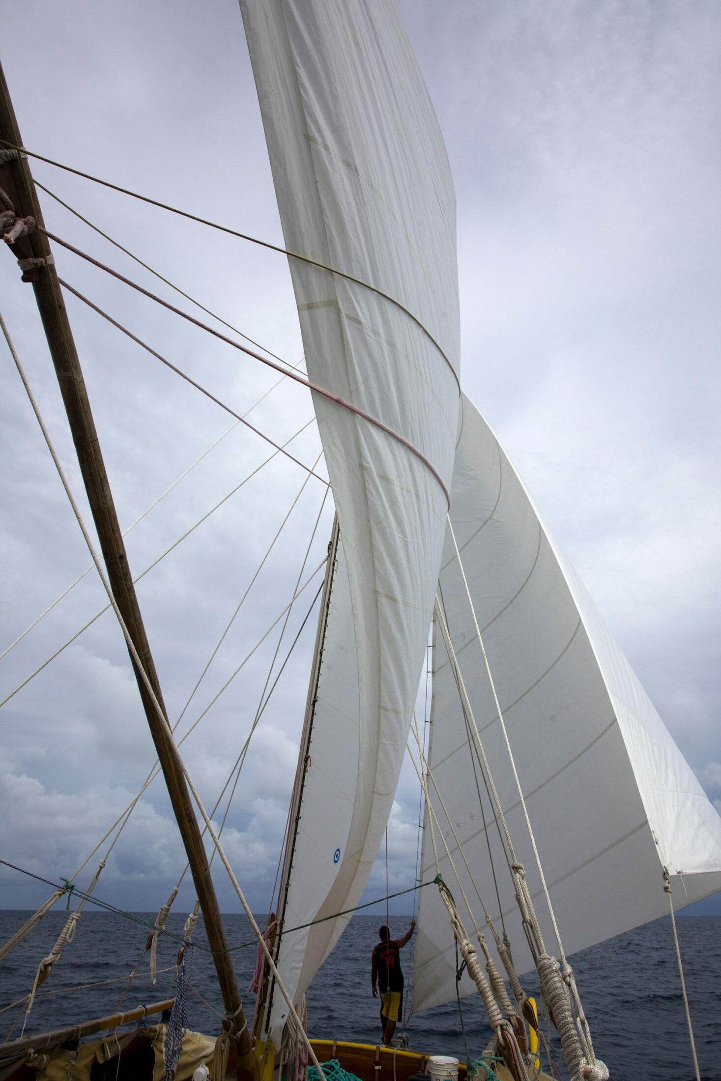
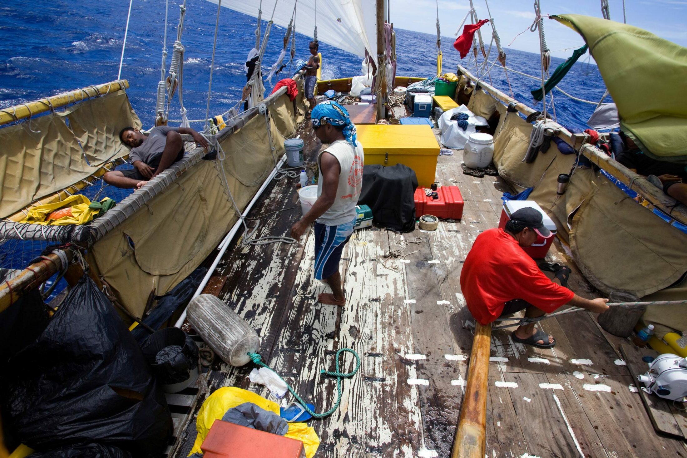
Miano Sowraenpiy and Pete Towmar of Satawal, an atoll in Micronesia, run the sail around during a tack.
Photo by Philipp Engelhorn
Aylie Baker was born in Maine. She has worked on community-driven storytelling projects that address water-related issues in Chile, Vermont, Oregon, and Micronesia. She is committed to supporting the healing of watershed communities.
Aylie Baker reflects on her experiences sailing by canoe under Micronesian Master Navigator Sesario Sewralur and shows how we can draw on an innate ability to orient ourselves in a shifting world.
I grew up dreaming of the open ocean.
The year before I was born, my parents left their home in Scotland and crossed the Atlantic on a small sailboat. It took them twenty-two days—twenty-two days of open horizon, no ships, a few squalls, and a basket of avocados that ripened all at once.
In my mind’s eye, my dad is at the mast with his sextant, calling out numbers, as he balances himself amid the waves to sight glowing planets and stars. And then there is my mother—her eyes flicking back and forth between the distant horizon and the compass before her, one hand coaxing the tiller, the other carefully jotting down positions in the diary she keeps of their crossing.
As they neared the Caribbean, the ocean changed. The long, lilting swells that had passed beneath them days before began to reflect back from a shoreline that was not yet visible. The surface grew choppy and uneven, until one morning a rogue wave rushed over the stern of their boat, washing into the cockpit and nearly swamping their craft.
Whenever my mother comes to this place in their story, I shiver. As the wave rises, I tremble—first with fear, then wonder—at my parents’ ability to navigate that moment and their crossing, and for the ocean that rose up beneath them.
It was hot the summer my parents arrived in the US, so hot they kept sailing north, eventually landing in “hundred-harbored Maine.”
That my parents ever learned to sail is still a marvel to me, as neither of them come from sailing lineages. Their parents were mountain people. Unwinding the long spool of my family’s history, I have often puzzled over the forces that drew them out of the mountains, down through the watersheds, to live at the lip of the sea.
Growing up, I lived in a house a few miles from the ocean, but even at this distance, it was never far from our lives. My father carried a tide chart in his briefcase and oars in the trunk of his car. In the entryway to our home hung an old, gilded barometer that my mother consulted periodically to read the weather and the shifting moods of her guests.
At school, our mascot was a clipper ship, an enormous three-masted schooner once built and launched in the tidal estuary that was our harbor.
When the last ice age retreated, it carved the rocky coast into a sprawling network of protected coves and meandering isthmuses. Tide after tide the warming seas swept into the valleys, circling mountains and flooding plateaus. Sunlight filtered into the shallow waters where giant sloths and mastodons once roamed, and out of the mingling of warm and cold currents, clouds of phytoplankton bloomed, and the seas slowly grew silver with fish. The ancestors of the Wabanaki peoples followed the retreating ice into this region, and for thousands of years, they traveled down the inland creeks and rivers that ran through the islands to the ocean, threading a vast network of water highways with their birchbark canoes as they fished and foraged on their seasonal rounds.
When European settlers began arriving en masse five hundred years ago, they sailed through the spruce-spired islands into sheltered bays that seemed perfect for launching a merchant marine. They built towns along the deepest harbors and began to clear the inland pine forests, sending groves of trees down the rivers to the shipyards they built at the water’s edge.
In its heyday Maine’s wooden ships were among the fastest in the world, and her shipwrights were considered cutting-edge technologists in the Age of Sail. In the old paintings, you can almost feel the wind they harnessed: fleets of ships slicing through cresting waves, their sailors straining behind billowing sails, stacked one on top of two on top of another. What it must have been like to watch the ships come into harbor!
After the American Revolution, brigs, schooners, and sloops ferried goods between the American colonies and the West Indies. They left Maine with their hulls stacked with bricks, salted fish, ice, and lumber and returned months later, slowly weaving their way through the coastal colonies with sugar, cotton, tea, even slaves. When miners unearthed gold in California in the late 1840s, Maine’s clippers dashed to her shores carrying prospectors, helping to rouse the Gold Rush.
But during the Victorian era, shipbuilding began to change. The Industrial Revolution ushered in a slow but steady shift from sails to steam and wood to iron. A new era of movement commenced, driven by expanding empires and foreign markets, and unrestricted by winds or currents. The shipyards slowly closed and craftsmen left the coast, some heading inland to work in the mills that clung to the waterfalls upriver, others to the railroads reaching steadily westward across the continent.
Today only a few of the tall ships remain, but of course traces of the shipping industry are still everywhere—in the widow’s walks that crown the palatial mansions once owned by sea captains and the sea shanties that drift from parade floats on the Fourth of July. Even deep in the woods, you find tall ships. A few remaining eastern white pines still tower over the rest of the canopy. So tall, so straight, these trees were once selected by surveyors as masts for the British Royal Navy, their trunks slashed with the “King’s Broad Arrow.” But somehow they escaped the wars at sea. Their scars, nearly healed, protect them now.
Clouds gather as the Alingano Maisu makes her way under full sail.
Photo by Philipp Engelhorn
Growing up, I saw evidence of these histories all around me, but their significance and relationship to me were invisible.
My sister and I learned to sail on small dinghies in the Harraseeket River, just downstream from the old mast landing, mill, and shipyard. Our local yacht club was housed in a wooden barn that once served as a fish-canning factory. There were a few lobster boats and a ferry that frequented the harbor, but most of the vessels we saw were for leisure.
The only story I knew of the Abenaki people was the one people told about the island at the head of the harbor, called Pound of Tea—which is what they say the settlers gave in exchange for land ownership hundreds of years ago.
In the summertime the wind blew from the south, straight through the entrance of the harbor and down the throat of the river. To reach the sea each morning, we rigged up and set off from the dock, tacking back and forth at angles to the wind, zigzagging through the moored boats and lobster pots. It was slow going, but over time we learned the contours of the river basin below us. We knew where the ledges rose up out of the silty bottom; where gusts of wind gathered at the surface and lifted our speed; how to catch the current ripping in and out with the tide; and how, in the lee of the island, the wind would die altogether, and we would have to send someone overboard to kick us back into the channel.
I grew up on the sea, and I knew how to rig a dinghy and hold a course; but beyond the river and the bay of islands that circled our tiny harbor, I knew very little. When our family set sail down east during the summers, island-hopping our way through Casco and Penobscot Bays, my sister and I were what you call fair-weather sailors. When the clouds rolled in, we moved below deck, out of the wind and rain.
During storms my parents suited up in their rain gear and sent my sister and I down into the cabin, pulling the hatch closed over our heads. As the wind picked up, the boat would heel to one side, and everything in the cabin tumbled with it. The lamp swung overhead, plates shifted inside their cabinets, anything loose and not stowed away toppled to the floor. Occasionally my dad would climb below, his raincoat dripping wet, to check the charts and, as I grew older, the GPS. But my sister and I stayed out of the way. We followed the sway of the boat, moving from low side to low side, reading, playing cards, lulled by the slosh of water inches from our ears and the moan of the wind spilling over the sails above.
Eventually the motor would sound and the boat would come to balance. My parents would call us up to close the sails and drop the anchor. At the sound of their voices, we’d rise from our bunks and peer out of the windows onto another island, another harbor to explore.
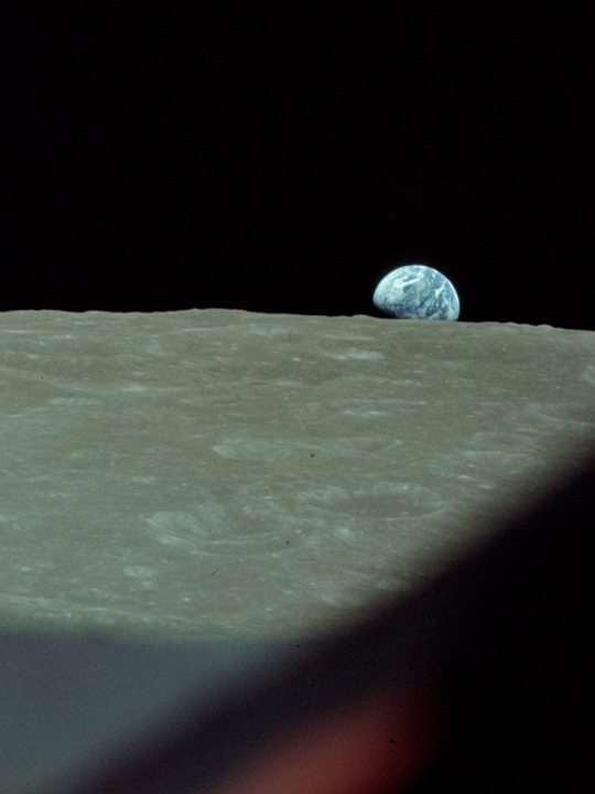
Stars wheel overhead, swells and winds emerge from the horizon, and the islands slowly glide toward, around, and away from the canoe. There is no forward or back
When I was in high school, reports started to come out about the effects of climate change on the Gulf of Maine, which appeared to be warming faster than any ocean on the planet. The reports showed invasive green crabs shifting north from southern waters, lobster molting earlier than usual, the weakening of shellfish signaling ocean acidification. In college I was drawn to oral history in part because the islanders we met during our summers sailing seemed to know more about living with the ocean than any scientist or scholar we knew on the mainland. When I graduated in 2009, I received a grant to travel to islands around the world for a year. I decided I wanted to learn about oral storytelling traditions and their role in climate adaptation. I booked plane tickets to the Maldives, Micronesia, Patagonia, and the Canaries and set off with an audio recorder for a year on my own.
When I reached Palau, Micronesia, I began to meet some resistance to my project, as I learned that, for many Pacific Islanders, stories of place are sacred geography. They form the foundations of land tenure, traditional law, fishing rights, and ecosystem management. As a matrilineal and matrilocal society, Palauans trace their ancestry back to their mother’s land. Stories, particularly those containing sacred ecological knowledge, are often kept very secret, shared quietly and carefully through family lines.
Everyone I met was welcoming and eager to talk story, but I found some questions I asked were brushed aside or lofted back to me. “Why would I tell you something in twenty minutes that took me twenty years to understand?” one man said to me. “Watch and learn,” advised another. And even, “You ask yourself.” These responses stung at first, but as I learned more about Palau’s colonial history, my stance softened. I came to appreciate these rebuffs and eventually understood: there is a power in holding and receiving stories in this way.
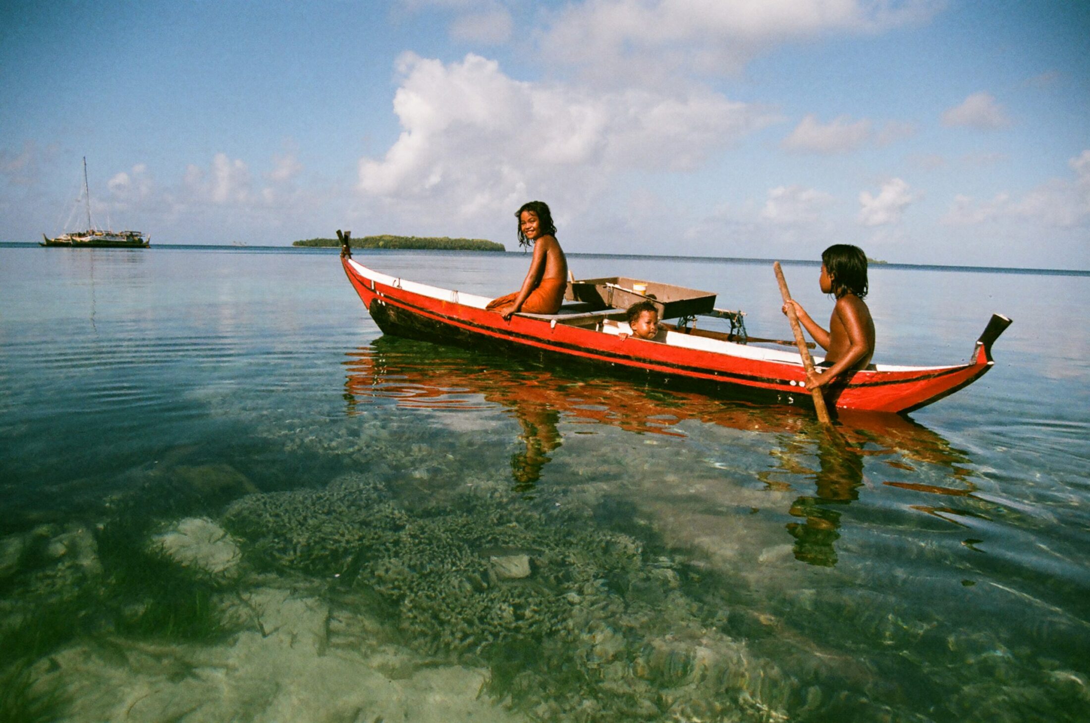
Brenda and her cousins paddle out to visit the voyaging canoe, Alingano Maisu.
Photo by Aylie Baker
Palauans have held on to their language and culture through the occupation of five different colonial powers. They finally gained independence in 1994 after fifty years of US occupation. In one collection of oral histories, I read that there are more ruins from WWII in Micronesian waters than in all of Western Europe, and I believe it. Over the years I have heard many war stories from Palauan people—about hiding out in the Rock Islands to escape the bombing; about building bridges and airports under the Japanese; about the famous airdrops, when the war was finally over and the Americans parachuted down baskets of canned food rations and cigarettes to the people who were starving. While recounting these events, a storyteller might pull back the vegetation to show me abandoned bunkers alongside their home or direct me to ruins scattered in the jungle.
I spent days diving around the skeletons of downed warships and fighter jets at the bottom of the lagoon and wandering around bunkers and abandoned tanks folded into the city landscape. One afternoon in 2013, I finally hiked Bloody Nose Ridge, where thousands of American soldiers died trying to overtake the Japanese in the Battle of Peleliu. Visiting these places—coming across broken bottles and helmets—I felt the heaviness and imprint of death.
Just as I was getting ready to leave Palau, my friend Debbie introduced me to Sesario. Sesario Sewralur is a Pwo, or Master Navigator, from Satawal, one of the outermost islands of the neighboring archipelago of Yap, Micronesia. At the time all I knew about Sesario was that he navigated without maps, GPS, or any other modern instrument, and that his father, Grand Master Mau Piailug, had helped launch a revival of canoe culture throughout Polynesia when he reopened the ancient sea-lane between Hawai’i and Tahiti and shared his knowledge with the Hawai’ian people in the 1970s. The canoe that Sesario captains, the Alingano Maisu, is a double-hulled Polynesian canoe built by Mau’s students as a gift to honor his legacy and serve the peoples of Micronesia in their own canoe revival.
Sesario was teaching at Palau Community College, so we arranged to meet down at the Maintenance Department where he worked part time. When I arrived he was fixing a small cabinet to hold a stove for an upcoming trip to the outer island of Ngulu. We talked for a long time, and when our conversation ended, he invited me to join the voyage. I didn’t even stop to think. I changed my plane ticket and joined the last few weeks of the course before the trip departed.
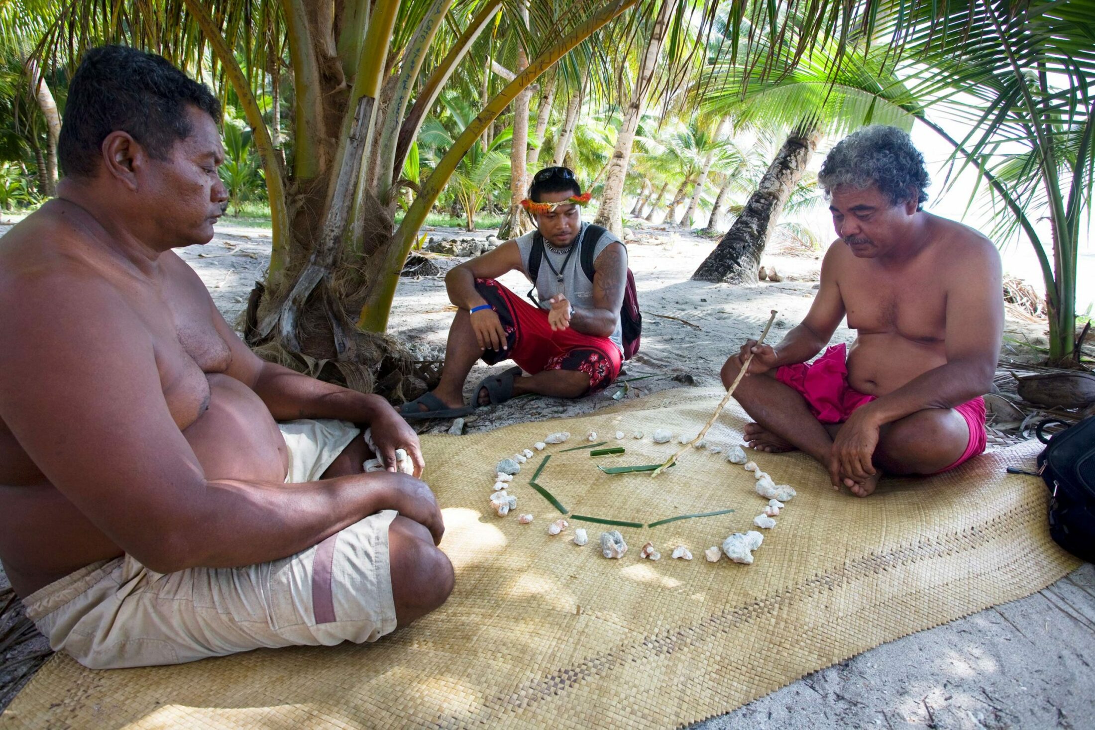
Kurt of Kayangel, left, and David of Satawal, center, listen as Master Navigator Sesario Sewralur recites the star points in the Carolinian Compass.
Photo by Philipp Engelhorn
When we look down on a map, we take in the world from a god’s eye view.
Walking or driving we toggle back and forth between the environment we exist in and the one lying flat in our hands or displayed on the screen before us. We imagine ourselves moving over a fixed world, toward that tree, through this suburb, over this mountain, past this intersection—always moving, always looking forward to our desired destination—while the way we’ve traveled recedes steadily behind us, off the screen, fading from consciousness.
In the traditional navigation Sesario practices, the canoe is at the heart of the world and the navigator sits at the very center of everything, quietly observing the shifting skies and seas from a place of stillness. Stars wheel overhead, swells and winds emerge from the horizon, and the islands slowly glide toward, around, and away from the canoe. There is no forward or back. Navigational cues come from all directions, and the navigator is present to the entire sphere of sea and sky, making small adjustments to the canoe as the journey slowly unfolds. No matter how many days have passed at sea, Sesario can always point to the direction of his home island.
When students in the outer islands are first learning to navigate, they gather together in the canoe house to learn paafiu, which means counting stars. An older navigator will lay down lumps of coral one by one, until he creates a large circle with thirty-two points. At the center, he places a tiny canoe made from young coconut. The circle echoes the distant horizon, and each lump of coral radiates out to a point where a star or constellation rises or sets. As students gather round to listen, the navigator will point to the different stars and call them by name.
When you face the rising sun at the equator, the earth’s poles are at your ears. All night, stars are rising out of the eastern horizon, arcing over the canoe and setting down in the west. At any one time, only a few of the constellations will be visible and close enough to the horizon to reveal direction. They cycle with the days and seasons, rising out of the sea slightly earlier each night. In order to learn to hold their course at sea, students practice reciting star points over and over, first calling out the names around the horizon, and then across and at angles, until they can hold the star points within.
This first lesson of paafiu forms the foundation for all the deeper levels of navigation that a student will learn during their lifetime. From under these star points emerge swells and prevailing winds. The rising sun and moon sweep north and then south between solstices. A calendar of storm stars correspond with periods of heavy wind and typhoons.
Through chants and song, a navigator will learn to hold the bearings of dozens of islands, each of which has its own constellation of radiating sea marks. Spiraling schools of parrot fish, shifting sandbars, a rim of reef where yellow sharks lurk, the fishing grounds of blue-footed boobies, the place where two winds rise up to meet—these are not fixed points but unique, dynamic, interrelating flows of life that have been continuously recognized and passed down over thousands of years in a long, branching weave of oral tradition held by the people of Oceania.
Consider: Long before Columbus or Magellan, before the invention of the compass or the clock, back when ships in Europe were still poling down the rivers and hugging the coasts, Pacific peoples were guiding their canoes across the largest ocean in the world. When Captain Cook sailed to Tahiti in 1769 to document the transit of Venus in the hopes of unlocking a scientific method for calculating longitude, he met the famous navigator and priest Tupaia. While scribes took notes, Tupaia recited detailed directions—including the channel locations and the names of high chiefs—to nearly all of the islands of Polynesia, an area larger than the continental United States.
He held all of this, and yet out on the open ocean, if you stand on the deck of a canoe—depending on your stature, eyesight, and time of day—you can only see two to three miles in any direction.
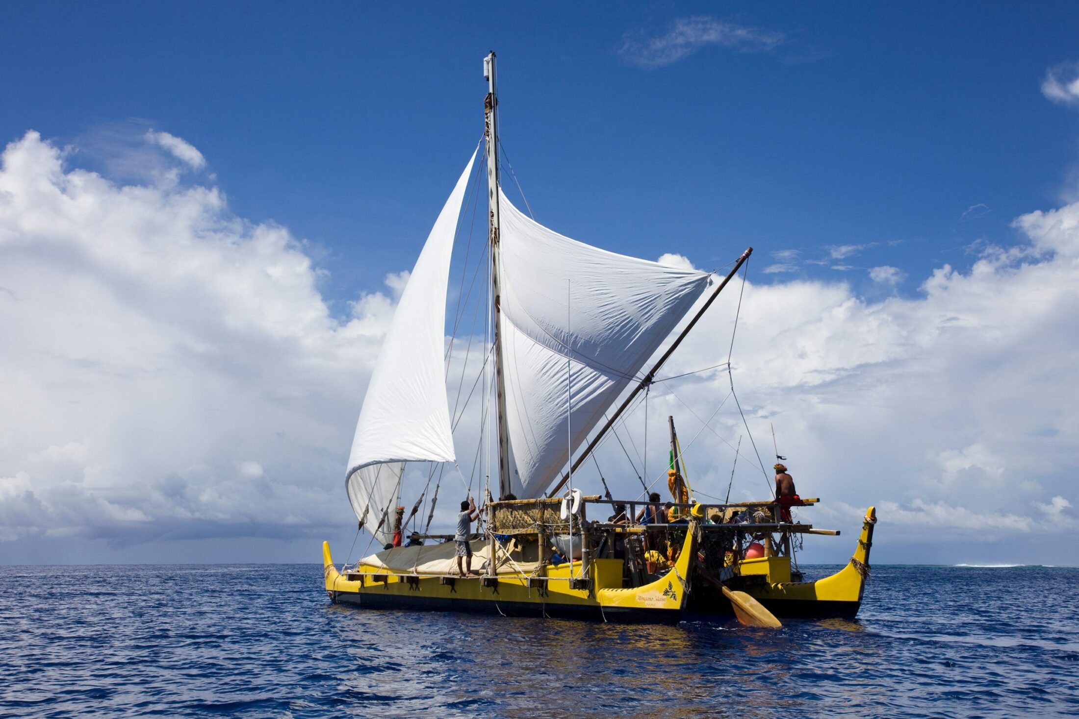
The voyaging canoe, Alingano Maisu.
Photo by Philipp Engelhorn
To be truthful, until I saw the Alingano Maisu, I had never seen a traditional sailing canoe before. From a distance the Maisu looked like a catamaran, but up close, it was nothing like it. Everything, including the mast and giant steering paddle, is lashed together with rope to provide flexibility on the water. The deck is a forty-by-ten-foot platform with a fiberglass canoe lashed to either side. The canoes are tall, maybe ten feet deep, painted the creamy yellow of cooked breadfruit. Canvas tents run down the length of each canoe, with hammocks hanging into the deep hulls. Below the hammocks is space to store food, water, and supplies.
On the day of departure, the high chiefs gave speeches, and friends and family of the canoe arrived with coconuts, bananas, and handwoven baskets filled with preserved taro and breadfruit for our voyage. We left the channel mid-morning with nine of us on board: Sesario and Kintu from Satawal; Debbie, Wayne, and Kurt from Palau; Elward from Woleai; Ben from the Southwest Islands; Elliott and I from the US.
As we sailed through the lagoon, the water grew steadily darker, and by afternoon the islands were sinking below the horizon, so that when it got dark, we could make out only a faint glow in the distance. “Lights from the airport,” Sesario told me when I asked. At dusk the stars began to appear, and there were so many that I struggled to find the few constellations I knew and, when I found them, to hold them in sight as we rocked with the waves.
Ngulu lay two hundred miles northeast of Palau and into the wind. When we set off, I had hoped to keep track of our movements as we tacked back and forth, but that first night, I fell asleep and didn’t wake for my watch. When I stepped out of my bunk in the morning, Palau was gone and the ocean stretched out in every direction. In the blazing sun, the adrenaline of departure was slowly giving way. After all my years of sailing, I suddenly felt queasy and feverish. I’d never felt so exposed before.
Frank Pedro of Sonsorol gets ready to release the steering paddle, as the crew prepares to tack.
Photo by Philipp Engelhorn
Even with the tents, there was little shelter on the canoe. Rain left us wet, and while the sun was high, there was no shade. When we cooked over the camp stove, waves showered over us and into the pot. The canoe had no restroom, only the side.
I marveled at the way Sesario and the crew were completely at ease through all of this. Back home, sailors are famous for their sharp words and blustery arguments. But this crew spent hours in silence, and Sesario never raised his voice in reprimand or complaint, only to sing or tell a joke.
He rarely slept, and only in short, quarter-hour naps. “Bird sleep” they call it—resting for mere moments like the frigate birds do, their heads tucked under one wing as they coast along on the thermals across miles of ocean. But even in these fleeting dozes, Sesario was never really asleep. He would be snoring only to suddenly wake up to adjust our heading when he felt the swell pattern shift against the hull. One night early in the trip, clouds rolled in, blocking out the stars. He took the paddle and turned around to face the stern of the canoe. High above us a tiny patch of sky sparkled, and with this handful of stars, he kept our course until the sky cleared.
High above us a tiny patch of sky sparkled, and with this handful of stars, he kept our course until the sky cleared.
I was lying in my bunk the night it started raining. It came slow and windswept at first, so that the droplets hit the canvas in undulating bursts, and then steadily heavier, until water was seeping through the seams and into my hammock. I could hear Sesario calling out to the crew above me, but I couldn’t make out what they were saying. As the waves mounted and splashed over us, I felt my chest begin to tighten. I found myself thinking of my father stepping down from the cockpit into the cabin during a storm, his raincoat dripping wet, tuning into the shipping forecast and checking the charts and instruments. I could see his face, stern and concentrated. I could hear his voice, urgent as he called directions up over the wind to my mother above.
When my watch was called, I braced for the worst and unzipped my tent to poke my head out. There was Sesario, standing with only shorts and T-shirt in the rain, the paddle under his armpit, singing into the storm. “Shower time!” he called out when he saw me and began to laugh.
Sesario had assigned two student navigators for our voyage. Wayne and Kurt each led a watch, while the other men in our crew alternated between running the sail around and taking the paddle. Debbie did most of the cooking. My job was to scan the horizon for container ships and make coffee and tea to help keep the crew awake for our six-hour shifts.
Even after my seasickness subsided, I couldn’t believe how hard it was to pay attention. I would try and settle into a comfortable position to look out over the horizon, and within moments I would be lost in the thickets of my own thoughts or drifting to sleep. When I recovered, I would look back and the clouds were gone, the ocean was different. I had been expecting to learn the moods of the sea, but whatever shifts were happening around me were so subtle, unfolding so slowly, they were difficult to perceive until they were already upon us.
Every once in a while, a plane would pass over us, and Sesario always knew where they were going. “Taiwan,” “China,” “Philippines,” he would call out. The first time this happened, I must have looked surprised, because he laughed and added, “Japanese and Americans always go straight!”
Even with the passing planes, I couldn’t wrap my head around how it all worked, and I spent a lot of the trip lost in my own thoughts and fears. Even in this haze, something began to sink in.
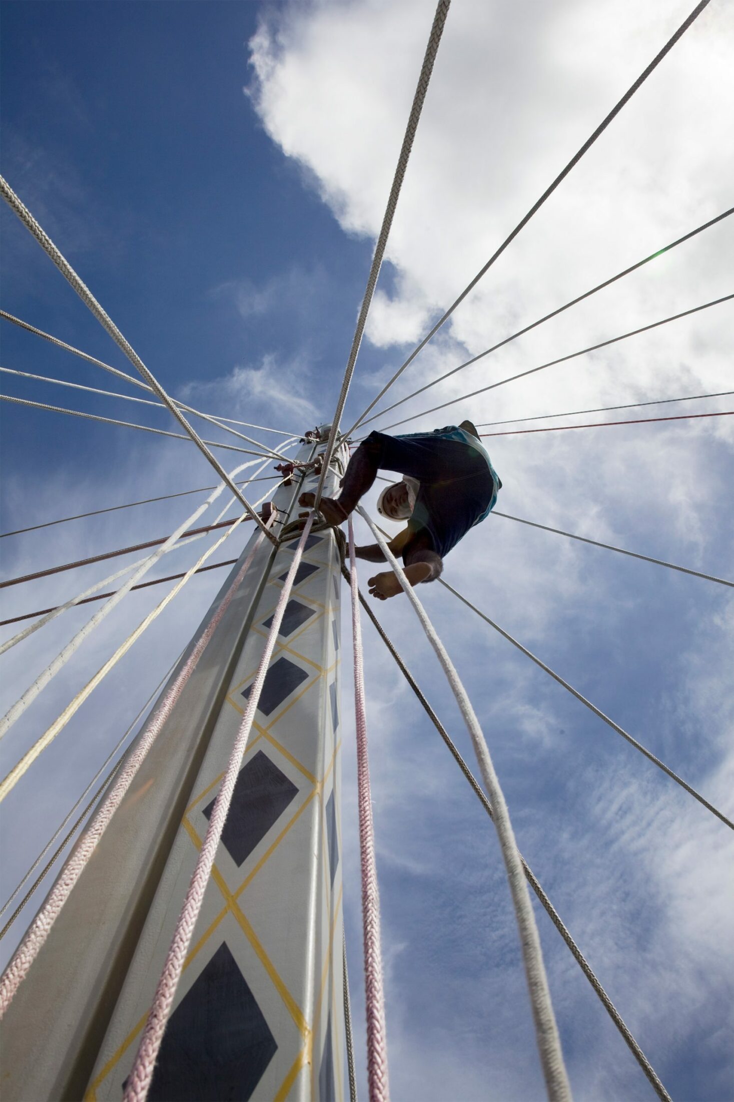
Pete Towmar of Satawal climbs down the mast after securing lines.
Photo by Philipp Engelhorn
“Something’s coming,” Sesario announced one morning. I remember looking around puzzled. The sun was shining and the sea was calm. But sure enough, that afternoon the eastern horizon began to bulge, and out of nowhere a cluster of giant swells emerged, rolling toward us. They rattled our sails as they passed below the canoe and stirred up odd weather during the final leg of our journey.
When we arrived in Ngulu a few days later, George and Maria told us that the wave had washed up there too, flooding the first stand of coconut trees. Reports on the radio claimed it was the last gasp of a tsunami that was racing across the Pacific, set off by an earthquake in central Chile.
Maybe my perception of the ocean began to change just knowing that we had felt those waves, felt them lift the canoe up and then down as the sails shook—knowing without doubt that I had felt them in my own body, cresting in the slight upturn of my stomach and releasing slowly when I heard Sesario announce to the crew hours later, “Don’t worry. We are safest on the ocean”; and then, “We had better go and check on Ngulu!”
Not in any particular moment but in a cascade of motioned memory, the ocean I’d learned to read on a map began to break free of its gridlines, and I started to sense the incredible capacity of water to hold and alter history. Sailing back to Palau, I no longer felt alone in the ring of horizon. Suspended between water and stars, I found myself wondering if the ocean was in fact alive, and what other turbulence was coursing through this rippling, cloud-studded, fish-teeming being. I came to realize that Sesario was offering his students a practice for remembering our innate ability to orient ourselves in a shifting cosmos, for moving with the pulsing ocean and all life flowing in and out of it.
A few weeks later we were back in Palau, and I flew onward across the Pacific, transiting in Santiago on my way to Patagonia. In the airport I could see traces of the earthquake everywhere: in twisted escalators and fault lines that splayed across the concrete floors; in the yellow tape that guided passengers away from damaged terminals; even, I felt, in the pace that people walked.
For weeks after the tsunami, minor quakes shook the Chilean coast. Crouching on the floor, surrounded by rattling china and shifting door frames, I found myself thinking of the canoe and of the waves that were rippling out across the planet, lapping against island after island as they made their way toward Palau.
When I came back to the US, I struggled to make sense of my experience. My understanding of the ocean had shifted dramatically. I was learning to pay more attention to the world around me, but I didn’t know how to integrate what I was witnessing.
Throughout my twenties I saved up money and traveled to Micronesia to sail with Sesario on the Maisu. Eventually, I met my partner, Miano Sowraenpiy, Sesario’s nephew and a longtime member of the crew.
Each voyage opened my eyes to the profound depth of canoe culture but also the incredible challenges this generation of Micronesian navigators are called to respond to at this time. In 2016 we sailed through the worst drought in Micronesia’s recorded history—an event which triggered fresh water shortages and fierce typhoons that fell outside of the traditional storm calendar. Even the uninhabited islands we visited showed signs of sea level rise and plastic pollution. Just as we were passing over the Marianas Trench, the deepest ocean in the world, articles were being published that reported traces of radioactive waste far below us.
Technologies themselves did not lead us astray, but our impulse to develop, adopt, and rely on them mirrors a slow wandering away from the receptive centers of ourselves.
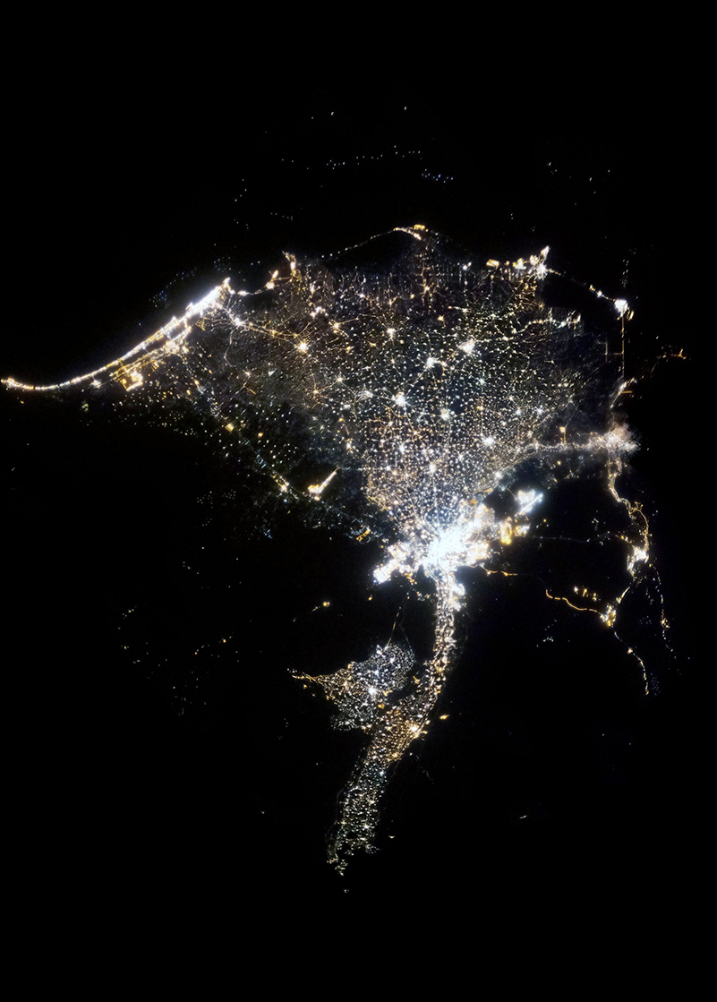
Returning to the US was always hard for me, in part because fossil fuel extraction seemed ever on the rise, but also because I began to notice how GPS technology was eroding what was left of our wayfinding capabilities. In the spring of 2013, I flew from Palau back to New York City, and I remember walking out of the subway on a starry night and struggling to break free of the shuffling crowd, because everyone was looking down at the maps on their phones. I started to read more about celestial navigation and the maritime history of the Atlantic, wanting to understand how we had come to abandon the stars and choose such a different way of moving through the world.
My partner Miano often says that before modern technology, we were all moved by nature. And he’s right. I think we forget that in the West. We have these accounts of Vikings making their way through the fog, reading the swell patterns, and sending ravens into the sky to guide their ships to Iceland. Even in Homer, the nymph Calypso imparts celestial instructions to Odysseus, urging him to mind the Pleiades and Big Dipper, as the Argo leaves Ogygia to head east across the sea.
But at some point we started to exploit these natural patterns. Part of the reason the Atlantic’s triangular slave trade was so devastatingly successful was that Europe’s imperial powers aligned their empires with prevailing winds and currents. The trade winds, as they have come to be known, are these great thoroughfares of converging winds that arise due to the rotation of the earth. The word trade in its earliest usage—dating back to the early fourteenth century—actually meant “path” or “track,” literally “a course of action.” Ships carrying slaves from West Africa followed the southeasterly trades west to the Caribbean and returned to Europe months later, following the Gulf Stream, with sugar, tobacco, and cotton in their holds.
For centuries European mariners kept their voyaging knowledge secret, rarely revealing how they made their way from place to place. When charts and coastal pilots began to surface in the Mediterranean a few centuries before Christ, they were heavily guarded, considered, as Rachel Carson points out in The Sea Around Us, “ways to wealth” and “keys to empire.” Until the 1800s, the most detailed maps of the world belonged not to states but to private companies, like the Dutch East India Company, who hired teams of hydrologists, botanists, and cartographers to scope out potential routes for commerce.
When you look at the history of navigational technology, you start to see these pivot points where orientation shifts dramatically. The compasses that we are familiar with today began to emerge with the discovery of the lodestone, or magnetite, across Eurasia over two thousand years ago. Magnetite is one of the only naturally-occurring magnetic stones, and because it is found in small patches at the earth’s surface, some scientists believe that it aligns its charge with earth’s magnetic field when lightning strikes. Early technologists learned to suspend shards of magnetite on strings or in bowls of water, so that with a prod of a finger, the north-south axis appeared.
I can only imagine what it must have been like for my ancestors to witness such a needle tremble and spin in its dogged search for north. In Satawalese, the North Star is called Wenewenen Fius Mwakiut: the star that never moves. And it is just that—the only point of stillness in our shared cosmologies. In a world of constant change, here was a tiny flicker of certainty, withstanding fog and deepest darkness. No wonder the Greeks believed these stones had souls! In Old English they came to be called lodestones, lode meaning “way” or “course”; to possess one has meant many things, but undoubtedly, they shifted the way people moved through the world.
By the time they came into wider circulation in Europe in the twelfth and thirteenth centuries, lodestones were starting to raise suspicion and in some circles were even referred to as the devil’s instrument. Centuries before shepherds followed stars to Bethlehem, Chinese chronicles tell of an emperor who mounted needles of lodestone on wagons to guide his army through the mist in pursuit of a retreating enemy. Fast-forward a few thousand years, and GPS technology first emerges during the Gulf War to guide “smart bombs” to their targets.
Technologies themselves did not lead us astray, but our impulse to develop, adopt, and rely on them mirrors a slow wandering away from the receptive centers of ourselves.
Hundreds of years of observing the planets, of striving to understand our place in the universe, of equations scribbled down and passed on to be elaborated over generations—all of that now gets compressed into the instruments that we use every day without a second thought. And part of what feels so scary to me about witnessing the rise and application of GPS in my lifetime is that all those generations of learning are obscured; they’re hidden in code, recorded on SIM cards and giant hard drives off in the desert. We can drive to the restaurant with the four-star Yelp review or fly thirteen hours across the Pacific Ocean without any appreciation for the incredible majesty behind these gestures.
It would be easier, more efficient, far faster to continue moving through the world along the grids that we’ve created, following the routes we are presented. But what is the impact on us? Recent studies are revealing the effects GPS is having on our brains and on the way we relate to the world. Our daily journeys are now riddled with refrains of Turn right, Turn left, Slow down, Stop. When these directional prompts come from outside of us, we don’t lay down memories in the same way we would navigating through the world without instruments. The mental maps that we construct of the places we inhabit are slowly being shredded, rendered into strip maps that lead to isolated, meandering points. The restaurant, the mountain, the grocery store, even Grandma’s house, begin to float around without any clear interrelationship or tether to the wider landscape. As our dependence on GPS technology increases, we are in danger of no longer integrating our journeys into a larger sense of home.
Even a map of home is a representation, a slice of space captured by the mind at a discrete point in time. It is always a fragment of the fabric of the universe. It doesn’t matter whether this map is updated every few years or every few seconds: it is flat. It will never be fully present or capture the rippling dynamism of the natural world. It will never be truly alive.
It’s scary to think about stepping back from these instruments, scary because stepping back might mean admitting that we never really learned where we are. For most of human history, this question has run like an umbilical cord to the core of who we are—and anyone who has been lost knows the waves of discomfort, fear, shame, guilt, loneliness, and longing that rise up in the face of not knowing.
Sesario is always reminding his students that each of us is capable of picking up signals that even the most powerful GPS could never detect. And we do, all of us, moment by passing moment. How ironic that we’ve designed wayfinding instruments and climate-controlled environments that shut out the many forces that are there, waiting to guide us. Humidity, vibration, shadows, birdsong—they reach out to us in every moment, silently imploring us to remember that we are—all of us, always—life responding to life.
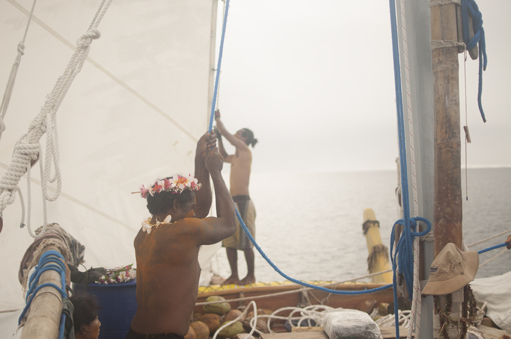
The crew of the Alingano Maisu prepares to leave the island of Lamotrek, during the 2016 voyage. Murais Sebangiol of Palau and Albino Esoailug of Satawal work together to pull up the jib.
Photo by Aylie Baker
To become a navigator in Satawalese culture, one must have full patience in their mind. When navigators emerge from the canoe house after the pwo ceremony, they are stepping into a responsibility to care for their island and ensure that their knowledge is passed on for generations to come.
It’s not only memorization of star bearings and sea marks that is necessary to reach this threshold. To be initiated, one must know how to read the weather, how to build and repair a canoe, how to prepare and administer traditional medicine, and how to uphold the intricate cultural protocols that govern the sea-lanes a navigator may cross during a lifetime. Even after becoming pwo, navigators never take nature or their spiritual leaders for granted. The old masters understood limits and designed rituals to honor and respect them. Even if some canoes were faster than others, or if younger navigators made exciting innovations in design, they never went ahead of their elders on the sea. In this way, a navigator’s movements are guided not only by the phenomenal world but also by a deep respect for the ancient, living agreements that exist between ocean peoples and all ocean life.
Close your eyes for a moment and imagine a vast capillary system spreading out across Micronesia and the Pacific Ocean, connecting all of its islands. On Satawal, the word for canoe, waa, also means vein. For thousands of years canoes have traveled these blue water highways, carrying people and stories.
Imagine what a whole fleet of canoes would look like. That’s how it used to be in Micronesia—not just one canoe, or a few, but dozens sailing together behind the Master Navigators. “The canoe is what flows between people,” Sesario tells us. “It’s what carries food and brings us to our relatives. This is how we survive.”
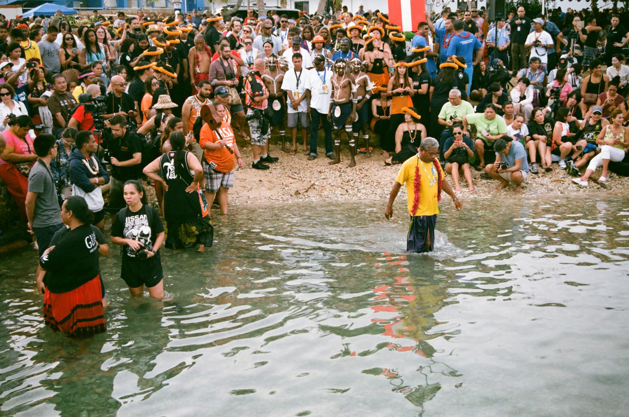
Sesario Sewralur wades into the waters at Paseo in Guam, returning to the Alingano Maisu after presenting a gift during the opening procession of canoes at the 2016 Festival of Pacific Arts.
Photo by Aylie Baker
Ask yourself where you are, what’s around you, and what the history is beneath your feet.